- Elevation
- 1 m
- above sea level
- Local time
- UTC+01:00
- Europe/Stockholm · UTC+01:00
- Airports
- GOT Göteborg Landvetter Airport49 km
- THN Trollhättan-Vänersborg Airport55 km
About Håholmen
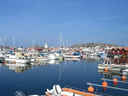
Håholmen is an island. Location: Västra Götaland County, Sweden. The best months to visit are June–August. The nearest airport is Göteborg Landvetter Airport (49 km). Nearby sights include Katten and Rersholmen.
Climate of Håholmen
Best months for sightseeingBest months for sightseeing: June–August.
This month · November
A cold month
Day 6° · Night 2° · Rain 86 mm
- Hottest month
- July (day 21°)
- Coldest month
- February (night -4°)
- Wettest month
- November (86 mm)
- Driest month
- April (45 mm)
Bars: average monthly low and high temperature. Below: precipitation. Monthly averages for 1970–2000 at about 18 km resolution, adjusted for elevation. Highlighted months are mild and relatively dry. Source: WorldClim 2.1 (CC BY 4.0).
Show values as a table
| Month | Jan | Feb | Mar | Apr | May | Jun | Jul | Aug | Sep | Oct | Nov | Dec |
|---|---|---|---|---|---|---|---|---|---|---|---|---|
| Average high (°C) | 2° | 2° | 5° | 9° | 16° | 19° | 21° | 20° | 16° | 11° | 6° | 4° |
| Average low (°C) | -3° | -4° | -1° | 2° | 6° | 10° | 12° | 12° | 9° | 5° | 2° | -2° |
| Precipitation (mm) | 66 | 48 | 53 | 45 | 49 | 64 | 63 | 73 | 84 | 83 | 86 | 80 |
How to get to Håholmen
The nearest airport is Göteborg Landvetter Airport (GOT), 49 km to the southeast as the crow flies. The nearest large city is Gothenburg, 33 km to the southeast.
Airports
- Göteborg Landvetter Airport (GOT) Göteborg 49 kmsoutheast
- Trollhättan-Vänersborg Airport (THN) Trollhättan 55 kmnortheast
- Jönköping Airport (JKG) Jönköping 143 kmeast
Nearby large cities
- Gothenburg Population: 608.5K 33 kmsoutheast
- Aalborg Population: 142.9K 147 kmsouthwest
- Jönköping Population: 112.8K 148 kmeast
- Drammen Population: 106K 216 kmnorthwest
- Kristiansand Population: 117.2K 219 kmwest
Straight-line distances; road distances are longer. Airport data: OurAirports.
Day trips from Håholmen
Within 100 km: 10 historic and cultural sites, 87 natural sites, 450 lakes, rivers and coasts.
0–25 km144 places
- Orust Island 22 kmN
- Håholmen Island 13 kmSW
- Halsholmen Island 10 kmS
- Brandholmen Island 15 kmNW
25–60 km215 places
- Hisingen Island 25 kmSE
- Skaftölandet Island 33 kmNW
- Grötö Island 32 kmNW
- Lindholmen Island 35 kmN
60–100 km188 places
- Flötemarksön Island 93 kmN
- Guleskär Island 74 kmNW
- Ormudden Natural site 79 kmN
- Langerøn Natural site 90 kmSW
Straight-line distances.
Nearest towns and villages
Nearby attractions & nature
Everything nearby-
Katten Island, Västra Götaland County1.9 km S
-
Rersholmen Island, Västra Götaland County2.7 km S
-
Lilla Dyrön Island, Rönnäng socken3.3 km SW
-
Kärrsön Island, Västra Götaland County3.5 km SW
-
Krokholmen Island, Västra Götaland County3.8 km S
-
Brattholmen Island, Västra Götaland County4.2 km NE
-
Hakenäset Natural site, Västra Götaland County4.7 km NE
-
Vetteberget Mountain, Tjörn Municipality4.5 km W
Sources & licences
Data last updated: · 2 independent sources