- Elevation
- 44 m
- above sea level
- Local time
- UTC+01:00
- Europe/Stockholm · UTC+01:00
- Airports
- KSD Karlstad Airport66 km
- ORB Örebro Airport89 km
About Torsö socken
Torsö socken is a village. Location: Mariestad, Mariestads Kommun. Elevation: 44 m. The best months to visit are June–August. The nearest airport is Karlstad Airport (66 km). Nearby sights include Vänern and Hovden.
Climate of Torsö socken
Best months for sightseeingBest months for sightseeing: June–August.
This month · November
A cold month
Day 6° · Night 1° · Rain 58 mm
- Hottest month
- July (day 21°)
- Coldest month
- February (night -4°)
- Wettest month
- September (63 mm)
- Driest month
- February (30 mm)
Bars: average monthly low and high temperature. Below: precipitation. Monthly averages for 1970–2000 at about 18 km resolution, adjusted for elevation. Highlighted months are mild and relatively dry. Source: WorldClim 2.1 (CC BY 4.0).
Show values as a table
| Month | Jan | Feb | Mar | Apr | May | Jun | Jul | Aug | Sep | Oct | Nov | Dec |
|---|---|---|---|---|---|---|---|---|---|---|---|---|
| Average high (°C) | 2° | 1° | 4° | 8° | 14° | 18° | 21° | 20° | 15° | 10° | 6° | 4° |
| Average low (°C) | -3° | -4° | -2° | 0° | 5° | 10° | 12° | 12° | 8° | 5° | 1° | -2° |
| Precipitation (mm) | 41 | 30 | 33 | 36 | 36 | 53 | 59 | 62 | 63 | 58 | 58 | 47 |
How to get to Torsö socken
The nearest airport is Karlstad Airport (KSD), 66 km to the north as the crow flies. The nearest large city is Örebro, 100 km to the northeast.
Airports
- Karlstad Airport (KSD) Karlstad 66 kmnorth
- Örebro Airport (ORB) Örebro 89 kmnortheast
- Trollhättan-Vänersborg Airport (THN) Trollhättan 98 kmsouthwest
Nearby large cities
- Örebro Population: 156K 100 kmnortheast
- Jönköping Population: 112.8K 125 kmsouth
- Gothenburg Population: 608.5K 163 kmsouthwest
- Västerås Population: 127.8K 185 kmnortheast
- Oslo Population: 1.1M 201 kmnorthwest
Straight-line distances; road distances are longer. Airport data: OurAirports.
Day trips from Torsö socken
Within 100 km: 3 historic and cultural sites, 25 natural sites, 62 lakes, rivers and coasts.
0–25 km13 places
- Djurö Island 10 kmW
- Dillö Island 17 kmS
- Lindön Island 18 kmS
- Österön Island 13 kmE
25–60 km32 places
- Kållandsö Island 37 kmSW
- Bärön Island 50 kmNW
- Korsholmen Island 27 kmW
- Härö Island 42 kmN
60–100 km45 places
- Lillön Island 91 kmNE
- Rinkön Island 76 kmE
- Musdragsskär Island 66 kmW
- Lilla Röcknen Island 68 kmE
Straight-line distances.
Nearby attractions & nature
Everything nearby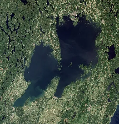
Sources & licences
Data last updated: