Skara
Located in Skara Municipality, Västra Götaland County Coordinates: 58°23′12″ N 13°26′18″ E
- Population
- 11,437
- 11.4K
- Elevation
- 120 m
- above sea level
- Local time
- UTC+01:00
- Europe/Stockholm · UTC+01:00
- Airports
- THN Trollhättan-Vänersborg Airport64 km
- JKG Jönköping Airport79 km
About Skara
Skara is a city. Location: Skara Municipality, Västra Götaland County. Population: 11,437. Elevation: 120 m.
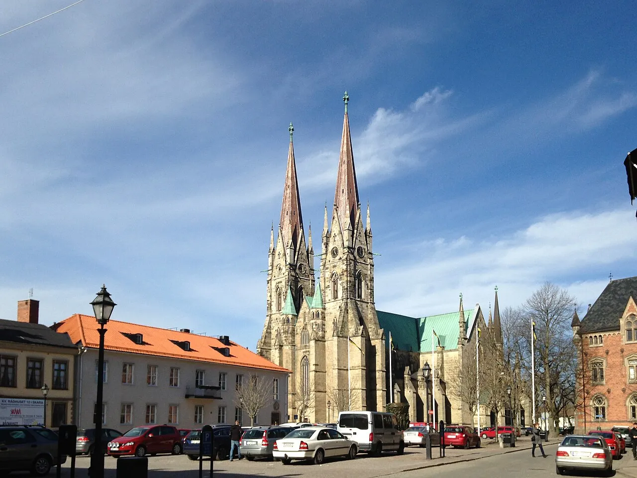
Skara is a locality and the seat of Skara Municipality, Västra Götaland County, Sweden with 11,475 inhabitants in 2023. Despite its small size, it is one of the oldest cities in Sweden, and has a long educational and ecclesiastical history. One of Sweden's oldest high schools, Katedralskolan (cathedral school), is situated in Skara. The former county of Skaraborg was named after a fortress near the town.
Source: Wikipedia · CC BY-SA 4.0
At a glance
- Area
- 8.4 km²
Source: Wikidata
Photos of Skara
-

Wilhelm Olof Luth · Public domain -

Borjanne · CC BY-SA 4.0 -

I99pema · CC BY-SA 4.0 -

Dagjoh · CC BY 3.0 -

I99pema · CC BY-SA 4.0


Travel notes for Skara
From Wikivoyage
Skara is a town with about 18,000 inhabitants in the region Västergötland in Sweden.
Get in+
By train:
The X 2000 train takes you to Stockholm (2 hours) and Gothenburg (1 hour).
By bus:
By car:
The European route E20 passes through Skara.
Source: Wikivoyage · CC BY-SA 4.0 · abridged
Population of Skara over time
| 2010 | 10,841 | |
|---|---|---|
| 2015 | 11,437 | |
| 2016 | 11,579 | |
| 2017 | 11,652 | |
| 2018 | 11,662 | |
| 2019 | 11,664 | |
| 2020 | 11,558 | |
| 2023 | 11,475 |
Censuses and official estimates; source: Wikidata.
Climate of Skara
Best months for sightseeingBest months for sightseeing: June–August.
This month · November
A cold month
Day 4° · Night 0° · Rain 55 mm
- Hottest month
- July (day 21°)
- Coldest month
- February (night -6°)
- Wettest month
- September (70 mm)
- Driest month
- February (29 mm)
Bars: average monthly low and high temperature. Below: precipitation. Monthly averages for 1970–2000 at about 18 km resolution, adjusted for elevation. Highlighted months are mild and relatively dry. Source: WorldClim 2.1 (CC BY 4.0).
Show values as a table
| Month | Jan | Feb | Mar | Apr | May | Jun | Jul | Aug | Sep | Oct | Nov | Dec |
|---|---|---|---|---|---|---|---|---|---|---|---|---|
| Average high (°C) | 0° | 0° | 4° | 9° | 16° | 19° | 21° | 20° | 15° | 10° | 4° | 2° |
| Average low (°C) | -5° | -6° | -3° | 0° | 5° | 9° | 11° | 10° | 7° | 3° | 0° | -4° |
| Precipitation (mm) | 42 | 29 | 33 | 40 | 42 | 61 | 62 | 61 | 70 | 58 | 55 | 51 |
How to get to Skara
The nearest airport is Trollhättan-Vänersborg Airport (THN), 64 km to the west as the crow flies. For international flights: Göteborg Landvetter Airport (GOT) (106 km). The nearest large city is Jönköping, 80 km to the southeast.
Airports
- Trollhättan-Vänersborg Airport (THN) Trollhättan 64 kmwest
- Jönköping Airport (JKG) Jönköping 79 kmsoutheast
- Göteborg Landvetter Airport (GOT) Göteborg 106 kmsouthwest
Nearby large cities
- Jönköping Population: 112.8K 80 kmsoutheast
- Gothenburg Population: 608.5K 115 kmsouthwest
- Örebro Population: 156K 142 kmnortheast
- Västerås Population: 127.8K 225 kmnortheast
- Oslo Population: 1.1M 229 kmnorthwest
Straight-line distances; road distances are longer. Airport data: OurAirports.
Day trips from Skara
Within 100 km: 4 historic and cultural sites, 26 natural sites, 58 lakes, rivers and coasts.
25–60 km21 places
- Kållandsö Island 35 kmNW
- Djurö Island 54 kmN
- Dillö Island 42 kmNE
- Korsholmen Island 54 kmN
60–100 km67 places
- Visingsö Island 65 kmSE
- Bärön Island 99 kmN
- Härö Island 98 kmN
- Knipan Island 98 kmN
Straight-line distances.
Sources & licences
Data last updated: · 2 independent sources