Trollhättan
Located in Trollhättan Municipality, Västra Götaland County Coordinates: 58°17′01″ N 12°17′19″ E
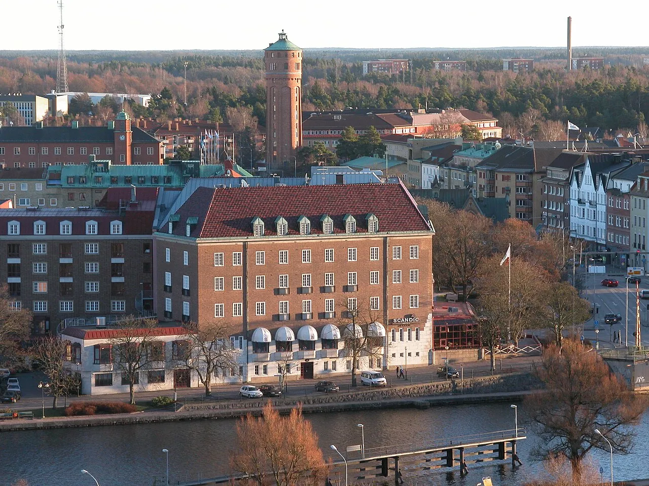
- Population
- 48,573
- 48.6K
- Elevation
- 49 m
- above sea level
- Local time
- UTC+01:00
- Europe/Stockholm · UTC+01:00
- Airports
- THN Trollhättan-Vänersborg Airport5 km
- GOT Göteborg Landvetter Airport69 km
About Trollhättan
Trollhättan is a city. Location: Trollhättan Municipality, Västra Götaland County. Population: 48,573. Elevation: 49 m.
Trollhättan (Swedish pronunciation: [ˈtrɔ̂lːˌhɛtːan] ) is the 23rd-largest city in Sweden, the seat of Trollhättan Municipality, Västra Götaland County. It is situated by Göta älv, near the lake Vänern, and has a population of approximately 50,000 in the city proper. It is located 75 km (46 mi) north of Sweden's second-largest city, Gothenburg.
Source: Wikipedia · CC BY-SA 4.0
Photos of Trollhättan
-

Boberger · CC BY-SA 4.0 -

W.carter · CC BY-SA 4.0 -

Kuriosatempel · CC BY-SA 4.0 -

Boberger · CC BY-SA 4.0 -

Bengt Oberger · CC BY-SA 4.0


Travel notes for Trollhättan
From Wikivoyage
Trollhättan is an industrial city in Sweden. It lies in Västergötland province in the modern (larger) Götaland region, and has 53,000 inhabitants.
Understand+
In Trollhättan the Trollhätte canal starts, connecting the Kattegat (west coast) with lake Vänern. Just outside the center of town, there are several sets of locks. A first set of small locks from 1800, which are now derelict. A second set of locks from around 1844. A third set of locks from 1916, which are still in use today. About 10 freight ships per day pass the locks today, and throughout the summer months about 4000 leisure boats pass by.
Together with Göta kanal, the canal forms a waterway between the Atlantic and the Baltic Sea.
Not far from the locks, is the Olide hydropower station. The waterfall of the mighty Göta river was tamed with the construction of a huge powerplant between 1905 and 1914. The power station is built with huge granite blocks and looks like an enormous castle. On some days in the summer months the waterfall is (partly) released again.
Trollhättan has been important to Swedish industry, with the SAAB Automobile factory. Nearby, the SAAB museum is located.
Get in+
By plane:
1 Trollhättan–Vänersborg Airport (THN IATA Fyrstads Flygplats). doesn't connect to many places other than Stockholm.
By train:
The train station (Resecentrum) lies just ten minutes walk from the center of the town. You can choose either to go north - Oslo or Karlstad or south towards Gothenburg or Copenhagen.
2 Trollhättan railway station (Trollhättan resecentrum). (updated Jan 2026)
By car:
80 km 1h north of Gothenburg via the road RV45.
Source: Wikivoyage · CC BY-SA 4.0 · abridged
Population of Trollhättan over time
| 2010 | 46,457 | |
|---|---|---|
| 2015 | 48,573 | |
| 2016 | 49,138 | |
| 2017 | 49,511 | |
| 2018 | 50,032 | |
| 2019 | 50,300 | |
| 2020 | 50,502 | |
| 2023 | 50,069 |
Censuses and official estimates; source: Wikidata.
Climate of Trollhättan
Best months for sightseeingBest months for sightseeing: June–August.
This month · November
A cold month
Day 5° · Night 1° · Rain 86 mm
- Hottest month
- July (day 21°)
- Coldest month
- February (night -5°)
- Wettest month
- November (86 mm)
- Driest month
- April (46 mm)
Bars: average monthly low and high temperature. Below: precipitation. Monthly averages for 1970–2000 at about 18 km resolution, adjusted for elevation. Highlighted months are mild and relatively dry. Source: WorldClim 2.1 (CC BY 4.0).
Show values as a table
| Month | Jan | Feb | Mar | Apr | May | Jun | Jul | Aug | Sep | Oct | Nov | Dec |
|---|---|---|---|---|---|---|---|---|---|---|---|---|
| Average high (°C) | 1° | 1° | 4° | 9° | 15° | 19° | 21° | 20° | 15° | 10° | 5° | 3° |
| Average low (°C) | -4° | -5° | -2° | 1° | 5° | 9° | 11° | 11° | 7° | 4° | 1° | -3° |
| Precipitation (mm) | 67 | 48 | 50 | 46 | 48 | 67 | 68 | 72 | 84 | 85 | 86 | 74 |
How to get to Trollhättan
The nearest airport is Trollhättan-Vänersborg Airport (THN), 5 km to the northeast as the crow flies. For international flights: Göteborg Landvetter Airport (GOT) (69 km). The nearest large city is Gothenburg, 67 km to the south.
Airports
- Trollhättan-Vänersborg Airport (THN) Trollhättan 5 kmnortheast
- Göteborg Landvetter Airport (GOT) Göteborg 69 kmsouth
- Jönköping Airport (JKG) Jönköping 120 kmsoutheast
Nearby large cities
- Gothenburg Population: 608.5K 67 kmsouth
- Jönköping Population: 112.8K 124 kmsoutheast
- Aalborg Population: 142.9K 197 kmsouthwest
- Örebro Population: 156K 202 kmnortheast
- Oslo Population: 1.1M 202 kmnorthwest
Straight-line distances; road distances are longer. Airport data: OurAirports.
Day trips from Trollhättan
Within 100 km: 8 historic and cultural sites, 85 natural sites, 455 lakes, rivers and coasts.
0–25 km2 places
- Kalvön Island 18 kmNW
- Brattåsholmen Island 23 kmW
25–60 km218 places
- Orust Island 41 kmW
- Skaftölandet Island 50 kmW
- Grötö Island 53 kmW
- Lindholmen Island 46 kmW
60–100 km328 places
- Hisingen Island 62 kmSW
- Kållandsö Island 66 kmNE
- Flötemarksön Island 67 kmNW
- Guleskär Island 78 kmW
Straight-line distances.
Nearby attractions & nature
Everything nearby-
Brattåsholmen Island, Västra Götaland County23 km W
-
Kalvön Island, Västra Götaland County18 km NW
Sources & licences
Data last updated: · 2 independent sources