Stora Levene
Located in Vara Municipality, Västra Götaland County Coordinates: 58°19′29″ N 12°55′31″ E
- Population
- 809
- 809
- Elevation
- 85 m
- above sea level
- Local time
- UTC+01:00
- Europe/Stockholm · UTC+01:00
- Airports
- THN Trollhättan-Vänersborg Airport34 km
- GOT Göteborg Landvetter Airport83 km
About Stora Levene
Stora Levene is a village. Location: Vara Municipality, Västra Götaland County. Population: 809. Elevation: 85 m.
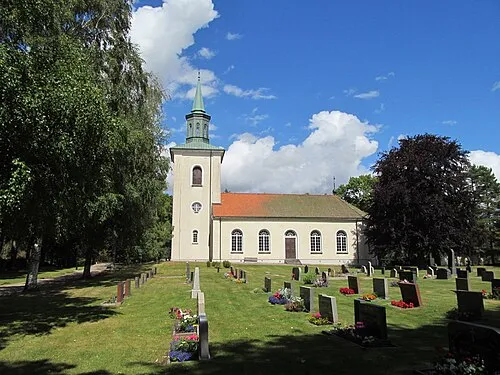
Stora Levene (Swedish pronunciation: [ˈstǔːra ˈlêːvɛnɛ]) is a locality situated in Vara Municipality, Västra Götaland County, Sweden with 761 inhabitants in 2010. According to a regnal list appended to the Westrogothic law, two Swedish kings in the 11th century, Håkan the Red and Stenkil, came from Levene. The church, in the church village on the outskirts of the modern village, is from the 13th century, and holds the grave of the 17th century landshövding Johan Henriksson Reuter.
Source: Wikipedia · CC BY-SA 4.0
At a glance
- Area
- 1.5 km²
Source: Wikidata
Population of Stora Levene over time
| 2010 | 761 | |
|---|---|---|
| 2015 | 809 | |
| 2016 | 809 | |
| 2017 | 818 | |
| 2018 | 810 | |
| 2019 | 794 | |
| 2020 | 794 | |
| 2023 | 773 |
Censuses and official estimates; source: Wikidata.
Climate of Stora Levene
Best months for sightseeingBest months for sightseeing: June–August.
This month · November
A cold month
Day 5° · Night 0° · Rain 66 mm
- Hottest month
- July (day 21°)
- Coldest month
- February (night -5°)
- Wettest month
- September (74 mm)
- Driest month
- February (34 mm)
Bars: average monthly low and high temperature. Below: precipitation. Monthly averages for 1970–2000 at about 18 km resolution, adjusted for elevation. Highlighted months are mild and relatively dry. Source: WorldClim 2.1 (CC BY 4.0).
Show values as a table
| Month | Jan | Feb | Mar | Apr | May | Jun | Jul | Aug | Sep | Oct | Nov | Dec |
|---|---|---|---|---|---|---|---|---|---|---|---|---|
| Average high (°C) | 1° | 1° | 4° | 9° | 16° | 19° | 21° | 21° | 15° | 10° | 5° | 2° |
| Average low (°C) | -4° | -5° | -2° | 1° | 6° | 9° | 11° | 10° | 7° | 4° | 0° | -3° |
| Precipitation (mm) | 47 | 34 | 39 | 38 | 44 | 63 | 64 | 66 | 74 | 68 | 66 | 54 |
How to get to Stora Levene
The nearest airport is Trollhättan-Vänersborg Airport (THN), 34 km to the west as the crow flies. For international flights: Göteborg Landvetter Airport (GOT) (83 km). The nearest large city is Gothenburg, 89 km to the southwest.
Airports
- Trollhättan-Vänersborg Airport (THN) Trollhättan 34 kmwest
- Göteborg Landvetter Airport (GOT) Göteborg 83 kmsouthwest
- Jönköping Airport (JKG) Jönköping 92 kmsoutheast
Nearby large cities
- Gothenburg Population: 608.5K 89 kmsouthwest
- Jönköping Population: 112.8K 95 kmsoutheast
- Örebro Population: 156K 169 kmnortheast
- Oslo Population: 1.1M 216 kmnorthwest
- Drammen Population: 106K 222 kmnorthwest
Straight-line distances; road distances are longer. Airport data: OurAirports.
Day trips from Stora Levene
Within 100 km: 11 historic and cultural sites, 55 natural sites, 280 lakes, rivers and coasts.
0–25 km3 places
- Frugårdsholme Island 20 kmNW
- Björkholme Island 19 kmNW
- Lekåsa kyrka Attraction 21 kmS
25–60 km17 places
- Kållandsö Island 40 kmN
- Lindön Island 58 kmNE
- Musdragsskär Island 55 kmNW
- Lilla Eken Island 47 kmN
60–100 km326 places
- Hisingen Island 87 kmSW
- Orust Island 78 kmW
- Skaftölandet Island 87 kmW
- Visingsö Island 88 kmE
Straight-line distances.
Nearby attractions & nature
Everything nearby-
 Lekåsa kyrka Attraction, Lekåsa socken21 km S
-
Björkholme Island, Västra Götaland County19 km NW
-
Frugårdsholme Island, Västra Götaland County20 km NW
Sources & licences
Data last updated: · 2 independent sources