- Elevation
- 600 m
- above sea level
- Local time
- UTC+01:00
- Europe/Zurich · UTC+01:00
- Airports
- BSL EuroAirport Basel–Mulhouse–Freiburg29 km
- BRN Bern Airport59 km
About Etang de Lucelle
Etang de Lucelle is a lake. Location: Pleigne, Delémont District. Elevation: 600 m. The best months to visit are June–August. The nearest airport is EuroAirport Basel–Mulhouse–Freiburg (29 km). Nearby sights include Lützel (Abbey : Lützel, Switzerland) and Kloster Lützel.
Photos of Etang de Lucelle
-
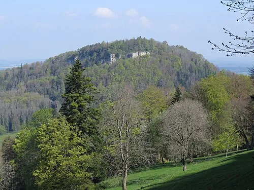
Mont Terri Ours25 · CC BY-SA 3.0

Climate of Etang de Lucelle
Best months for sightseeingBest months for sightseeing: June–August.
This month · November
A cold month
Day 7° · Night 1° · Rain 93 mm
- Hottest month
- July (day 22°)
- Coldest month
- January (night -3°)
- Wettest month
- June (108 mm)
- Driest month
- March (72 mm)
Bars: average monthly low and high temperature. Below: precipitation. Monthly averages for 1970–2000 at about 18 km resolution, adjusted for elevation. Highlighted months are mild and relatively dry. Source: WorldClim 2.1 (CC BY 4.0).
Show values as a table
| Month | Jan | Feb | Mar | Apr | May | Jun | Jul | Aug | Sep | Oct | Nov | Dec |
|---|---|---|---|---|---|---|---|---|---|---|---|---|
| Average high (°C) | 3° | 4° | 8° | 12° | 16° | 20° | 22° | 22° | 18° | 13° | 7° | 4° |
| Average low (°C) | -3° | -2° | 0° | 2° | 7° | 10° | 12° | 12° | 9° | 5° | 1° | -2° |
| Precipitation (mm) | 78 | 78 | 72 | 83 | 107 | 108 | 96 | 92 | 88 | 87 | 93 | 94 |
How to get to Etang de Lucelle
The nearest airport is EuroAirport Basel–Mulhouse–Freiburg (BSL), 29 km to the northeast as the crow flies. The nearest large city is Basel, 29 km to the northeast.
Airports
- EuroAirport Basel–Mulhouse–Freiburg (BSL) Bâle / Mulhouse 29 kmnortheast
- Bern Airport (BRN) Bern 59 kmsouth
- Zürich Airport (ZRH) Zurich 98 kmeast
Nearby large cities
- Basel Population: 177.6K 29 kmnortheast
- Mulhouse Population: 111.4K 38 kmnorth
- Bern Population: 121.6K 55 kmsouth
- Freiburg im Breisgau Population: 237.5K 79 kmnortheast
- Besançon Population: 128.4K 95 kmwest
Straight-line distances; road distances are longer. Airport data: OurAirports.
Day trips from Etang de Lucelle
Within 100 km: 420 historic and cultural sites, 1,612 natural sites, 430 lakes, rivers and coasts.
0–25 km74 places
- Etang de la Gruère Lake 25 kmSW
- Etangs Rougeat Lake 8 kmNW
- Pisciculture Lake 12 kmNW
- Lac Tabeillon Lake 16 kmSW
25–60 km617 places
- Kleiner Bremgartenwald Mountain 52 kmS
- Sankt Petersinsel Island 39 kmS
- Lake Wohlen Lake 51 kmS
- Lake Murten Lake 56 kmS
60–100 km1,771 places
- Fahr Abbey Attraction 90 kmE
- Strandbad Neuhaus Beach 93 kmSE
- Strandbad Manor Farm Beach 93 kmSE
- Strandbad Leissigen Beach 94 kmSE
Straight-line distances.
Nearest towns and villages
-
Lucelle Village, Arrondissement of Altkirch0.5 km N
-
Bourrignon Municipality, Delémont District2.5 km S
-
La Baroche Municipality, Porrentruy District3.4 km W
-
Pleigne Village, Pleigne3.7 km E
-
Lucelle Village, Lucelle0.5 km N
-
Charmoille Village, La Baroche2.9 km W
Nearby attractions & nature
Everything nearby-
Lützel (Abbey : Lützel, Switzerland) Historic site, Grand Est0.3 km N
-
Kloster Lützel Attraction, Grand Est0.3 km N
-
Les Ordons Mountain, Bourrignon3.6 km S
-
Le Morimont Mountain, La Baroche3.5 km NW
-
Mont Terri Mountain, Cornol7 km SW
-
Glaserberg Mountain, Ligsdorf6 km NE
-
Mont Russelin Mountain, Boécourt7.2 km SW
-
Etang de Vendlincourt Lake, Vendlincourt7.2 km NW
Sources & licences
Data last updated: