Franches Montagnes
Located in Canton of Jura, Switzerland Coordinates: 47°12′00″ N 7°00′00″ E
- Elevation
- 1,034 m
- above sea level
- Local time
- UTC+01:00
- Europe/Zurich · UTC+01:00
- Airports
- BRN Bern Airport50 km
- BSL EuroAirport Basel–Mulhouse–Freiburg59 km
About Franches Montagnes
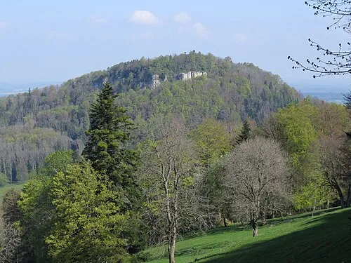
Franches Montagnes is a mountain. Location: Canton of Jura, Switzerland. Elevation: 1,034 m. The best months to visit are July–August. The nearest airport is Bern Airport (50 km). Nearby sights include Petit Crêt and Gros Crêt.
Climate of Franches Montagnes
Best months for sightseeingBest months for sightseeing: July–August.
This month · November
A wet month
Day 5° · Night -1° · Rain 109 mm
- Hottest month
- July (day 19°)
- Coldest month
- January (night -5°)
- Wettest month
- June (122 mm)
- Driest month
- March (87 mm)
Bars: average monthly low and high temperature. Below: precipitation. Monthly averages for 1970–2000 at about 18 km resolution, adjusted for elevation. Highlighted months are mild and relatively dry. Source: WorldClim 2.1 (CC BY 4.0).
Show values as a table
| Month | Jan | Feb | Mar | Apr | May | Jun | Jul | Aug | Sep | Oct | Nov | Dec |
|---|---|---|---|---|---|---|---|---|---|---|---|---|
| Average high (°C) | 1° | 2° | 5° | 9° | 14° | 17° | 19° | 19° | 16° | 11° | 5° | 2° |
| Average low (°C) | -5° | -5° | -2° | 0° | 4° | 7° | 10° | 10° | 7° | 3° | -1° | -4° |
| Precipitation (mm) | 99 | 100 | 87 | 93 | 116 | 122 | 106 | 106 | 101 | 99 | 109 | 116 |
How to get to Franches Montagnes
The nearest airport is Bern Airport (BRN), 50 km to the southeast as the crow flies. For international flights: EuroAirport Basel–Mulhouse–Freiburg (BSL) (59 km). The nearest large city is Bern, 44 km to the southeast.
Airports
- Bern Airport (BRN) Bern 50 kmsoutheast
- EuroAirport Basel–Mulhouse–Freiburg (BSL) Bâle / Mulhouse 59 kmnortheast
- Zürich Airport (ZRH) Zurich 120 kmeast
Nearby large cities
- Bern Population: 121.6K 44 kmsoutheast
- Basel Population: 177.6K 59 kmnortheast
- Mulhouse Population: 111.4K 66 kmnorth
- Besançon Population: 128.4K 75 kmwest
- Lausanne Population: 139.1K 81 kmsouth
Straight-line distances; road distances are longer. Airport data: OurAirports.
Day trips from Franches Montagnes
Within 100 km: 323 historic and cultural sites, 1,924 natural sites, 397 lakes, rivers and coasts.
0–25 km78 places
- Sankt Petersinsel Island 18 kmSE
- Lake Biel Lake 19 kmSE
- Etang de la Gruère Lake 6 kmNE
- Lac de Moron Lake 23 kmSW
25–60 km406 places
- Kleiner Bremgartenwald Mountain 42 kmSE
- Ile d'Ogoz Island 56 kmS
- Lake Wohlen Lake 36 kmSE
- Lake Neuchâtel Lake 32 kmS
60–100 km2,160 places
- Strandbad Neuhaus Beach 85 kmSE
- Strandbad Manor Farm Beach 85 kmSE
- Strandbad Leissigen Beach 84 kmSE
- Strandbad Iseltwald Beach 92 kmSE
Straight-line distances.
Nearest towns and villages
-
Les Breuleux Municipality, Franches-Montagnes District0.6 km N
-
Les Breuleux Village, Les Breuleux1.4 km NE
-
Muriaux Municipality, Franches-Montagnes District2.4 km NW
-
 Le Noirmont Village, Le Noirmont4.2 km NW
-
Le Noirmont Municipality, Franches-Montagnes District4.5 km W
-
Les Vacheries Village, Les Breuleux1.1 km N
Nearby attractions & nature
Everything nearby-
Petit Crêt Mountain, Les Breuleux1.1 km NE
-
Gros Crêt Mountain, Les Breuleux1.2 km E
-
Rond Rochet Mountain, Les Breuleux1.9 km NW
-
Le Point de Vue Mountain, Muriaux2.2 km W
-
Le Peu Mountain, Muriaux2.4 km N
-
Mont Crosin Mountain, Cormoret2.6 km SE
-
Les Laises Mountain, Le Noirmont3.3 km NW
-
Mont-Soleil Mountain, Saint-Imier3.9 km S
More nature in Switzerland
-
Cras au Sauvage Mountain, Les Genevez (JU)11 km NE
-
 Mont Terri Mountain, Cornol25 km NE
-
La Faulx d'Enson Mountain, Haute-Ajoie18 km N
-
Préhisto-Parc de Réclère Natural site, Canton of Jura19 km N
-
Mont Russelin Mountain, Boécourt24 km NE
-
Les Ordons Mountain, Bourrignon27 km NE
Sources & licences
Data last updated: