Solothurn
Located in Solothurn District, Canton of Solothurn Coordinates: 47°12′30″ N 7°31′48″ E
- Population
- 16,933
- 16.9K
- Elevation
- 432 m
- above sea level
- Local time
- UTC+01:00
- Europe/Zurich · UTC+01:00
- Places inside
- 9
- listed under Solothurn
About Solothurn
Solothurn is a municipality. Location: Solothurn District, Canton of Solothurn. Population: 16,933. Elevation: 432 m.
In comparison
- Nearest larger town: Grenchen, 11 km W
- 27 sights and natural places within 10 km Kloster Solothurn, Jesuitenkirche
- Listed here: Attraction: 4, Neighbourhood: 3, City: 1, Village: 1
Places in Solothurn
9 places-
Solothurn City16.8K
-
Cathédrale Saint-Ours-et-Saint-Victor Attraction
-
Jesuitenkirche Attraction
-
Kloster Solothurn Attraction
-
Solothurn (Alleepark) Neighbourhood
-
Solothurn (Sonnenpark) Village
-
Solothurn (Vorstadt) Neighbourhood
-
Solothurn (West-Stadt) Neighbourhood
-
Voliere Solothurn Attraction
Nearby attractions & nature
Everything nearby-
Voliere Chantier Attraction, Canton of Solothurn0.9 km E
-
Obach River, Switzerland1 km S
-
Dürrbach River, Switzerland1.4 km NW
-
Nesselboden Mountain, Oberdorf (SO)4.4 km N
-
Emme River, Switzerland3.3 km E
-
Bellacher Weiher Lake, Bellach3.8 km W
-
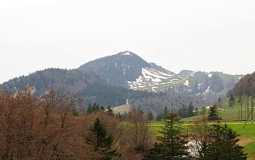 Hasenmatt Mountain, Selzach7.1 km NW
-
Dilitschchopf Mountain, Welschenrohr-Gänsbrunnen5.9 km NW
Sources & licences
Data last updated: