- Elevation
- 1,445 m
- above sea level
- Local time
- UTC+01:00
- Europe/Zurich · UTC+01:00
- Airports
- BRN Bern Airport37 km
- BSL EuroAirport Basel–Mulhouse–Freiburg40 km
About Hasenmatt
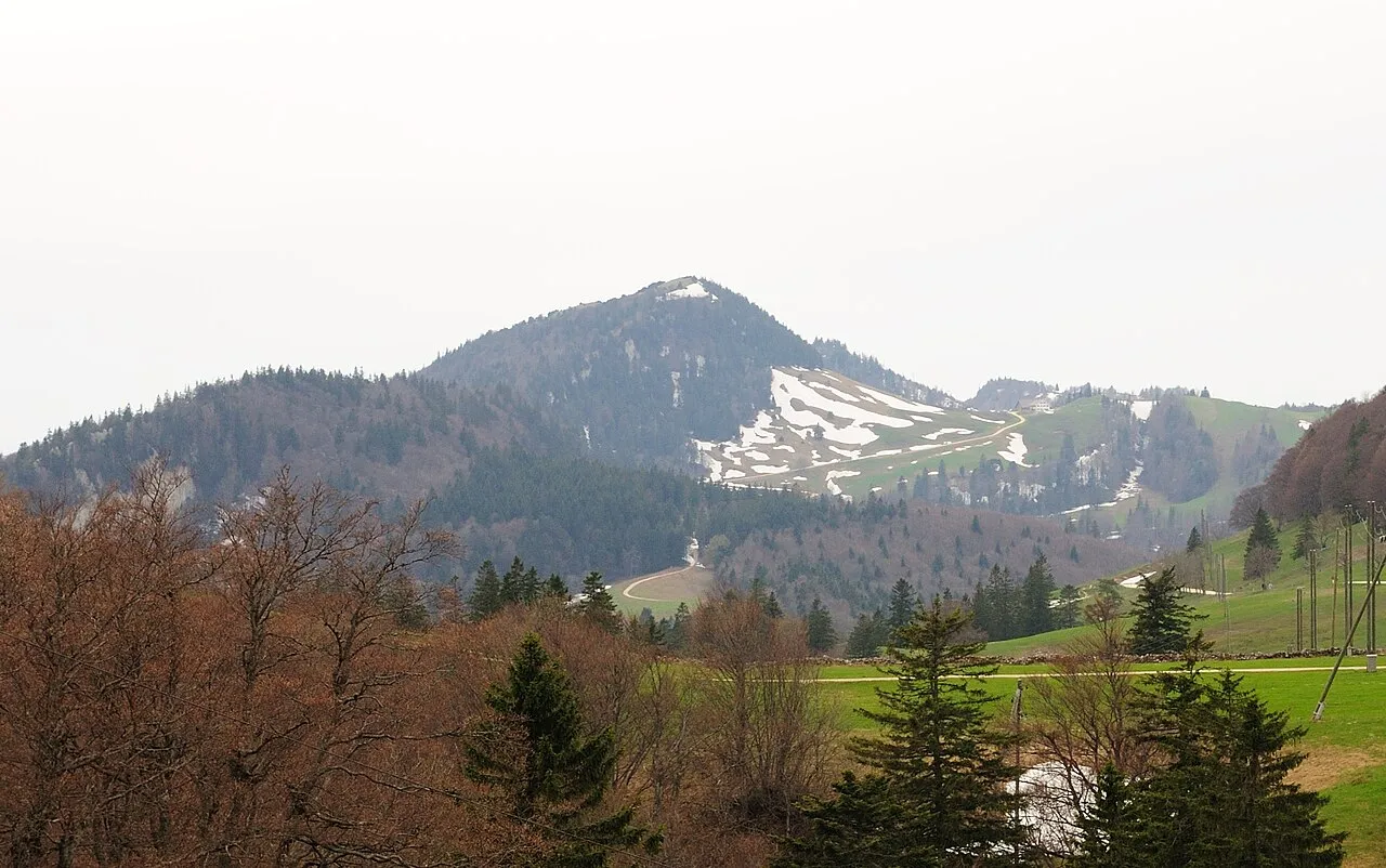
Hasenmatt is a mountain. Location: Selzach, Bezirk Lebern. Elevation: 1,445 m.
The Hasenmatt is a mountain of the Jura range, located north of Grenchen and Solothurn in the Swiss canton of Solothurn. Reaching a height of 1,445 metres above sea level, it is the highest summit in the canton of Solothurn. The Hasenmatt is also the easternmost summit above 1,400 metres of the Jura Mountains. The summit of the Hasenmatt can be easily reached by several trails and a road culminating at 1,318 metres.
Source: Wikipedia · CC BY-SA 4.0
At a glance
- Topographic prominence
- 618 m
Source: Wikidata
Photos of Hasenmatt
-

Jörg Braukmann · CC BY-SA 4.0 -

Jörg Braukmann · CC BY-SA 4.0 -

Ernst Klöti · CC BY-SA 4.0


Climate of Hasenmatt
Best months for sightseeingBest months for sightseeing: July–August.
This month · November
A wet month
Day 2° · Night -4° · Rain 104 mm
- Hottest month
- July (day 17°)
- Coldest month
- January (night -8°)
- Wettest month
- June (128 mm)
- Driest month
- March (81 mm)
Bars: average monthly low and high temperature. Below: precipitation. Monthly averages for 1970–2000 at about 18 km resolution, adjusted for elevation. Highlighted months are mild and relatively dry. Source: WorldClim 2.1 (CC BY 4.0).
Show values as a table
| Month | Jan | Feb | Mar | Apr | May | Jun | Jul | Aug | Sep | Oct | Nov | Dec |
|---|---|---|---|---|---|---|---|---|---|---|---|---|
| Average high (°C) | -2° | -1° | 3° | 6° | 11° | 14° | 17° | 17° | 13° | 8° | 2° | -1° |
| Average low (°C) | -8° | -7° | -5° | -3° | 2° | 5° | 7° | 7° | 4° | 0° | -4° | -6° |
| Precipitation (mm) | 87 | 88 | 81 | 94 | 118 | 128 | 113 | 108 | 96 | 97 | 104 | 103 |
How to get to Hasenmatt
The nearest airport is Bern Airport (BRN), 37 km to the south as the crow flies. For international flights: EuroAirport Basel–Mulhouse–Freiburg (BSL) (40 km). The nearest large city is Bern, 33 km to the south.
Airports
- Bern Airport (BRN) Bern 37 kmsouth
- EuroAirport Basel–Mulhouse–Freiburg (BSL) Bâle / Mulhouse 40 kmnorth
- Zürich Airport (ZRH) Zurich 86 kmeast
Nearby large cities
- Bern Population: 121.6K 33 kmsouth
- Basel Population: 177.6K 36 kmnorth
- Mulhouse Population: 111.4K 57 kmnorth
- Zurich Population: 415.4K 84 kmeast
- Freiburg im Breisgau Population: 237.5K 89 kmnorth
Straight-line distances; road distances are longer. Airport data: OurAirports.
Day trips from Hasenmatt
Within 100 km: 396 historic and cultural sites, 3,176 natural sites, 560 lakes, rivers and coasts.
0–25 km104 places
- Inkwilersee Lake 17 kmE
- Burgaeschisee Lake 18 kmSE
- Häftli Lake 12 kmSW
- Alte Zihl Lake 15 kmSW
25–60 km640 places
- Kleiner Bremgartenwald Mountain 30 kmS
- Arbeiterstrandbad Tennwil Beach 58 kmE
- Sankt Petersinsel Island 30 kmSW
- Mauesee-Insel Island 48 kmE
60–100 km3,388 places
- Fahr Abbey Attraction 77 kmE
- Strandbad Neuhaus Beach 69 kmSE
- Strandbad Manor Farm Beach 68 kmSE
- Strandbad Leissigen Beach 70 kmS
Straight-line distances.
Nearest towns and villages
-
Lommiswil Municipality, Bezirk Lebern2 km SE
-
Oberdorf (SO) Municipality, Bezirk Lebern3.2 km E
-
Selzach Village, Selzach4.1 km S
-
Bettlach Municipality, Bezirk Lebern4.5 km SW
-
Gänsbrunnen Village, Welschenrohr-Gänsbrunnen2.5 km NE
-
Bettlach Village, Bettlach5 km SW
Nearby attractions & nature
Everything nearby-
Stallflue Mountain, Selzach1.4 km W
-
Gitziflue Mountain, Oberdorf (SO)1.6 km E
-
Dilitschchopf Mountain, Welschenrohr-Gänsbrunnen2.9 km NE
-
Wandflue Mountain, Selzach3.2 km W
-
Bettlachstock Mountain, Bettlach3.3 km SW
-
Oberdörferberg Mountain, Welschenrohr-Gänsbrunnen2.8 km NW
-
Nesselboden Mountain, Oberdorf (SO)4.4 km E
-
Graitery Mountain, Court5.1 km W
Sources & licences
Data last updated: · 2 independent sources