Tschlin
Located in Valsot, Region Engiadina Bassa / Val Müstair Coordinates: 46°52′11″ N 10°25′32″ E
- Elevation
- 1,535 m
- above sea level
- Local time
- UTC+01:00
- Europe/Zurich · UTC+01:00
- Airports
- INN Innsbruck Airport82 km
- BZO Bolzano Airport83 km
About Tschlin
Tschlin is a village. Location: Valsot, Region Engiadina Bassa / Val Müstair. Elevation: 1,535 m. The best months to visit are July–August. The nearest airport is Innsbruck Airport (82 km). Nearby sights include Mot Tea Nova and Motta d'Alp.
Photos of Tschlin
-
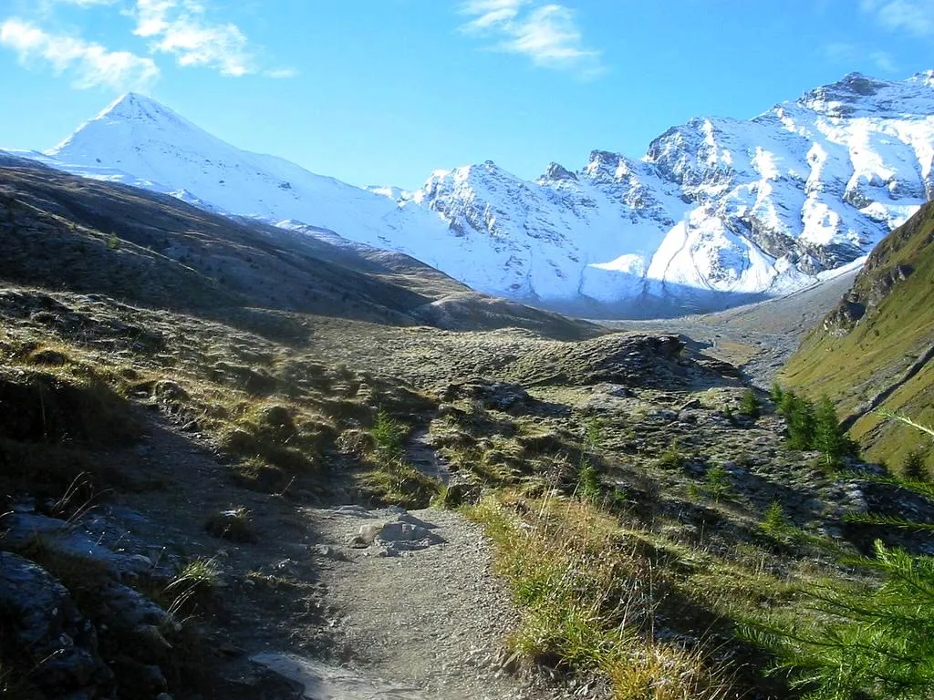
Muttler ZachT · Public domain

Climate of Tschlin
Best months for sightseeingBest months for sightseeing: July–August.
This month · November
A cold month
Day 4° · Night -3° · Rain 72 mm
- Hottest month
- July (day 18°)
- Coldest month
- February (night -7°)
- Wettest month
- July (115 mm)
- Driest month
- February (57 mm)
Bars: average monthly low and high temperature. Below: precipitation. Monthly averages for 1970–2000 at about 18 km resolution, adjusted for elevation. Highlighted months are mild and relatively dry. Source: WorldClim 2.1 (CC BY 4.0).
Show values as a table
| Month | Jan | Feb | Mar | Apr | May | Jun | Jul | Aug | Sep | Oct | Nov | Dec |
|---|---|---|---|---|---|---|---|---|---|---|---|---|
| Average high (°C) | 0° | 1° | 4° | 6° | 11° | 15° | 18° | 17° | 15° | 10° | 4° | 2° |
| Average low (°C) | -7° | -7° | -4° | -2° | 3° | 6° | 8° | 8° | 6° | 2° | -3° | -5° |
| Precipitation (mm) | 64 | 57 | 69 | 73 | 84 | 104 | 115 | 108 | 81 | 69 | 72 | 69 |
How to get to Tschlin
The nearest airport is Innsbruck Airport (INN), 82 km to the northeast as the crow flies. The nearest large city is Innsbruck, 86 km to the northeast.
Airports
- Innsbruck Airport (INN) Innsbruck 82 kmnortheast
- Bolzano Airport (BZO) Bolzano (BZ) 83 kmsoutheast
- Sankt Gallen Altenrhein Airport (ACH) St. Gallen 95 kmnorthwest
Nearby large cities
- Innsbruck Population: 132.5K 86 kmnortheast
- Winterthur Population: 111.8K 147 kmnorthwest
- Zurich Population: 415.4K 153 kmwest
- Munich Population: 1.5M 165 kmnortheast
- Augsburg Population: 301.1K 171 kmnorth
Straight-line distances; road distances are longer. Airport data: OurAirports.
Day trips from Tschlin
Within 100 km: 221 historic and cultural sites, 5,763 natural sites, 965 lakes, rivers and coasts.
0–25 km560 places
- Lai Verd Lake 21 kmW
- Lai da Minschun Lake 15 kmW
- Lai Blau Lake 21 kmW
- Lai da Sesvenna Lake 17 kmS
25–60 km2,227 places
- Lej Languard Lake 57 kmSW
- Lake Davos Lake 44 kmW
- Lai Alv Lake 59 kmSW
- Lejs d'Albris Lake 57 kmSW
60–100 km4,162 places
- Spadalone Mountain 84 kmS
- Chaviolas Island 72 kmSW
- Lajets Lake 76 kmSW
- Walensee Lake 98 kmW
Straight-line distances.
Nearby attractions & nature
Everything nearby-
Mot Tea Nova Mountain, Valsot2.1 km NW
-
Motta d'Alp Mountain, Valsot3.4 km NE
-
Mot da las Amblanas Mountain, Valsot3.5 km NW
-
Mot dal Müs-chel Mountain, Valsot3.7 km SE
-
Muttler Mountain, Samnaun4.9 km NW
-
Piz Ajüz Mountain, Valsot4.2 km SE
Sources & licences
Data last updated: