Märstetten
Located in Weinfelden District, Thurgau Coordinates: 47°35′20″ N 9°04′39″ E
- Population
- 2,889
- 2.9K
- Elevation
- 463 m
- above sea level
- Local time
- UTC+01:00
- Europe/Zurich · UTC+01:00
- Places inside
- 25
- listed under Märstetten
About Märstetten
Märstetten is a municipality. Location: Weinfelden District, Thurgau. Population: 2,889. Elevation: 463 m.
In comparison
- No. 8 of 18 places in Weinfelden District by population
- Nearest larger town: Weinfelden, 3 km SE
- 16 sights and natural places within 10 km Schloss Altenklingen, Ergolfweiher
- Listed here: Village: 22, Neighbourhood: 2, Lake: 1
Places in Märstetten
25 places-
Märstetten-Dorf Village2.6K
-
Altenburg Village
-
Bachtobel Village
-
Boltshausen Village
-
Brunnenholz Village
-
Bühl Village
-
Dattenhub Village
-
Entenmoos Village
-
Ergolfweiher Lake
-
Euggelberg Village
-
Evenhüsli Village
-
Gaishaus Village
-
Geissbühl Village
-
Grubmühle Village
-
Hinterruberbaum Village
-
Klingenmühle Village
-
Märstetten-Station Neighbourhood
-
Muhlershaus Village
-
Neuburg Village
-
Ottoberg Neighbourhood
-
Riet Village
-
Rossrüti Village
-
Ruberbaum Village
-
Sonnenberg Village
-
Wald Village
Nearby attractions & nature
Everything nearby-
Schloss Altenklingen Historic site, Wigoltingen1.5 km N
-
Connyland Natural site, Thurgau3.2 km NW
-
Ottenberg Mountain, Weinfelden4.6 km E
-
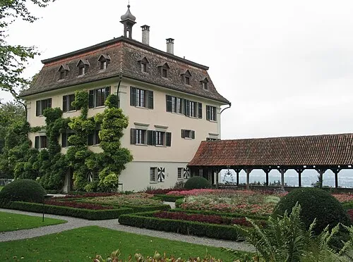 Schloss Wolfsberg Historic site, Ermatingen7.8 km N
-
Maerwiler Moos Lake, Affeltrangen5.6 km S
-
Schloss Klingenberg Historic site, Homburg6.8 km NW
-
Anderbach Lake, Homburg6.2 km NW
-
Bommerweiher Lake, Kemmental6.3 km NE
Sources & licences
Data last updated: