- Elevation
- 446 m
- above sea level
- Local time
- UTC+01:00
- Europe/Zurich · UTC+01:00
- Airports
- FDH Bodensee Airport Friedrichshafen33 km
- ACH Sankt Gallen Altenrhein Airport39 km
About Klingenmühle
Klingenmühle is a village. Location: Märstetten, Weinfelden District. Elevation: 446 m. The best months to visit are May–September. The nearest airport is Bodensee Airport Friedrichshafen (33 km). Nearby sights include Schloss Altenklingen and Connyland.
Climate of Klingenmühle
Best months for sightseeingBest months for sightseeing: May–September.
This month · November
A cold month
Day 7° · Night 2° · Rain 79 mm
- Hottest month
- July (day 24°)
- Coldest month
- January (night -2°)
- Wettest month
- June (121 mm)
- Driest month
- January (53 mm)
Bars: average monthly low and high temperature. Below: precipitation. Monthly averages for 1970–2000 at about 18 km resolution, adjusted for elevation. Highlighted months are mild and relatively dry. Source: WorldClim 2.1 (CC BY 4.0).
Show values as a table
| Month | Jan | Feb | Mar | Apr | May | Jun | Jul | Aug | Sep | Oct | Nov | Dec |
|---|---|---|---|---|---|---|---|---|---|---|---|---|
| Average high (°C) | 3° | 5° | 10° | 14° | 19° | 22° | 24° | 24° | 19° | 13° | 7° | 4° |
| Average low (°C) | -2° | -2° | 1° | 4° | 8° | 11° | 14° | 13° | 10° | 6° | 2° | -1° |
| Precipitation (mm) | 53 | 61 | 57 | 77 | 92 | 121 | 116 | 105 | 80 | 72 | 79 | 70 |
Other places to visit in this season: May June July August September
How to get to Klingenmühle
The nearest airport is Bodensee Airport Friedrichshafen (FDH), 33 km to the east as the crow flies. The nearest large city is Winterthur, 29 km to the west.
Airports
- Bodensee Airport Friedrichshafen (FDH) Friedrichshafen 33 kmeast
- Sankt Gallen Altenrhein Airport (ACH) St. Gallen 39 kmeast
- Zürich Airport (ZRH) Zurich 43 kmwest
Nearby large cities
- Winterthur Population: 111.8K 29 kmwest
- Zurich Population: 415.4K 48 kmsouthwest
- Reutlingen Population: 112.6K 99 kmnorth
- Freiburg im Breisgau Population: 237.5K 102 kmnorthwest
- Ulm Population: 120.5K 112 kmnortheast
Straight-line distances; road distances are longer. Airport data: OurAirports.
Nearby attractions & nature
Everything nearby-
Schloss Altenklingen Historic site, Wigoltingen0.1 km N
-
Connyland Natural site, Thurgau2.2 km NW
-
Ergolfweiher Lake, Märstetten2.7 km SW
-
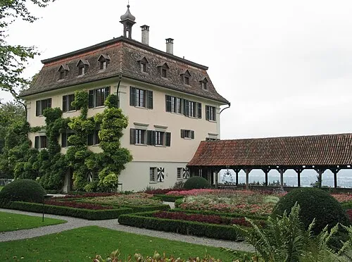 Schloss Wolfsberg Historic site, Ermatingen6.4 km N
-
Ottenberg Mountain, Weinfelden4.9 km SE
-
Anderbach Lake, Homburg5.4 km NW
Sources & licences
Data last updated: