Gasselterboerveen
Located in Gemeente Aa en Hunze, Drenthe Coordinates: 52°59′54″ N 6°50′35″ E

- Population
- 40
- 40
- Elevation
- 3 m
- above sea level
- Local time
- UTC+01:00
- Europe/Amsterdam · UTC+01:00
- Airports
- GRQ Groningen Airport Eelde22 km
- FMO Münster Osnabrück Airport112 km
About Gasselterboerveen
Gasselterboerveen is a village. Location: Gemeente Aa en Hunze, Drenthe. Population: 40. Elevation: 3 m.
Gasselterboerveen is a hamlet in the Dutch province of Drenthe. It is a part of the municipality of Aa en Hunze, and lies about 19 km east of Assen. The statistical area "Gasselterboerveen", which can also include the surrounding countryside, has a population of around 50.
Source: Wikipedia · CC BY-SA 4.0
At a glance
- Heritage designation
- Rijksmonument
Source: Wikidata
Photos of Gasselterboerveen
-

A. J. van der Wal · CC BY-SA 4.0 -

A. J. van der Wal · CC BY-SA 4.0 -

A. J. van der Wal · CC BY-SA 4.0


Climate of Gasselterboerveen
Best months for sightseeingBest months for sightseeing: June–August.
This month · November
A cold month
Day 9° · Night 3° · Rain 73 mm
- Hottest month
- August (day 22°)
- Coldest month
- January (night -1°)
- Wettest month
- July (78 mm)
- Driest month
- April (45 mm)
Bars: average monthly low and high temperature. Below: precipitation. Monthly averages for 1970–2000 at about 18 km resolution, adjusted for elevation. Highlighted months are mild and relatively dry. Source: WorldClim 2.1 (CC BY 4.0).
Show values as a table
| Month | Jan | Feb | Mar | Apr | May | Jun | Jul | Aug | Sep | Oct | Nov | Dec |
|---|---|---|---|---|---|---|---|---|---|---|---|---|
| Average high (°C) | 4° | 5° | 9° | 13° | 18° | 20° | 21° | 22° | 18° | 14° | 9° | 6° |
| Average low (°C) | -1° | -1° | 1° | 3° | 7° | 10° | 12° | 12° | 9° | 6° | 3° | 1° |
| Precipitation (mm) | 68 | 47 | 64 | 45 | 55 | 76 | 78 | 59 | 68 | 72 | 73 | 76 |
How to get to Gasselterboerveen
The nearest airport is Groningen Airport Eelde (GRQ), 22 km to the northwest as the crow flies. The nearest large city is Groningen, 31 km to the northwest.
Airports
- Groningen Airport Eelde (GRQ) Groningen 22 kmnorthwest
- Münster Osnabrück Airport (FMO) Greven 112 kmsoutheast
- Bremen Airport (BRE) Bremen 131 kmeast
Nearby large cities
- Groningen Population: 244.8K 31 kmnorthwest
- Leeuwarden Population: 124.5K 73 kmwest
- Zwolle Population: 129.8K 74 kmsouthwest
- Enschede Population: 153.7K 87 kmsouth
- Oldenburg Population: 159.2K 93 kmeast
Straight-line distances; road distances are longer. Airport data: OurAirports.
Day trips from Gasselterboerveen
Within 100 km: 103 historic and cultural sites, 561 natural sites, 360 lakes, rivers and coasts.
0–25 km4 places
- Wedderborg Historic site 17 kmNE
- Bourtange Fortress Historic site 23 kmE
- Police Custody Camp Westerbork Historic site 23 kmSW
- Bourtange Fortress Museum Museum 23 kmE
25–60 km276 places
- Hatzumer Sand Island 48 kmNE
- Wolfmeer Lake 55 kmNE
- Uphuser Meer Lake 51 kmNE
- Twekmeer Lake 56 kmNE
60–100 km744 places
- East Frisian Islands Island 90 kmNE
- Norderney Island 84 kmN
- Borkum Island 66 kmN
- Baltrum Island 89 kmNE
Straight-line distances.
Nearby attractions & nature
Everything nearby-
Bourtange Fortress Historic site, Westerwolde Municipality23 km E
-
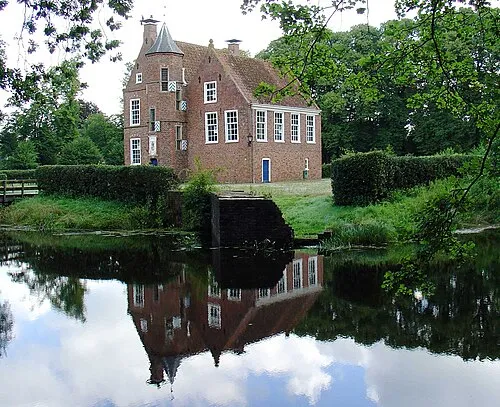 Wedderborg Historic site, Westerwolde Municipality17 km NE
-
Bourtange Fortress Museum Museum, Westerwolde Municipality23 km E
-
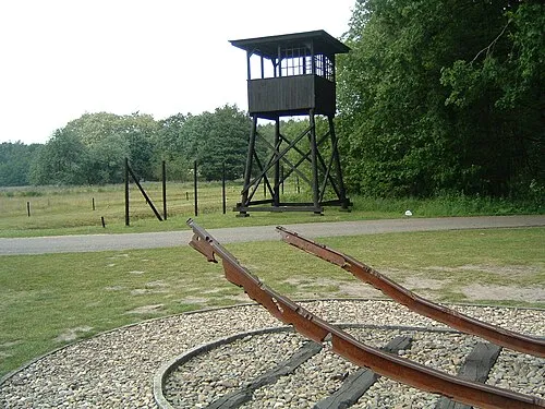 Police Custody Camp Westerbork Historic site, Gemeente Midden-Drenthe23 km SW
Other cities and towns in Gemeente Aa en Hunze
-
 Gieten Village, Gemeente Aa en Hunze5.4 km W
-
 Nieuwediep Village, Gemeente Aa en Hunze5 km N
-
 Eext Village, Gemeente Aa en Hunze7.6 km W
-
 Eexterveen Village, Gemeente Aa en Hunze6.7 km NW
-
Eexterzandvoort Village, Gemeente Aa en Hunze5.7 km NW
-
Gasselterboerveenschemond Village, Gemeente Aa en Hunze2.7 km E
Sources & licences
Data last updated: · 2 independent sources