- Population
- 2,175
- 2.2K
- Elevation
- 15 m
- above sea level
- Local time
- UTC+01:00
- Europe/Amsterdam · UTC+01:00
- Airports
- GRQ Groningen Airport Eelde49 km
- FMO Münster Osnabrück Airport86 km
About Veenoord
Veenoord is a village. Location: Gemeente Emmen, Drenthe. Population: 2,175. Elevation: 15 m.
Veenoord is a village in the Netherlands and it is part of the Emmen municipality in Drenthe. It forms a single urban area with Nieuw-Amsterdam. Vincent van Gogh stayed in the Scholte Inn during his Drenthe period.
Source: Wikipedia · CC BY-SA 4.0
Climate of Veenoord
Best months for sightseeingBest months for sightseeing: June–August.
This month · November
A cold month
Day 9° · Night 3° · Rain 69 mm
- Hottest month
- August (day 22°)
- Coldest month
- February (night -1°)
- Wettest month
- June (75 mm)
- Driest month
- April (44 mm)
Bars: average monthly low and high temperature. Below: precipitation. Monthly averages for 1970–2000 at about 18 km resolution, adjusted for elevation. Highlighted months are mild and relatively dry. Source: WorldClim 2.1 (CC BY 4.0).
Show values as a table
| Month | Jan | Feb | Mar | Apr | May | Jun | Jul | Aug | Sep | Oct | Nov | Dec |
|---|---|---|---|---|---|---|---|---|---|---|---|---|
| Average high (°C) | 5° | 5° | 9° | 13° | 18° | 20° | 22° | 22° | 18° | 14° | 9° | 6° |
| Average low (°C) | 0° | -1° | 1° | 3° | 7° | 10° | 12° | 12° | 9° | 6° | 3° | 1° |
| Precipitation (mm) | 66 | 47 | 62 | 44 | 53 | 75 | 75 | 55 | 67 | 69 | 69 | 74 |
How to get to Veenoord
The nearest airport is Groningen Airport Eelde (GRQ), 49 km to the north as the crow flies. The nearest large city is Enschede, 55 km to the south.
Airports
- Groningen Airport Eelde (GRQ) Groningen 49 kmnorth
- Münster Osnabrück Airport (FMO) Greven 86 kmsoutheast
- Weeze (Niederrhein) Airport (NRN) Weeze 133 kmsouth
Nearby large cities
- Enschede Population: 153.7K 55 kmsouth
- Zwolle Population: 129.8K 56 kmsouthwest
- Groningen Population: 244.8K 60 kmnorth
- Apeldoorn Population: 136.7K 82 kmsouthwest
- Leeuwarden Population: 124.5K 89 kmnorthwest
Straight-line distances; road distances are longer. Airport data: OurAirports.
Nearby attractions & nature
Everything nearby-
Breiberg Mountain, Coevorden13 km W
-
Kniepenberg Mountain, Wielen21 km S
-
Auf dem Bült Mountain, Twist17 km SE
-
Großer Sand Natural site, Lower Saxony24 km E
-
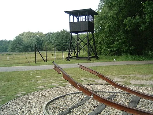 Police Custody Camp Westerbork Historic site, Gemeente Midden-Drenthe23 km NW
-
Spöllberg Mountain, Gölenkamp24 km S
Sources & licences
Data last updated: · 2 independent sources