
- Elevation
- 15 m
- above sea level
- Local time
- UTC+01:00
- Europe/Amsterdam · UTC+01:00
- Airports
- GRQ Groningen Airport Eelde41 km
- FMO Münster Osnabrück Airport104 km
About Tiendeveen
Tiendeveen is a village. Location: Gemeente Hoogeveen, Drenthe. Elevation: 15 m.
Tiendeveen is a village in the Netherlands, in the municipality of Hoogeveen. Tiendeveen takes its name from the Dutch word for peat, "veen", which is collected there, just as in Hoogeveen and Witteveen.
Source: Wikipedia · CC BY-SA 4.0
Climate of Tiendeveen
Best months for sightseeingBest months for sightseeing: June–August.
This month · November
A cold month
Day 9° · Night 3° · Rain 79 mm
- Hottest month
- August (day 22°)
- Coldest month
- January (night 0°)
- Wettest month
- December (82 mm)
- Driest month
- April (49 mm)
Bars: average monthly low and high temperature. Below: precipitation. Monthly averages for 1970–2000 at about 18 km resolution, adjusted for elevation. Highlighted months are mild and relatively dry. Source: WorldClim 2.1 (CC BY 4.0).
Show values as a table
| Month | Jan | Feb | Mar | Apr | May | Jun | Jul | Aug | Sep | Oct | Nov | Dec |
|---|---|---|---|---|---|---|---|---|---|---|---|---|
| Average high (°C) | 5° | 5° | 9° | 13° | 18° | 20° | 22° | 22° | 18° | 14° | 9° | 6° |
| Average low (°C) | 0° | 0° | 2° | 3° | 7° | 10° | 12° | 11° | 9° | 6° | 3° | 1° |
| Precipitation (mm) | 73 | 52 | 68 | 49 | 59 | 76 | 77 | 57 | 74 | 75 | 79 | 82 |
How to get to Tiendeveen
The nearest airport is Groningen Airport Eelde (GRQ), 41 km to the north as the crow flies. The nearest large city is Zwolle, 40 km to the southwest.
Airports
- Groningen Airport Eelde (GRQ) Groningen 41 kmnorth
- Münster Osnabrück Airport (FMO) Greven 104 kmsoutheast
- Amsterdam Airport Schiphol (AMS) Amsterdam 130 kmwest
Nearby large cities
- Zwolle Population: 129.8K 40 kmsouthwest
- Groningen Population: 244.8K 53 kmnorth
- Enschede Population: 153.7K 64 kmsouth
- Leeuwarden Population: 124.5K 71 kmnorthwest
- Apeldoorn Population: 136.7K 71 kmsouthwest
Straight-line distances; road distances are longer. Airport data: OurAirports.
Day trips from Tiendeveen
Within 100 km: 90 historic and cultural sites, 493 natural sites, 241 lakes, rivers and coasts.
0–25 km7 places
- Radewijkerbeek River 21 kmS
- Radewijke River 24 kmSE
- Hunnenkloosterberg Mountain 12 kmW
- Havelterberg Mountain 22 kmW
25–60 km132 places
- Putjensberg Mountain 54 kmSW
- Dankernsee Lake 44 kmE
- Heeder See Lake 56 kmNE
- Biener See Lake 54 kmE
60–100 km685 places
- Borkum Island 93 kmN
- Nordstrand Beach 98 kmN
- Borkum Island 93 kmN
- Lütje Hörn Island 96 kmN
Straight-line distances.
Nearby attractions & nature
Everything nearby-
Bendersche Berg Mountain, Gemeente Westerveld11 km NW
-
Hunnenkloosterberg Mountain, Gemeente De Wolden12 km W
-
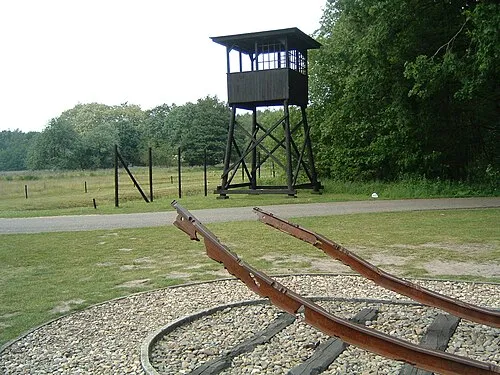 Police Custody Camp Westerbork Historic site, Gemeente Midden-Drenthe12 km N
-
Breiberg Mountain, Coevorden12 km SE
-
Havelterberg Mountain, Gemeente Westerveld22 km W
-
Radewijke River, Thuringia24 km SE
Other cities and towns in Gemeente Hoogeveen
-
 Pesse Village, Gemeente Hoogeveen6.7 km NW
-
Nieuw Moscou Village, Gemeente Hoogeveen8.4 km S
-
Zwartschaap Village, Gemeente Hoogeveen2.9 km NW
-
 Stuifzand Village, Gemeente Hoogeveen3 km W
-
Stadterij Village, Gemeente Hoogeveen3.8 km W
-
Kalenberg Village, Gemeente Hoogeveen7.2 km W
Sources & licences
Data last updated: · 2 independent sources