Burgum
Located in Tytsjerksteradiel Municipality, Friesland Coordinates: 53°11′33″ N 5°59′24″ E
- Population
- 9,720
- 9.7K
- Elevation
- 3 m
- above sea level
- Local time
- UTC+01:00
- Europe/Amsterdam · UTC+01:00
- Airports
- GRQ Groningen Airport Eelde40 km
- AMS Amsterdam Airport Schiphol129 km
About Burgum
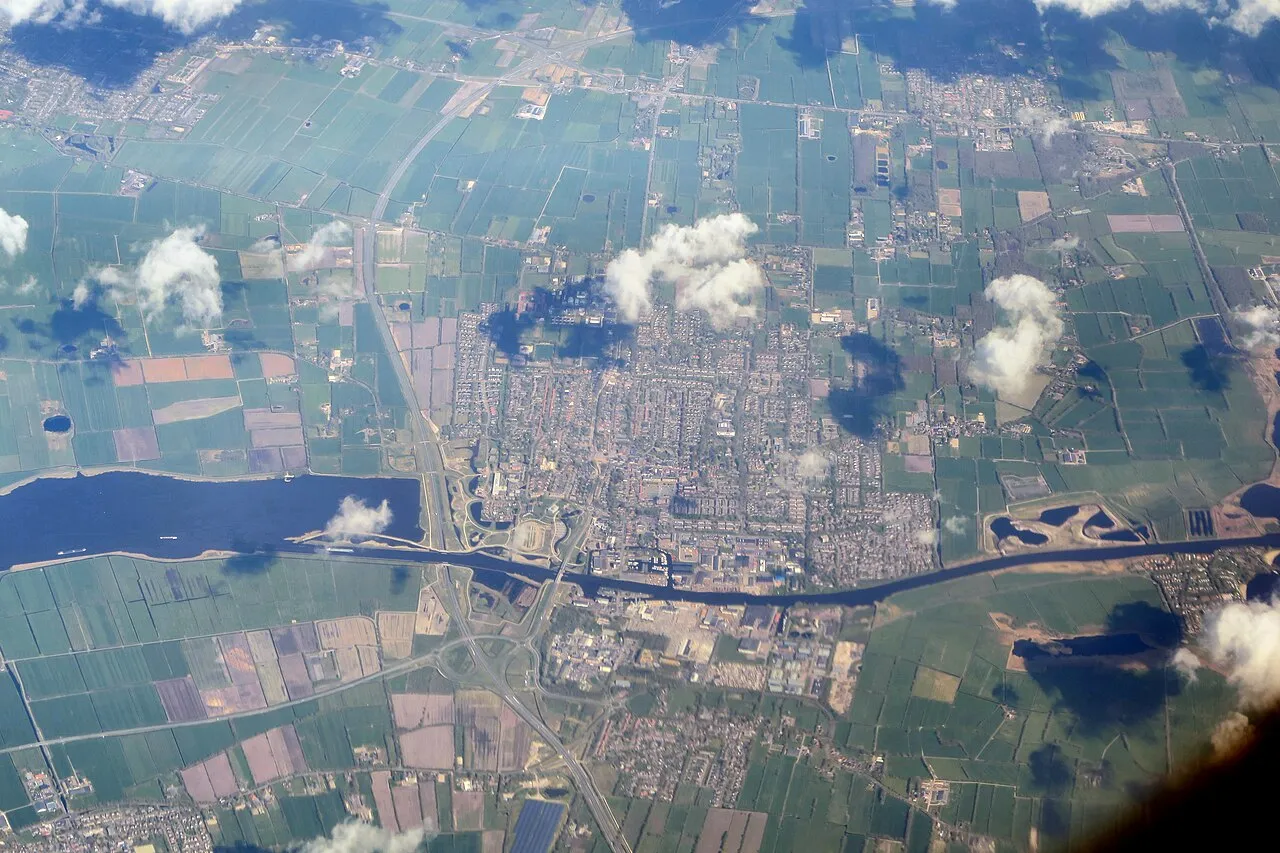
Burgum is a town. Location: Tytsjerksteradiel Municipality, Friesland. Population: 9,720. Elevation: 3 m.
Burgum is the largest and administrative town of the municipality of Tytsjerksteradiel, in the Dutch province of Friesland. It had a population of 10,058 inhabitants in January 2017. On 1 January 1989 the official name of the village was changed from Bergum to Burgum. This was done to match the Frisian name of the village. Bergum is the current name in Dutch. The name Burgum is suggestive of an area of higher altitude than the surrounding area. The province of Friesland is bordered in the north by the Wadden Sea.
Source: Wikipedia · CC BY-SA 4.0
Photos of Burgum
-

Gouwenaar · CC BY-SA 4.0 -

RomkeHoekstra · CC BY-SA 4.0 -

Theun · CC BY-SA 3.0 -

Grasmat · CC BY-SA 4.0 -

A.-K. D · CC BY-SA 4.0


Climate of Burgum
Best months for sightseeingBest months for sightseeing: June–August.
This month · November
A cold month
Day 9° · Night 3° · Rain 90 mm
- Hottest month
- August (day 21°)
- Coldest month
- February (night 0°)
- Wettest month
- November (90 mm)
- Driest month
- April (42 mm)
Bars: average monthly low and high temperature. Below: precipitation. Monthly averages for 1970–2000 at about 18 km resolution, adjusted for elevation. Highlighted months are mild and relatively dry. Source: WorldClim 2.1 (CC BY 4.0).
Show values as a table
| Month | Jan | Feb | Mar | Apr | May | Jun | Jul | Aug | Sep | Oct | Nov | Dec |
|---|---|---|---|---|---|---|---|---|---|---|---|---|
| Average high (°C) | 5° | 5° | 8° | 11° | 16° | 18° | 20° | 21° | 18° | 13° | 9° | 6° |
| Average low (°C) | 0° | 0° | 2° | 4° | 7° | 10° | 12° | 12° | 10° | 7° | 3° | 1° |
| Precipitation (mm) | 69 | 49 | 60 | 42 | 53 | 68 | 73 | 64 | 85 | 83 | 90 | 78 |
How to get to Burgum
The nearest airport is Groningen Airport Eelde (GRQ), 40 km to the east as the crow flies. The nearest large city is Leeuwarden, 12 km to the west.
Airports
- Groningen Airport Eelde (GRQ) Groningen 40 kmeast
- Amsterdam Airport Schiphol (AMS) Amsterdam 129 kmsouthwest
- Münster Osnabrück Airport (FMO) Greven 165 kmsoutheast
Nearby large cities
- Leeuwarden Population: 124.5K 12 kmwest
- Groningen Population: 244.8K 39 kmeast
- Zwolle Population: 129.8K 76 kmsouth
- Almere Stad Population: 176.4K 105 kmsouthwest
- Apeldoorn Population: 136.7K 109 kmsouth
Straight-line distances; road distances are longer. Airport data: OurAirports.
Day trips from Burgum
Within 100 km: 50 historic and cultural sites, 98 natural sites, 100 lakes, rivers and coasts.
0–25 km3 places
- Leeuwarden Concentration Camp Historic site 13 kmW
- Cambuur Stadion Landmark 12 kmW
- Natuurmuseum Fryslân Museum 13 kmW
25–60 km22 places
- Ameland Island 31 kmNW
- Balg Beach 41 kmNE
- Oosterstrand Beach 39 kmNE
- Het Rif Beach 31 kmN
60–100 km223 places
- Texel Island 78 kmW
- Borkum Island 64 kmNE
- Juist Island 86 kmNE
- Putjensberg Mountain 88 kmS
Straight-line distances.
Sources & licences
Data last updated: · 2 independent sources