Skûlenboarch
Located in Tytsjerksteradiel Municipality, Friesland Coordinates: 53°12′00″ N 6°04′00″ E
- Elevation
- -1 m
- above sea level
- Local time
- UTC+01:00
- Europe/Amsterdam · UTC+01:00
- Airports
- GRQ Groningen Airport Eelde35 km
- AMS Amsterdam Airport Schiphol133 km
About Skûlenboarch
Skûlenboarch is a village. Location: Tytsjerksteradiel Municipality, Friesland. Elevation: -1 m.
Skûlenboarch (Dutch: Schuilenburg) is a hamlet in Tytsjerksteradiel in the province Friesland of the Netherlands. The hamlet lies south of Jistrum, every house north of the Prinses Margriet Canal falls officially under Jistrum. The houses south of the canal are officially part of Eastermar. A bridge connects the two halves of Skûlenboarch with each other. The Joost Wiersmawei(road) connects the hamlet with Jistrum and a cycling path connects the yacht harbour with Skûlenboarch.
Source: Wikipedia · CC BY-SA 4.0
Climate of Skûlenboarch
Best months for sightseeingBest months for sightseeing: June–August.
This month · November
A cold month
Day 9° · Night 3° · Rain 92 mm
- Hottest month
- August (day 21°)
- Coldest month
- February (night 0°)
- Wettest month
- November (92 mm)
- Driest month
- April (45 mm)
Bars: average monthly low and high temperature. Below: precipitation. Monthly averages for 1970–2000 at about 18 km resolution, adjusted for elevation. Highlighted months are mild and relatively dry. Source: WorldClim 2.1 (CC BY 4.0).
Show values as a table
| Month | Jan | Feb | Mar | Apr | May | Jun | Jul | Aug | Sep | Oct | Nov | Dec |
|---|---|---|---|---|---|---|---|---|---|---|---|---|
| Average high (°C) | 5° | 5° | 8° | 12° | 16° | 19° | 21° | 21° | 18° | 13° | 9° | 6° |
| Average low (°C) | 0° | 0° | 2° | 4° | 7° | 10° | 12° | 12° | 10° | 7° | 3° | 1° |
| Precipitation (mm) | 72 | 50 | 63 | 45 | 53 | 71 | 73 | 62 | 83 | 83 | 92 | 81 |
How to get to Skûlenboarch
The nearest airport is Groningen Airport Eelde (GRQ), 35 km to the east as the crow flies. The nearest large city is Leeuwarden, 17 km to the west.
Airports
- Groningen Airport Eelde (GRQ) Groningen 35 kmeast
- Amsterdam Airport Schiphol (AMS) Amsterdam 133 kmsouthwest
- Münster Osnabrück Airport (FMO) Greven 162 kmsoutheast
Nearby large cities
- Leeuwarden Population: 124.5K 17 kmwest
- Groningen Population: 244.8K 33 kmeast
- Zwolle Population: 129.8K 77 kmsouth
- Almere Stad Population: 176.4K 109 kmsouthwest
- Apeldoorn Population: 136.7K 110 kmsouth
Straight-line distances; road distances are longer. Airport data: OurAirports.
Day trips from Skûlenboarch
Within 100 km: 53 historic and cultural sites, 129 natural sites, 116 lakes, rivers and coasts.
0–25 km4 places
- Leeuwarden Concentration Camp Historic site 18 kmW
- Zwartendijksterschans Historic site 23 kmSE
- Cambuur Stadion Landmark 17 kmW
- Natuurmuseum Fryslân Museum 18 kmW
25–60 km31 places
- Borkum Island 59 kmNE
- Borkum Island 58 kmNE
- Greune Stee Natural site 59 kmNE
- Sendemast des Wasser- und Schiffahrtsamts Borkum Landmark 58 kmNE
60–100 km263 places
- Texel Island 84 kmW
- Norderney Island 97 kmNE
- Juist Island 82 kmNE
- Putjensberg Mountain 89 kmS
Straight-line distances.
Nearby attractions & nature
Everything nearby-
 Cambuur Stadion Landmark, Leeuwarden Municipality17 km W
-
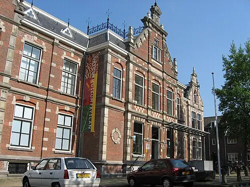 Natuurmuseum Fryslân Museum, Leeuwarden Municipality18 km W
-
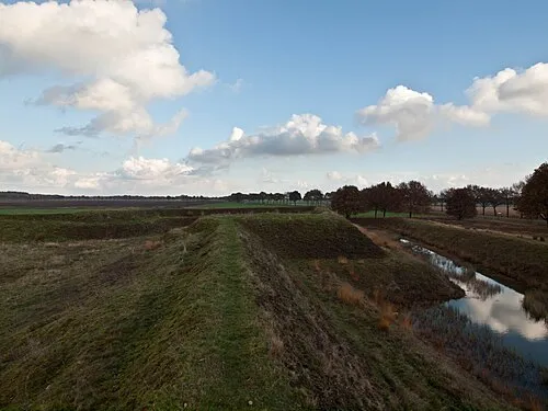 Zwartendijksterschans Historic site, Gemeente Noordenveld23 km SE
-
Leeuwarden Concentration Camp Historic site, Leeuwarden Municipality18 km W
Other cities and towns in Tytsjerksteradiel Municipality
-
 Hurdegaryp Village, Tytsjerksteradiel Municipality8.5 km W
-
 Sumar Village, Tytsjerksteradiel Municipality4.8 km SW
-
 Sumarreheide Village, Tytsjerksteradiel Municipality6 km SW
-
 Garyp Village, Tytsjerksteradiel Municipality7.6 km SW
-
 Tytsjerk Village, Tytsjerksteradiel Municipality11 km W
-
 Suwâld Village, Tytsjerksteradiel Municipality9.6 km W
Sources & licences
Data last updated: · 2 independent sources