- Population
- 1,405
- 1.4K
- Elevation
- 28 m
- above sea level
- Local time
- UTC+01:00
- Europe/Amsterdam · UTC+01:00
- Airports
- NRN Weeze (Niederrhein) Airport50 km
- DUS Düsseldorf Airport73 km
About Bredevoort
Bredevoort is a village. Location: Aalten Municipality, Gelderland. Population: 1,405. Elevation: 28 m.
Bredevoort (Low Saxon: Brevoort) is a small city with city privileges of about 1600 inhabitants in the municipality of Aalten, Netherlands. It is between the towns of Aalten and Winterswijk. Bredevoort has presented itself as Bredevoort boekenstad (Bredevoort book town), after the examples of Hay-on-Wye in Wales and Redu in Belgium. There are now more than 20 second-hand book shops in the town. Bredevoort was a Heerlijkheid and a separate municipality until 1818.
Source: Wikipedia · CC BY-SA 4.0
Population of Bredevoort over time
| 2008 | 1,525 | |
|---|---|---|
| 2021 | 1,450 | |
| 2023 | 1,539 |
Censuses and official estimates; source: Wikidata.
Climate of Bredevoort
Best months for sightseeingBest months for sightseeing: June–August.
This month · November
A cold month
Day 9° · Night 3° · Rain 69 mm
- Hottest month
- July (day 23°)
- Coldest month
- February (night 0°)
- Wettest month
- June (77 mm)
- Driest month
- April (46 mm)
Bars: average monthly low and high temperature. Below: precipitation. Monthly averages for 1970–2000 at about 18 km resolution, adjusted for elevation. Highlighted months are mild and relatively dry. Source: WorldClim 2.1 (CC BY 4.0).
Show values as a table
| Month | Jan | Feb | Mar | Apr | May | Jun | Jul | Aug | Sep | Oct | Nov | Dec |
|---|---|---|---|---|---|---|---|---|---|---|---|---|
| Average high (°C) | 5° | 6° | 9° | 13° | 18° | 21° | 23° | 22° | 18° | 14° | 9° | 6° |
| Average low (°C) | 0° | 0° | 2° | 4° | 8° | 11° | 13° | 12° | 10° | 6° | 3° | 1° |
| Precipitation (mm) | 65 | 47 | 65 | 46 | 63 | 77 | 69 | 60 | 71 | 64 | 69 | 75 |
How to get to Bredevoort
The nearest airport is Weeze (Niederrhein) Airport (NRN), 50 km to the southwest as the crow flies. The nearest large city is Enschede, 36 km to the northeast.
Airports
- Weeze (Niederrhein) Airport (NRN) Weeze 50 kmsouthwest
- Düsseldorf Airport (DUS) Düsseldorf 73 kmsouth
- Münster Osnabrück Airport (FMO) Greven 76 kmeast
Nearby large cities
- Enschede Population: 153.7K 36 kmnortheast
- Arnhem Population: 162.4K 49 kmwest
- Bottrop Population: 119.9K 51 kmsoutheast
- Apeldoorn Population: 136.7K 54 kmnorthwest
- Nijmegen Population: 177.4K 54 kmwest
Straight-line distances; road distances are longer. Airport data: OurAirports.
Day trips from Bredevoort
Within 100 km: 250 historic and cultural sites, 615 natural sites, 406 lakes, rivers and coasts.
0–25 km50 places
- Schmales Meer Lake 23 kmSW
- Millinger Meer Lake 23 kmSW
- Hagener Meer Lake 23 kmSW
- Tiglersberg Mountain 25 kmS
25–60 km410 places
- Wijlermeer Lake 48 kmW
- Strang Lake 32 kmW
- Halterner Talsperre Lake 47 kmSE
- Margaretensee Lake 59 kmS
60–100 km811 places
- Putjensberg Mountain 66 kmNW
- Kasteel Arcen Historic site 60 kmSW
- Else River 86 kmSE
- Werse River 74 kmE
Straight-line distances.
Nearby attractions & nature
Everything nearby-
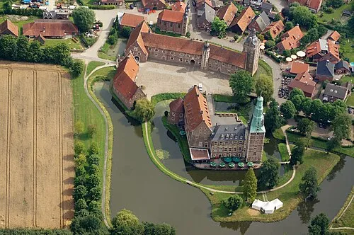 Schloss Raesfeld Historic site, Raesfeld24 km SE
-
Daßberg Mountain, Vreden14 km NE
-
Sternbusch Natural site, North Rhine-Westphalia11 km E
-
Bocholt Pfarrkirche St. Georg Attraction, Bocholt12 km S
-
Reyerdingsbach River, North Rhine-Westphalia11 km SW
-
Rösing Busch Natural site, North Rhine-Westphalia12 km SE
Sources & licences
Data last updated: · 2 independent sources