Klarenbeek
Located in Apeldoorn Municipality, Gelderland Coordinates: 52°10′03″ N 6°03′45″ E

- Population
- 565
- 565
- Elevation
- 10 m
- above sea level
- Local time
- UTC+01:00
- Europe/Amsterdam · UTC+01:00
- Airports
- NRN Weeze (Niederrhein) Airport63 km
- AMS Amsterdam Airport Schiphol90 km
About Klarenbeek
Klarenbeek is a village. Location: Apeldoorn Municipality, Gelderland. Population: 565. Elevation: 10 m.
Klarenbeek is a village in the eastern Netherlands. The village belongs to two municipalities, Apeldoorn and Voorst, with the municipality border situated in the middle of the village. Klarenbeek is named after an estate situated next to the Klaarbeek. This estate was later also named Klarenbeek. Both Klaarbeek and Klarenbeek translate to "Clear Stream" in English. Klarenbeek has its own railway station, Klarenbeek railway station, 2 km northeast of the village on the railway line between Apeldoorn and Zutphen.
Source: Wikipedia · CC BY-SA 4.0
Photos of Klarenbeek
-

Schaik, W.P.F.M. van · CC0 -

Dirk Jan van Zoest · CC BY 3.0 -

Hansmuller · CC BY-SA 4.0


Climate of Klarenbeek
Best months for sightseeingBest months for sightseeing: June–August.
This month · November
A cold month
Day 9° · Night 3° · Rain 80 mm
- Hottest month
- August (day 23°)
- Coldest month
- February (night 0°)
- Wettest month
- December (85 mm)
- Driest month
- April (49 mm)
Bars: average monthly low and high temperature. Below: precipitation. Monthly averages for 1970–2000 at about 18 km resolution, adjusted for elevation. Highlighted months are mild and relatively dry. Source: WorldClim 2.1 (CC BY 4.0).
Show values as a table
| Month | Jan | Feb | Mar | Apr | May | Jun | Jul | Aug | Sep | Oct | Nov | Dec |
|---|---|---|---|---|---|---|---|---|---|---|---|---|
| Average high (°C) | 5° | 6° | 9° | 13° | 18° | 21° | 23° | 23° | 19° | 14° | 9° | 6° |
| Average low (°C) | 0° | 0° | 2° | 4° | 8° | 10° | 12° | 12° | 10° | 6° | 3° | 1° |
| Precipitation (mm) | 76 | 52 | 73 | 49 | 62 | 76 | 74 | 62 | 75 | 71 | 80 | 85 |
How to get to Klarenbeek
The nearest airport is Weeze (Niederrhein) Airport (NRN), 63 km to the south as the crow flies. The nearest large city is Apeldoorn, 8 km to the northwest.
Airports
- Weeze (Niederrhein) Airport (NRN) Weeze 63 kmsouth
- Amsterdam Airport Schiphol (AMS) Amsterdam 90 kmwest
- Eindhoven Airport (EIN) Eindhoven 93 kmsouthwest
Nearby large cities
- Apeldoorn Population: 136.7K 8 kmnorthwest
- Arnhem Population: 162.4K 23 kmsouthwest
- Zwolle Population: 129.8K 38 kmnorth
- Nijmegen Population: 177.4K 39 kmsouth
- Amersfoort Population: 139.9K 46 kmwest
Straight-line distances; road distances are longer. Airport data: OurAirports.
Day trips from Klarenbeek
Within 100 km: 197 historic and cultural sites, 330 natural sites, 204 lakes, rivers and coasts.
0–25 km40 places
- Zwarte Berg Mountain 13 kmSW
- Waterberg Mountain 12 kmW
- Valkenberg Mountain 16 kmNW
- Valenberg Mountain 20 kmNW
25–60 km138 places
- Putjensberg Mountain 26 kmN
- Wijlermeer Lake 40 kmS
- Strang Lake 37 kmS
- Schmales Meer Lake 51 kmSE
60–100 km553 places
- Poppelsche Leij River 98 kmSW
- Kasteel Arcen Historic site 78 kmS
- Halterner Talsperre Lake 92 kmSE
- Schrolik Lake 92 kmS
Straight-line distances.
Nearby attractions & nature
Everything nearby-
De Reeënberg Mountain, Apeldoorn Municipality6.4 km SW
-
Schalterberg Mountain, Apeldoorn Municipality8.2 km SW
-
Valenberg Mountain, Apeldoorn Municipality10 km SW
-
Waterberg Mountain, Apeldoorn Municipality12 km W
-
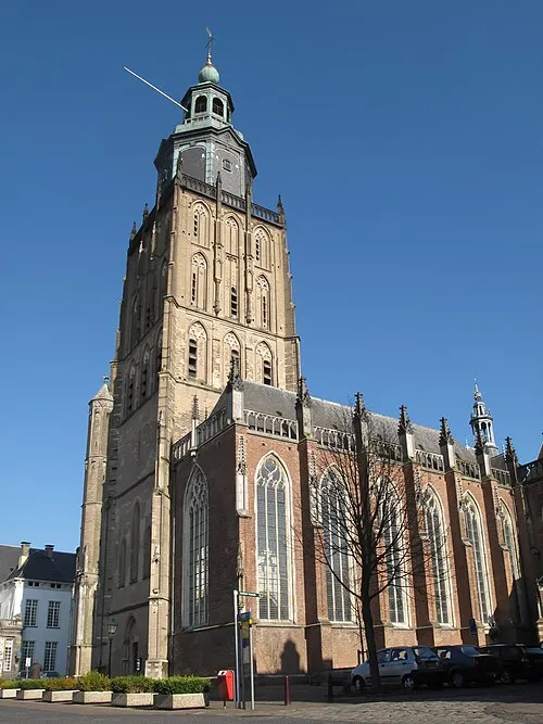 St Walburgis Church Attraction, Gemeente Zutphen9.6 km E
-
Zwarte Berg Mountain, Apeldoorn Municipality13 km SW
Other cities and towns in Apeldoorn Municipality
-
 Beekbergen Village, Apeldoorn Municipality6.8 km W
-
Woudhuis Neighbourhood, Apeldoorn Municipality6.2 km NW
-
Matengaarde Neighbourhood, Apeldoorn Municipality5.7 km NW
-
 Ugchelen Village, Apeldoorn Municipality9.1 km W
-
Matendreef Neighbourhood, Apeldoorn Municipality6.4 km NW
-
Matenhorst Neighbourhood, Apeldoorn Municipality6.3 km NW
Sources & licences
Data last updated: · 2 independent sources