- Elevation
- 65 m
- above sea level
- Local time
- UTC+01:00
- Europe/Amsterdam · UTC+01:00
- Airports
- NRN Weeze (Niederrhein) Airport33 km
- DUS Düsseldorf Airport76 km
About Galgenberg
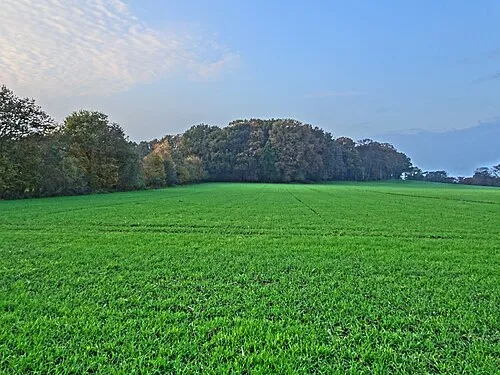
Galgenberg is a mountain. Location: Gemeente Montferland, Gelderland. Elevation: 65 m. The best months to visit are June–August. The nearest airport is Weeze (Niederrhein) Airport (33 km). Nearby sights include Rijsberg and Keurvorstenheuvel.
Climate of Galgenberg
Best months for sightseeingBest months for sightseeing: June–August.
This month · November
A cold month
Day 9° · Night 3° · Rain 68 mm
- Hottest month
- August (day 22°)
- Coldest month
- February (night -1°)
- Wettest month
- December (74 mm)
- Driest month
- April (44 mm)
Bars: average monthly low and high temperature. Below: precipitation. Monthly averages for 1970–2000 at about 18 km resolution, adjusted for elevation. Highlighted months are mild and relatively dry. Source: WorldClim 2.1 (CC BY 4.0).
Show values as a table
| Month | Jan | Feb | Mar | Apr | May | Jun | Jul | Aug | Sep | Oct | Nov | Dec |
|---|---|---|---|---|---|---|---|---|---|---|---|---|
| Average high (°C) | 5° | 6° | 9° | 13° | 18° | 20° | 22° | 22° | 18° | 14° | 9° | 6° |
| Average low (°C) | 0° | -1° | 2° | 4° | 8° | 10° | 12° | 12° | 9° | 6° | 3° | 1° |
| Precipitation (mm) | 66 | 47 | 65 | 44 | 61 | 72 | 71 | 59 | 70 | 64 | 68 | 74 |
How to get to Galgenberg
The nearest airport is Weeze (Niederrhein) Airport (NRN), 33 km to the south as the crow flies. The nearest large city is Arnhem, 25 km to the northwest.
Airports
- Weeze (Niederrhein) Airport (NRN) Weeze 33 kmsouth
- Düsseldorf Airport (DUS) Düsseldorf 76 kmsoutheast
- Eindhoven Airport (EIN) Eindhoven 78 kmsouthwest
Nearby large cities
- Arnhem Population: 162.4K 25 kmnorthwest
- Nijmegen Population: 177.4K 28 kmwest
- Apeldoorn Population: 136.7K 40 kmnorthwest
- Moers Population: 103.5K 56 kmsoutheast
- Enschede Population: 153.7K 57 kmnortheast
Straight-line distances; road distances are longer. Airport data: OurAirports.
Day trips from Galgenberg
Within 100 km: 246 historic and cultural sites, 450 natural sites, 327 lakes, rivers and coasts.
0–25 km58 places
- Wijlermeer Lake 22 kmW
- Strang Lake 7 kmSW
- Schmales Meer Lake 18 kmSE
- Millinger Meer Lake 15 kmSE
25–60 km300 places
- Putjensberg Mountain 59 kmN
- Kasteel Arcen Historic site 47 kmS
- Poelvenn Lake 59 kmS
- Kaplanskuhlen Lake 50 kmS
60–100 km665 places
- Warandeheide Natural site 99 kmSW
- Veldhoven Bos Natural site 88 kmSW
- Varkensbos Natural site 88 kmSW
- Spreeuwenkooi Natural site 99 kmSW
Straight-line distances.
Nearest towns and villages
-
 Zeddam Village, Gemeente Montferland1.4 km NE
-
 's-Heerenberg Village, Gemeente Montferland1.9 km S
-
Stokkum Village, Gemeente Montferland2.5 km SW
-
 Braamt Village, Gemeente Montferland3.6 km N
-
 Azewijn Village, Gemeente Montferland4 km E
-
Beek gem Montferland Village, Gemeente Montferland4.5 km W
Nearby attractions & nature
Everything nearby-
Rijsberg Mountain, Gemeente Montferland2.7 km NW
-
Keurvorstenheuvel Mountain, Gemeente Montferland3 km NW
-
Kalflach River, North Rhine-Westphalia7.4 km S
-
Strang Lake, North Rhine-Westphalia7.4 km SW
-
Wild River, Germany7.6 km W
-
Salmorth Natural site, North Rhine-Westphalia10 km SW
-
Sternberg Mountain, Kleve14 km SW
-
 Hingstberg Mountain, Kranenburg17 km SW
Sources & licences
Data last updated: · 2 independent sources