- Population
- 36,188
- 36.2K
- Elevation
- 10 m
- above sea level
- Local time
- UTC+01:00
- Europe/Amsterdam · UTC+01:00
- Airports
- NRN Weeze (Niederrhein) Airport60 km
- EIN Eindhoven Airport95 km
About Zutphen
Zutphen is a town. Location: Gemeente Zutphen, Gelderland. Population: 36,188. Elevation: 10 m.
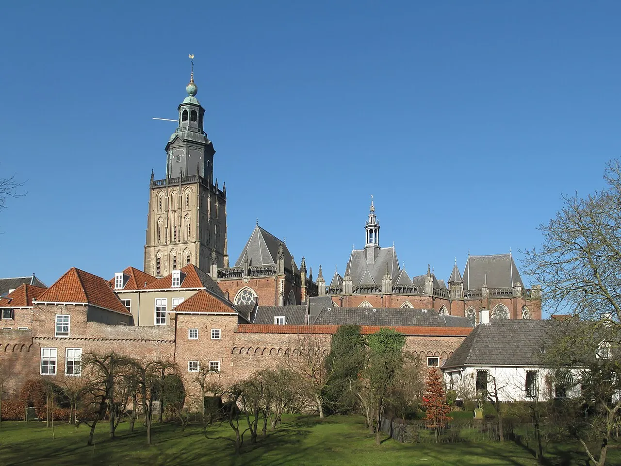
Zutphen (Dutch pronunciation: [ˈzʏtfə(n)] ; Dutch Low Saxon: Zutfent) is a city and municipality located in the province of Gelderland, Netherlands. It lies some 30 km (18.6 mi) northeast of Arnhem, on the eastern bank of the river IJssel at the point where it is joined by the Berkel. First mentioned in the 11th century, the place-name appears to mean "south fen" (zuid-veen in modern Dutch). In 2005, the municipality of Zutphen was merged with the municipality of Warnsveld, retaining its name.
Source: Wikipedia · CC BY-SA 4.0
Photos of Zutphen
-

Multichill2 · CC BY 4.0 -

Henk Monster · CC BY 3.0 -

Henk Monster · CC BY 3.0 -

Nicolaes van Geelkercken · CC0 -

Unknown author Unknown author · CC BY-SA 4.0


Travel notes for Zutphen
From Wikivoyage
Zutphen (population 47,000) is an historic city in the center-eastern part of the Netherlands. The city has existed since Roman times and received its city rights in 1190, making it one of the oldest medieval cities in the Netherlands.
The city was voted as having the best city center of The Netherlands in the category of small cities in 2006. (The winner in the category of major cities was Groningen.)
It has an untouched historic city center that gives you the feeling of travelling hundreds of years back in time. It is not widely known to foreign tourists and waiting to be discovered.
Understand+
Zutphen is located in a river valley at the river IJssel, a sidebranch from the branch of the Rhine known as the Nederrijn. The small river Berkel (no shipping possible) as well as the major Twentekanaal (canal) flow into the IJssel near Zutphen. The city lies at the border of the hilly forested Veluwe region and the more flat and agricultural Achterhoek.
The language spoken is Dutch; nearly everyone speaks English, and German is widely understood.
Get in+
By public transit:
The 1 Zutphen train station. is located close to the city centre. Train services here consist of an Intercity between Roosendaal and Zwolle via Nijmegen and Tilburg, and regular trains connecting to Wijchen, Apeldoorn, Winterswijk and Oldenzaal via Hengelo. The train station is well-serviced and is a small hub for the area.
As for buses, the same train station is also the major bus hub, making switching between the two rather easy. Connections from here consist of Line 80 connecting to Vorden, Line 81 connecting to Deventer (though the train to Zwolle is the quicker option for getting to Deventer), Lines 82 and 682, which connect to several towns in Bronckhorst and ends in Doetinchem and Line 273, which is a substitute of the train link to Oldenzaal.
From Amsterdam:
In the morning: Take the Intercity from Amsterdam Central to direction Nijmegen till Arnhem, the you have to change train. In Arnhem you take the Intercity in the direction Zwolle.
In the afternoon and evening: Take the Intercity from Amsterdam Central to Amersfoort, there you have to chance train to the direction of Enschede. At the first station (Apeldoorn), you change train again: the local train to Zutphen.
During peakhours (morning and afternoon) "Peakhours Intercities" Amsterdam Central - Apeldoorn (direction Deventer) are in service. You don't need to travel via Arnhem or don't have to change train in Amersfoort. You only have to take the peakhour Intercity from Amsterdam Central in direction Deventer till Apeldoorn en there change train to the local train to Zutphen.
See ns.nl for times and prices.
By car:
From Amsterdam:
Source: Wikivoyage · CC BY-SA 4.0 · abridged
Twin towns and sister cities of Zutphen
- Satu Mare· Romania
Source: Wikidata. Only places with a page on this site are shown.
Climate of Zutphen
Best months for sightseeingBest months for sightseeing: June–August.
This month · November
A cold month
Day 9° · Night 3° · Rain 72 mm
- Hottest month
- August (day 23°)
- Coldest month
- February (night 0°)
- Wettest month
- December (77 mm)
- Driest month
- April (46 mm)
Bars: average monthly low and high temperature. Below: precipitation. Monthly averages for 1970–2000 at about 18 km resolution, adjusted for elevation. Highlighted months are mild and relatively dry. Source: WorldClim 2.1 (CC BY 4.0).
Show values as a table
| Month | Jan | Feb | Mar | Apr | May | Jun | Jul | Aug | Sep | Oct | Nov | Dec |
|---|---|---|---|---|---|---|---|---|---|---|---|---|
| Average high (°C) | 5° | 6° | 9° | 13° | 18° | 20° | 22° | 23° | 19° | 14° | 9° | 6° |
| Average low (°C) | 0° | 0° | 2° | 4° | 8° | 11° | 12° | 12° | 10° | 6° | 3° | 1° |
| Precipitation (mm) | 70 | 48 | 67 | 46 | 62 | 73 | 74 | 61 | 73 | 66 | 72 | 77 |
How to get to Zutphen
The nearest airport is Weeze (Niederrhein) Airport (NRN), 60 km to the south as the crow flies. The nearest large city is Apeldoorn, 18 km to the northwest.
Airports
- Weeze (Niederrhein) Airport (NRN) Weeze 60 kmsouth
- Eindhoven Airport (EIN) Eindhoven 95 kmsouthwest
- Amsterdam Airport Schiphol (AMS) Amsterdam 100 kmwest
Nearby large cities
- Apeldoorn Population: 136.7K 18 kmnorthwest
- Arnhem Population: 162.4K 27 kmsouthwest
- Nijmegen Population: 177.4K 41 kmsouthwest
- Zwolle Population: 129.8K 42 kmnorth
- Enschede Population: 153.7K 48 kmeast
Straight-line distances; road distances are longer. Airport data: OurAirports.
Day trips from Zutphen
Within 100 km: 216 historic and cultural sites, 382 natural sites, 262 lakes, rivers and coasts.
0–25 km26 places
- Zwarte Berg Mountain 18 kmSW
- Zuurberg Mountain 22 kmNE
- Waterberg Mountain 21 kmW
- Valenberg Mountain 15 kmW
25–60 km222 places
- Putjensberg Mountain 32 kmNW
- Wijlermeer Lake 40 kmSW
- Strang Lake 33 kmS
- Schmales Meer Lake 44 kmS
60–100 km612 places
- Kasteel Arcen Historic site 74 kmS
- Halterner Talsperre Lake 83 kmSE
- Schrolik Lake 88 kmS
- Schönwasser Lake 93 kmS
Straight-line distances.
Nearby attractions & nature
Everything nearby-
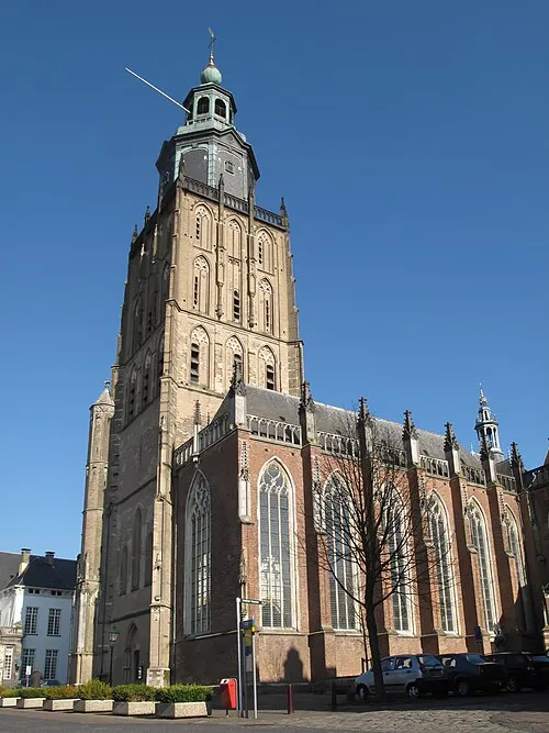 St Walburgis Church Attraction, Gemeente Zutphen0.4 km W
-
Jutberg Mountain, Rheden Municipality12 km SW
-
Geitenberg Mountain, Rheden Municipality12 km SW
-
Carolinaberg Mountain, Rheden Municipality13 km SW
-
De Reeënberg Mountain, Apeldoorn Municipality14 km W
-
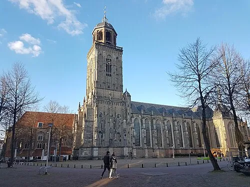 Lebuïnuskerk Attraction, Deventer Municipality13 km N
-
Valenberg Mountain, Apeldoorn Municipality15 km W
-
Hullekesberg Mountain, Rheden Municipality16 km SW
Sources & licences
Data last updated: · 2 independent sources