- Elevation
- 12 m
- above sea level
- Local time
- UTC+01:00
- Europe/Amsterdam · UTC+01:00
- Airports
- NRN Weeze (Niederrhein) Airport67 km
- FMO Münster Osnabrück Airport85 km
About Armhoede
Armhoede is a village. Location: Lochem Municipality, Gelderland. Elevation: 12 m.
Armhoede is a hamlet in the municipality of Lochem in the province of Gelderland in the Netherlands. It is located two kilometers northeast of Lochem on the canal from Zutphen to Enschede. Administratively, it is largely part of the village of Exel. The name Armhoede (Dutch for 'poverty') would originally have been the name of a meadow nearby, which served as a general pasture for the less wealthy cattle herders. There is a landfill near Armhoede, which was closed in 2004 and has now been covered.
Source: Wikipedia · CC BY-SA 4.0
Climate of Armhoede
Best months for sightseeingBest months for sightseeing: June–August.
This month · November
A cold month
Day 9° · Night 3° · Rain 74 mm
- Hottest month
- August (day 22°)
- Coldest month
- January (night 0°)
- Wettest month
- December (78 mm)
- Driest month
- April (46 mm)
Bars: average monthly low and high temperature. Below: precipitation. Monthly averages for 1970–2000 at about 18 km resolution, adjusted for elevation. Highlighted months are mild and relatively dry. Source: WorldClim 2.1 (CC BY 4.0).
Show values as a table
| Month | Jan | Feb | Mar | Apr | May | Jun | Jul | Aug | Sep | Oct | Nov | Dec |
|---|---|---|---|---|---|---|---|---|---|---|---|---|
| Average high (°C) | 5° | 6° | 9° | 13° | 18° | 20° | 22° | 22° | 19° | 14° | 9° | 6° |
| Average low (°C) | 0° | 0° | 2° | 4° | 8° | 10° | 12° | 12° | 9° | 6° | 3° | 1° |
| Precipitation (mm) | 70 | 47 | 65 | 46 | 62 | 76 | 74 | 62 | 73 | 66 | 74 | 78 |
How to get to Armhoede
The nearest airport is Weeze (Niederrhein) Airport (NRN), 67 km to the south as the crow flies. The nearest large city is Enschede, 31 km to the east.
Airports
- Weeze (Niederrhein) Airport (NRN) Weeze 67 kmsouth
- Münster Osnabrück Airport (FMO) Greven 85 kmeast
- Düsseldorf Airport (DUS) Düsseldorf 101 kmsouth
Nearby large cities
- Enschede Population: 153.7K 31 kmeast
- Apeldoorn Population: 136.7K 33 kmwest
- Arnhem Population: 162.4K 43 kmsouthwest
- Zwolle Population: 129.8K 45 kmnorthwest
- Nijmegen Population: 177.4K 55 kmsouthwest
Straight-line distances; road distances are longer. Airport data: OurAirports.
Day trips from Armhoede
Within 100 km: 184 historic and cultural sites, 530 natural sites, 317 lakes, rivers and coasts.
0–25 km7 places
- Zuurberg Mountain 11 kmN
- Lokerenk Mountain 11 kmN
- Grote Koningsbelt Mountain 18 kmN
- Apenberg Mountain 12 kmNE
25–60 km288 places
- Putjensberg Mountain 40 kmNW
- Wijlermeer Lake 52 kmSW
- Strang Lake 41 kmSW
- Schmales Meer Lake 45 kmS
60–100 km736 places
- Kasteel Arcen Historic site 80 kmS
- Werse River 86 kmE
- Halterner Talsperre Lake 72 kmSE
- Schrolik Lake 93 kmS
Straight-line distances.
Nearby attractions & nature
Everything nearby-
Zuurberg Mountain, Gemeente Rijssen-Holten11 km N
-
Lokerenk Mountain, Gemeente Rijssen-Holten11 km N
-
Apenberg Mountain, Gemeente Hof van Twente12 km NE
-
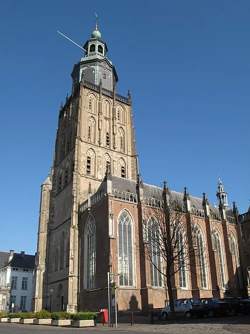 St Walburgis Church Attraction, Gemeente Zutphen18 km W
-
Grote Koningsbelt Mountain, Hellendoorn Municipality18 km N
-
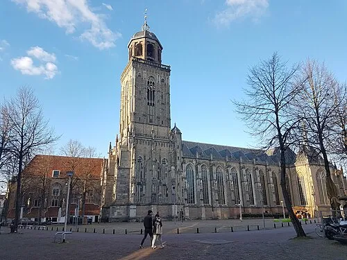 Lebuïnuskerk Attraction, Deventer Municipality22 km NW
Sources & licences
Data last updated: · 2 independent sources