Hatert
Located in Nijmegen Municipality, Gelderland Coordinates: 51°48′23″ N 5°49′50″ E

- Population
- 10,210
- 10.2K
- Elevation
- 13 m
- above sea level
- Local time
- UTC+01:00
- Europe/Amsterdam · UTC+01:00
- Airports
- NRN Weeze (Niederrhein) Airport31 km
- EIN Eindhoven Airport51 km
About Hatert
Hatert is a neighbourhood. Location: Nijmegen Municipality, Gelderland. Population: 10,210.
Hatert is a suburb in the south of Nijmegen, in the Netherlands. As of 2021 it has a population of 10.115. It is situated between the centre of Nijmegen and the suburb of Dukenburg. It is renowned for its big shopping centre Hatert Centrum and the market every Wednesday attracts a lot of visitors from all over the town. It is a relatively new suburb having been created in the 20th century. Hatert was built around a village with the same name. It is the biggest district in Nijmegen (based on population numbers).
Source: Wikipedia · CC BY-SA 4.0
Photos of Hatert
-

Waalbrug de:Benutzer:DoubleH · CC BY-SA 3.0 -
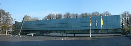
Museum Het Valkhof Ellywa · CC BY-SA 4.0


Climate of Hatert
Best months for sightseeingBest months for sightseeing: June–August.
This month · November
A cold month
Day 9° · Night 3° · Rain 71 mm
- Hottest month
- August (day 23°)
- Coldest month
- February (night 0°)
- Wettest month
- June (73 mm)
- Driest month
- April (45 mm)
Bars: average monthly low and high temperature. Below: precipitation. Monthly averages for 1970–2000 at about 18 km resolution, adjusted for elevation. Highlighted months are mild and relatively dry. Source: WorldClim 2.1 (CC BY 4.0).
Show values as a table
| Month | Jan | Feb | Mar | Apr | May | Jun | Jul | Aug | Sep | Oct | Nov | Dec |
|---|---|---|---|---|---|---|---|---|---|---|---|---|
| Average high (°C) | 5° | 6° | 10° | 13° | 18° | 21° | 23° | 23° | 19° | 14° | 9° | 6° |
| Average low (°C) | 0° | 0° | 2° | 4° | 8° | 11° | 12° | 12° | 10° | 6° | 3° | 1° |
| Precipitation (mm) | 66 | 49 | 66 | 45 | 60 | 73 | 66 | 56 | 70 | 65 | 71 | 73 |
How to get to Hatert
The nearest airport is Weeze (Niederrhein) Airport (NRN), 31 km to the southeast as the crow flies. The nearest large city is Nijmegen, 4 km to the north.
Airports
- Weeze (Niederrhein) Airport (NRN) Weeze 31 kmsoutheast
- Eindhoven Airport (EIN) Eindhoven 51 kmsouthwest
- Düsseldorf Airport (DUS) Düsseldorf 87 kmsoutheast
Nearby large cities
- Nijmegen Population: 177.4K 4 kmnorth
- Arnhem Population: 162.4K 20 kmnorth
- 's-Hertogenbosch Population: 160.8K 38 kmwest
- Apeldoorn Population: 136.7K 46 kmnorth
- Eindhoven Population: 235.7K 47 kmsouthwest
Straight-line distances; road distances are longer. Airport data: OurAirports.
Day trips from Hatert
Within 100 km: 262 historic and cultural sites, 401 natural sites, 306 lakes, rivers and coasts.
0–25 km41 places
- Wijlermeer Lake 8 kmE
- Strang Lake 24 kmE
- Forst Tiergarten Natural site 19 kmE
- Salmorth Natural site 21 kmE
25–60 km223 places
- Poppelsche Leij River 60 kmSW
- Kasteel Arcen Historic site 45 kmSE
- Schrolik Lake 58 kmSE
- Schmales Meer Lake 41 kmE
60–100 km705 places
- IJsselmonde Island 91 kmW
- Putjensberg Mountain 67 kmN
- Wetsberg Mountain 98 kmSW
- Schemersberg Mountain 95 kmS
Straight-line distances.
Nearby attractions & nature
Everything nearby-
Hooge Langeberg Mountain, Berg en Dal Municipality3.8 km E
-
Waalbrug Landmark, Nijmegen Municipality5.8 km NE
-
Museum Het Valkhof Museum, Nijmegen Municipality5.3 km NE
-
Lage Langeberg Mountain, Berg en Dal Municipality4.3 km E
-
Muntberg Mountain, Berg en Dal Municipality5.2 km E
-
Meiberg Mountain, Berg en Dal Municipality5.6 km E
Sources & licences
Data last updated: · 2 independent sources