- Elevation
- 16 m
- above sea level
- Local time
- UTC+01:00
- Europe/Amsterdam · UTC+01:00
- Airports
- NRN Weeze (Niederrhein) Airport6 km
- EIN Eindhoven Airport55 km
About Siebengewald
Siebengewald is a village. Location: Bergen Municipality, Limburg. Elevation: 16 m.
Siebengewald is a village in the municipality of Bergen, in the upper northern part of the province of Limburg, the Netherlands. It is located 27 km southeast of Nijmegen, near the German border. The village was mentioned in 1326 as "zeuenghe waet", and means "seven parties who can use a common forest". Siebengewald developed in the Late Middle Ages, and became part of the Kingdom of the Netherlands in 1818. Siebengewald was home to 293 people in 1840. In 1863, a parish was established.
Source: Wikipedia · CC BY-SA 4.0
Climate of Siebengewald
Best months for sightseeingBest months for sightseeing: June–August.
This month · November
A cold month
Day 9° · Night 3° · Rain 67 mm
- Hottest month
- August (day 23°)
- Coldest month
- February (night 0°)
- Wettest month
- June (72 mm)
- Driest month
- April (44 mm)
Bars: average monthly low and high temperature. Below: precipitation. Monthly averages for 1970–2000 at about 18 km resolution, adjusted for elevation. Highlighted months are mild and relatively dry. Source: WorldClim 2.1 (CC BY 4.0).
Show values as a table
| Month | Jan | Feb | Mar | Apr | May | Jun | Jul | Aug | Sep | Oct | Nov | Dec |
|---|---|---|---|---|---|---|---|---|---|---|---|---|
| Average high (°C) | 5° | 6° | 10° | 13° | 18° | 21° | 23° | 23° | 19° | 14° | 9° | 6° |
| Average low (°C) | 0° | 0° | 2° | 4° | 8° | 11° | 13° | 12° | 10° | 7° | 3° | 1° |
| Precipitation (mm) | 63 | 47 | 63 | 44 | 61 | 72 | 67 | 57 | 65 | 62 | 67 | 70 |
How to get to Siebengewald
The nearest airport is Weeze (Niederrhein) Airport (NRN), 6 km to the southeast as the crow flies. The nearest large city is Nijmegen, 27 km to the northwest.
Airports
- Weeze (Niederrhein) Airport (NRN) Weeze 6 kmsoutheast
- Eindhoven Airport (EIN) Eindhoven 55 kmsouthwest
- Düsseldorf Airport (DUS) Düsseldorf 61 kmsoutheast
Nearby large cities
- Nijmegen Population: 177.4K 27 kmnorthwest
- Venlo Population: 102K 32 kmsouth
- Arnhem Population: 162.4K 39 kmnorth
- Moers Population: 103.5K 43 kmsoutheast
- Krefeld Population: 238K 47 kmsoutheast
Straight-line distances; road distances are longer. Airport data: OurAirports.
Day trips from Siebengewald
Within 100 km: 315 historic and cultural sites, 516 natural sites, 411 lakes, rivers and coasts.
0–25 km85 places
- Kasteel Arcen Historic site 21 kmS
- Wijlermeer Lake 21 kmNW
- Strang Lake 22 kmN
- Das Meer Lake 19 kmNE
25–60 km319 places
- Itterbeek River 57 kmS
- Witbeek River 58 kmS
- Warmbeek River 58 kmSW
- Rioolbeek River 57 kmSW
60–100 km838 places
- Putjensberg Mountain 83 kmN
- Wetsberg Mountain 98 kmSW
- Schemersberg Mountain 87 kmSW
- Sacramentsberg Mountain 94 kmSW
Straight-line distances.
Nearby attractions & nature
Everything nearby-
Hees Natural site, North Rhine-Westphalia6.5 km SE
-
Kendel River, Germany6 km NW
-
Nuthgraben River, North Rhine-Westphalia6.1 km NW
-
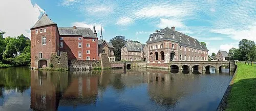 Schloß Wissen Historic site, Weeze7.9 km SE
-
Eckelsche Beek River, Germany6.3 km W
-
Ottersgraben River, North Rhine-Westphalia6.5 km E
Sources & licences
Data last updated: · 2 independent sources