- Population
- 175
- 175
- Elevation
- 32 m
- above sea level
- Local time
- UTC+01:00
- Europe/Amsterdam · UTC+01:00
- Airports
- MST Maastricht Aachen Airport29 km
- NRN Weeze (Niederrhein) Airport53 km
About Reutje
Reutje is a village. Location: Gemeente Roerdalen, Limburg. Population: 175. Elevation: 32 m.
Reutje or 't Reutje (Dutch: [(ət) ˈrøːtɕə]; Limburgish: 't Räötje [ət ˈʀœːtʃə]) is a hamlet in Dutch Limburg. It belongs to the municipality of Roerdalen. It lies a few km from Sint Odiliënberg. It was first mentioned in 1251 as "curtis in Raetken", and means "cultivated forest". Reutje has place name signs. It was home to 184 people in 1840. There is a small café 'Bie Tiel' and a big fanfare, Sint Wiro. Reutje also has its own song: Träötje mien Landj, composed by Wiel Janssen and Pièrre Bonné.
Source: Wikipedia · CC BY-SA 4.0
Climate of Reutje
Best months for sightseeingBest months for sightseeing: June–August.
This month · November
A cold month
Day 9° · Night 3° · Rain 62 mm
- Hottest month
- August (day 23°)
- Coldest month
- February (night 0°)
- Wettest month
- June (77 mm)
- Driest month
- April (45 mm)
Bars: average monthly low and high temperature. Below: precipitation. Monthly averages for 1970–2000 at about 18 km resolution, adjusted for elevation. Highlighted months are mild and relatively dry. Source: WorldClim 2.1 (CC BY 4.0).
Show values as a table
| Month | Jan | Feb | Mar | Apr | May | Jun | Jul | Aug | Sep | Oct | Nov | Dec |
|---|---|---|---|---|---|---|---|---|---|---|---|---|
| Average high (°C) | 5° | 6° | 10° | 13° | 18° | 21° | 23° | 23° | 19° | 14° | 9° | 6° |
| Average low (°C) | 0° | 0° | 3° | 4° | 9° | 11° | 13° | 13° | 10° | 7° | 3° | 2° |
| Precipitation (mm) | 59 | 48 | 61 | 45 | 63 | 77 | 67 | 54 | 60 | 57 | 62 | 66 |
How to get to Reutje
The nearest airport is Maastricht Aachen Airport (MST), 29 km to the southwest as the crow flies. The nearest large city is Venlo, 29 km to the north.
Airports
- Maastricht Aachen Airport (MST) Maastricht 29 kmsouthwest
- Weeze (Niederrhein) Airport (NRN) Weeze 53 kmnorth
- Düsseldorf Airport (DUS) Düsseldorf 56 kmeast
Nearby large cities
- Venlo Population: 102K 29 kmnorth
- Mönchengladbach Population: 261.7K 31 kmeast
- Maastricht Population: 122.4K 38 kmsouthwest
- Aachen Population: 265.2K 40 kmsouth
- Krefeld Population: 238K 45 kmnortheast
Straight-line distances; road distances are longer. Airport data: OurAirports.
Day trips from Reutje
Within 100 km: 419 historic and cultural sites, 1,222 natural sites, 811 lakes, rivers and coasts.
0–25 km59 places
- Stokkemderbos Natural site 25 kmSW
- Itterbeek River 12 kmW
- Zanderbeek River 20 kmW
- Witbeek River 13 kmW
25–60 km591 places
- Île Monsin Island 59 kmSW
- Île de Franche Garenne Island 53 kmSW
- Lac d'Eupen Lake 57 kmS
- Schemersberg Mountain 42 kmW
60–100 km1,802 places
- Île du Moulin Island 69 kmSW
- Lac de la Gileppe Lake 61 kmS
- Vijvers van Bellefroid Lake 95 kmW
- Lac de Robertville Lake 76 kmS
Straight-line distances.
Nearby attractions & nature
Everything nearby-
Rothen Bach River, Germany5.3 km E
-
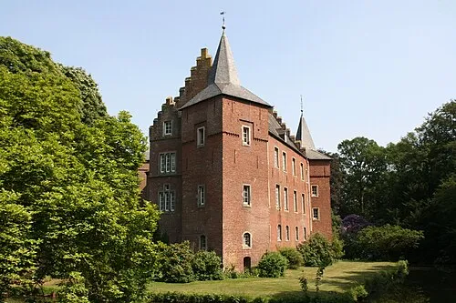 Schloß Elsum Historic site, Wassenberg8.9 km E
-
Noordplas Beach, Roermond Municipality8.4 km N
-
Schaagbach River, North Rhine-Westphalia7.1 km E
-
Ophovener Wald Natural site, North Rhine-Westphalia8.2 km E
-
Worm River, Germany7.7 km SE
Sources & licences
Data last updated: · 2 independent sources