- Population
- 44,975
- 45K
- Elevation
- 31 m
- above sea level
- Local time
- UTC+01:00
- Europe/Amsterdam · UTC+01:00
- Airports
- MST Maastricht Aachen Airport35 km
- NRN Weeze (Niederrhein) Airport47 km
About Roermond
Roermond is a town. Location: Roermond Municipality, Limburg. Population: 44,975. Elevation: 31 m.
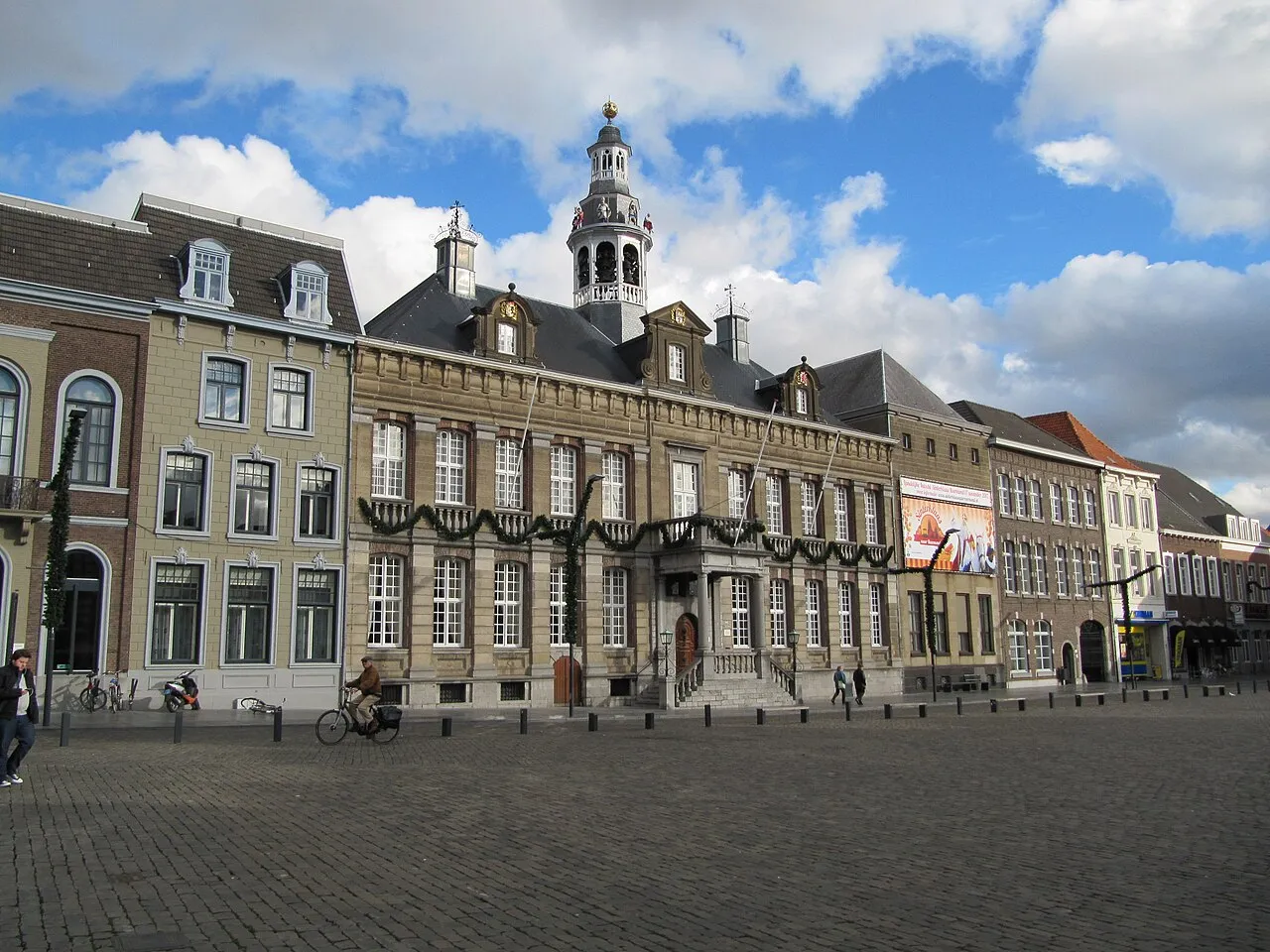
Roermond (Dutch pronunciation: [ruːrˈmɔnt] ; Limburgish: Remunj [ʀəˈmʏɲ] or Remuunj [ʀəˈmyːɲ]) is a city, municipality, and diocese in the Limburg province of the Netherlands. Roermond is a historically important town on the lower Roer on the east bank of the river Meuse. It received town rights in 1231. Roermond's town centre has become a designated conservation area. Through the centuries, the town has filled the role of commercial centre and a principal town in the duchy of Guelders.
Source: Wikipedia · CC BY-SA 4.0
Photos of Roermond
-

Paul Arps from The Netherlands · CC BY 2.0 -

Earth Science and Remote Sensing Unit, NASA Johnson Space Center · Public domain -

Ted Potters from Roermond · Public domain -

Ted Potters from Roermond · Public domain -

Rijksmuseum · CC0


Travel notes for Roermond
From Wikivoyage
Roermond is a city in the Dutch province of Limburg. Located at the point where the rivers Meuse and Rur meet, Roermond was a historically prominent town and a trade centre. It gained its city charter around 1231 and became the seat of the Roman Catholic Diocese of Roermond in 1559. In the protected city centre you'll find today, many monuments and several churches remain, making Roermond an interesting town to visit. Its location along the so-called Maasplassen, a 3000-hectare area of lakes, streams and canals makes it a popular destination for water sports and also yachts, and it has a number of good marinas.
Understand+
Roermond receives a large number of visitors every year, and is a rather well known destination for Dutch, German and to a lesser degree Belgian tourists. Apart from the water sports facilities and historic centre, this is also due to successful efforts to turn Roermond into a prime shopping centre for the larger region. The large Designer Outlet Centre, opened by McArthurGlen in 2001, alone draws in some 3.75 million visitors per year. The city centre has also been praised for its ample shopping facilities, and as shops are open on Sunday, Roermond draws in plenty of daytrip visitors from all directions, including many Germans.
Tourist Information Office (VVV), Markt 17 (on the market square), ☏ +31 475-335847. The VVV office provides information, can assist in booking of hotels or activities and sells or distributes a collections of maps and informative publications. This is also the place to book boat trips or guided tours.
Get in+
By car:
Roermond is well connected by road, and several major access roads have been upgraded or newly made in the past years. The A73 highway passes the town via tunnels, providing fast connections to the south (directions of Maastricht, joining the A2 after some 10 km) and north (direction of Nijmegen). There's a connection to Germany (direction of Düsseldorf) in the west via the A52. For the direction of Weert, Eindhoven and other north or north-west destinations, the provincial N280 road connects the centre of Roermond the A2. The N271, also a provincial road, is the best connection to Venlo.
By train:
1 Roermond railway station. The train station is close to the city centre and is served by quarterly fast intercity trains operated by NS and by commuter trains to smaller destinations in the region, operated by Arriva. The fast intercity to the south (Sittard, Maastricht and Heerlen) leaves 4 times per hour, usually from platform 1 (but always check.) In the other direction the same connection runs to Weert, Eindhoven, Utrecht, and Amsterdam. Usually it leaves from platform 2. The typical travel time to Amsterdam takes 2 hours, Maastricht and Eindhoven are served in 30 minutes.
A slow train to Venlo (22 minutes) also runs twice per hour, stopping in Swalmen, Reuver and Tegelen. Also southbound there are 2 local trains per hour.
By bus:
The bus station is at the train station, and serves as a starting and ending point for many lines circling the city and connecting it to nearby villages. Special bus connections are available to transfer shopping visitors from the town centre to the Outlet Centre, Retail Park and House and Garden Boulevard. Bus lines are operated by Veolia.
If you're flying in, Schiphol airport, Eindhoven airport and Maastricht-Aachen airport are all nearby. Alternatively, consider airports across the German border. Especially Düsseldorf (DUS IATA) is nearby and has many international flights.
Source: Wikivoyage · CC BY-SA 4.0 · abridged
Climate of Roermond
Best months for sightseeingBest months for sightseeing: June–August.
This month · November
A cold month
Day 9° · Night 3° · Rain 65 mm
- Hottest month
- July (day 23°)
- Coldest month
- February (night 0°)
- Wettest month
- June (73 mm)
- Driest month
- April (44 mm)
Bars: average monthly low and high temperature. Below: precipitation. Monthly averages for 1970–2000 at about 18 km resolution, adjusted for elevation. Highlighted months are mild and relatively dry. Source: WorldClim 2.1 (CC BY 4.0).
Show values as a table
| Month | Jan | Feb | Mar | Apr | May | Jun | Jul | Aug | Sep | Oct | Nov | Dec |
|---|---|---|---|---|---|---|---|---|---|---|---|---|
| Average high (°C) | 5° | 6° | 10° | 13° | 19° | 21° | 23° | 23° | 19° | 14° | 9° | 7° |
| Average low (°C) | 0° | 0° | 2° | 4° | 8° | 11° | 13° | 12° | 10° | 7° | 3° | 1° |
| Precipitation (mm) | 62 | 48 | 63 | 44 | 63 | 73 | 66 | 57 | 62 | 60 | 65 | 69 |
How to get to Roermond
The nearest airport is Maastricht Aachen Airport (MST), 35 km to the southwest as the crow flies. The nearest large city is Venlo, 23 km to the northeast.
Airports
- Maastricht Aachen Airport (MST) Maastricht 35 kmsouthwest
- Weeze (Niederrhein) Airport (NRN) Weeze 47 kmnorth
- Eindhoven Airport (EIN) Eindhoven 51 kmnorthwest
Nearby large cities
- Venlo Population: 102K 23 kmnortheast
- Mönchengladbach Population: 261.7K 32 kmeast
- Krefeld Population: 238K 43 kmeast
- Maastricht Population: 122.4K 44 kmsouthwest
- Eindhoven Population: 235.7K 45 kmnorthwest
Straight-line distances; road distances are longer. Airport data: OurAirports.
Day trips from Roermond
Within 100 km: 412 historic and cultural sites, 1,040 natural sites, 778 lakes, rivers and coasts.
0–25 km55 places
- Sint-Martens-Heide Natural site 25 kmW
- Itterbeek River 10 kmW
- Zanderbeek River 22 kmSW
- Witbeek River 11 kmW
25–60 km546 places
- Île de Franche Garenne Island 59 kmS
- Schemersberg Mountain 44 kmSW
- Sacramentsberg Mountain 56 kmSW
- Kaaienberg Mountain 54 kmW
60–100 km1,629 places
- Île du Moulin Island 75 kmS
- Île Monsin Island 65 kmSW
- Lac de la Gileppe Lake 68 kmS
- Lac d'Eupen Lake 64 kmS
Straight-line distances.
Nearby attractions & nature
Everything nearby-
Noordplas Beach, Roermond Municipality1.6 km NW
-
Galgenberg Mountain, Niederkrüchten6.5 km NE
-
Lingberg Mountain, Niederkrüchten6.9 km E
-
Vogelsberg Mountain, Niederkrüchten8.3 km E
-
Schwalm River, Germany6.5 km N
-
Elmpter Wald Natural site, North Rhine-Westphalia7.5 km E
-
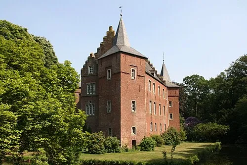 Schloß Elsum Historic site, Wassenberg13 km SE
-
Diergardtscher Wald Natural site, North Rhine-Westphalia9.5 km NE
Sources & licences
Data last updated: · 2 independent sources