Holthees
Located in Land van Cuijk, North Brabant Coordinates: 51°34′33″ N 6°00′20″ E
- Elevation
- 16 m
- above sea level
- Local time
- UTC+01:00
- Europe/Amsterdam · UTC+01:00
About Holthees
Holthees is a village. Location: Land van Cuijk, North Brabant. Elevation: 16 m.
Holthees is a village in the former municipality of Boxmeer on the border of the Dutch provinces North Brabant and Limburg. Since 2022 it has been part of the new municipality of Land van Cuijk.
Read more on Wikipedia Text: Wikipedia contributors · CC BY-SA 4.0 · shortened
At a glance
- Area
- 2.9 km²
Source: Wikidata
In comparison
- Nearest larger town: Smakt, 1 km S
- 4 sights and natural places within 10 km Vliegenberg, Hansenberg
Climate of Holthees
Best months for sightseeing: June–August.
| Month | Jan | Feb | Mar | Apr | May | Jun | Jul | Aug | Sep | Oct | Nov | Dec |
|---|---|---|---|---|---|---|---|---|---|---|---|---|
| Average high (°C) | 5° | 6° | 10° | 13° | 18° | 21° | 23° | 23° | 19° | 14° | 9° | 6° |
| Average low (°C) | 0° | 0° | 2° | 4° | 8° | 11° | 13° | 12° | 10° | 7° | 3° | 1° |
| Precipitation (mm) | 63 | 47 | 63 | 44 | 61 | 72 | 67 | 57 | 65 | 62 | 67 | 70 |
Monthly averages for 1970–2000 at about 18 km resolution, adjusted for elevation. Highlighted months are mild and relatively dry. Source: WorldClim 2.1 (CC BY 4.0).
Airports nearest to Holthees
- Weeze (Niederrhein) Airport (NRN) Weeze 10 km
- Eindhoven Airport (EIN) Eindhoven 46 km
- Düsseldorf Airport (DUS) Düsseldorf 62 km
Straight-line distance; airports with scheduled flights only. Source: OurAirports (public domain).
Nearby attractions & nature
Everything nearby-
Vliegenberg Mountain, Land van Cuijk0.7 km NE
-
Hondsberg Mountain, Land van Cuijk6.4 km W
-
Hansenberg Mountain, Venray Municipality5 km SW
-
Eckelsche Beek River, Germany6.4 km N
-
Dikkenberg Mountain, Bergen Municipality12 km E
-
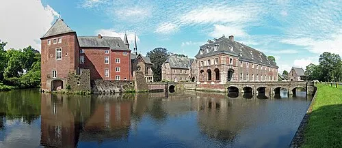 Schloß Wissen Historic site, Weeze13 km E
Sources & licences
Data last updated: · 2 independent sources