- Population
- 1,595
- 1.6K
- Elevation
- 3 m
- above sea level
- Local time
- UTC+01:00
- Europe/Amsterdam · UTC+01:00
- Airports
- AMS Amsterdam Airport Schiphol48 km
- RTM Rotterdam The Hague Airport93 km
About Hem
Hem is a village. Location: Gemeente Drechterland, North Holland. Population: 1,595. Elevation: 3 m.
Hem (West Frisian: Him) (population estimate: 1230) is a village in the municipality Drechterland, located in the north west of the Netherlands, in the province of North Holland and the region of West-Frisia. The village was first mentioned around 1312 as Hem, and means "silted land in a bend of a stream". Hem developed in the 12th century as a peat excavation settlement. The tower of the Dutch Reformed church dates from around 1500. The baluster and spire were constructed after a 1897 fire.
Source: Wikipedia · CC BY-SA 4.0
Climate of Hem
Best months for sightseeingBest months for sightseeing: June–August.
This month · November
A cold month
Day 10° · Night 5° · Rain 87 mm
- Hottest month
- August (day 21°)
- Coldest month
- February (night 1°)
- Wettest month
- November (87 mm)
- Driest month
- April (45 mm)
Bars: average monthly low and high temperature. Below: precipitation. Monthly averages for 1970–2000 at about 18 km resolution, adjusted for elevation. Highlighted months are mild and relatively dry. Source: WorldClim 2.1 (CC BY 4.0).
Show values as a table
| Month | Jan | Feb | Mar | Apr | May | Jun | Jul | Aug | Sep | Oct | Nov | Dec |
|---|---|---|---|---|---|---|---|---|---|---|---|---|
| Average high (°C) | 6° | 6° | 8° | 11° | 16° | 18° | 21° | 21° | 18° | 14° | 10° | 7° |
| Average low (°C) | 2° | 1° | 3° | 4° | 8° | 11° | 13° | 14° | 12° | 8° | 5° | 3° |
| Precipitation (mm) | 67 | 50 | 65 | 45 | 53 | 66 | 66 | 63 | 80 | 85 | 87 | 78 |
How to get to Hem
The nearest airport is Amsterdam Airport Schiphol (AMS), 48 km to the southwest as the crow flies. The nearest large city is Almere Stad, 32 km to the south.
Airports
- Amsterdam Airport Schiphol (AMS) Amsterdam 48 kmsouthwest
- Rotterdam The Hague Airport (RTM) Rotterdam 93 kmsouthwest
- Groningen Airport Eelde (GRQ) Groningen 107 kmnortheast
Nearby large cities
- Almere Stad Population: 176.4K 32 kmsouth
- Zaanstad Population: 140.1K 34 kmsouthwest
- Amsterdam Population: 741.6K 38 kmsouthwest
- Haarlem Population: 162.5K 48 kmsouthwest
- Hoofddorp Population: 132.7K 52 kmsouthwest
Straight-line distances; road distances are longer. Airport data: OurAirports.
Day trips from Hem
Within 100 km: 121 historic and cultural sites, 85 natural sites, 20 lakes, rivers and coasts.
0–25 km5 places
- Oosterkerk Attraction 8 kmW
- Edam Fort Historic site 18 kmSW
- De Ven Landmark 11 kmNE
- Kasteel Radboud Historic site 13 kmN
25–60 km109 places
- Texel Island 53 kmNW
- Strandslag Zandloper Beach 41 kmNW
- Strandslag Voordijk Beach 39 kmNW
- Strandslag Sint Maartenszee Beach 38 kmNW
60–100 km112 places
- IJsselmonde Island 99 kmSW
- Putjensberg Mountain 62 kmSE
- Radewijkerbeek River 98 kmE
- Ameland Island 97 kmNE
Straight-line distances.
Nearby attractions & nature
Everything nearby-
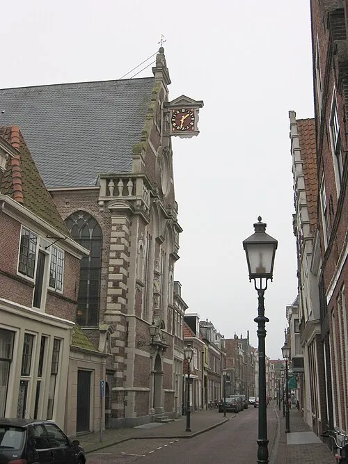 Oosterkerk Attraction, Hoorn Municipality8.5 km W
-
 Westfries Museum Museum, Hoorn Municipality8.8 km W
-
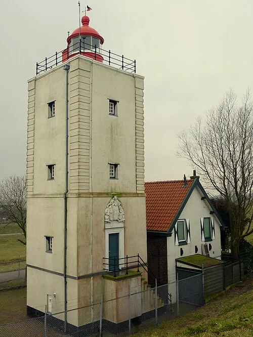 De Ven Landmark, Gemeente Enkhuizen11 km NE
-
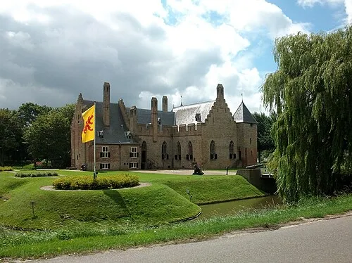 Kasteel Radboud Historic site, Medemblik Municipality13 km N
-
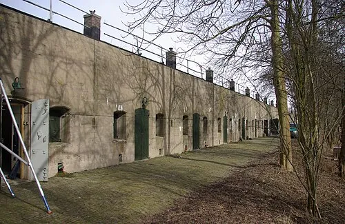 Edam Fort Historic site, Edam-Volendam18 km SW
Sources & licences
Data last updated: · 2 independent sources