Wieringerwaard
Located in Hollands Kroon Municipality, North Holland Coordinates: 52°50′09″ N 4°51′55″ E

- Population
- 2,360
- 2.4K
- Elevation
- -1 m
- above sea level
- Local time
- UTC+01:00
- Europe/Amsterdam · UTC+01:00
- Airports
- AMS Amsterdam Airport Schiphol59 km
- RTM Rotterdam The Hague Airport102 km
About Wieringerwaard
Wieringerwaard is a village. Location: Hollands Kroon Municipality, North Holland. Population: 2,360. Elevation: -1 m.
Wieringerwaard is a polder and a village in the municipality of Hollands Kroon in the Dutch province of North Holland. Wieringerwaard was formerly a separate municipality, until it merged with Barsingerhorn in 1970.
Source: Wikipedia · CC BY-SA 4.0
Photos of Wieringerwaard
-

Dmitrij M · CC BY 3.0 -

Gerard Dukker · CC BY-SA 4.0 -

A. J. van der Wal · CC BY-SA 4.0 -

Siebe Jan Bouma · CC BY-SA 4.0 -

Siebe Jan Bouma · CC BY-SA 4.0


Population of Wieringerwaard over time
| 1840 | 914 | |
|---|---|---|
| 1849 | 1,035 | |
| 1859 | 1,079 | |
| 1869 | 1,285 | |
| 1879 | 1,340 | |
| 1889 | 1,287 | |
| 1899 | 1,172 | |
| 1909 | 1,127 | |
| 1920 | 1,148 | |
| 1930 | 1,171 | |
| 1947 | 1,479 | |
| 1960 | 1,297 |
Censuses and official estimates; source: Wikidata.
Climate of Wieringerwaard
Best months for sightseeingBest months for sightseeing: June–August.
This month · November
A cold month
Day 9° · Night 5° · Rain 95 mm
- Hottest month
- August (day 20°)
- Coldest month
- February (night 0°)
- Wettest month
- November (95 mm)
- Driest month
- April (40 mm)
Bars: average monthly low and high temperature. Below: precipitation. Monthly averages for 1970–2000 at about 18 km resolution, adjusted for elevation. Highlighted months are mild and relatively dry. Source: WorldClim 2.1 (CC BY 4.0).
Show values as a table
| Month | Jan | Feb | Mar | Apr | May | Jun | Jul | Aug | Sep | Oct | Nov | Dec |
|---|---|---|---|---|---|---|---|---|---|---|---|---|
| Average high (°C) | 5° | 5° | 8° | 11° | 16° | 18° | 20° | 20° | 18° | 14° | 9° | 7° |
| Average low (°C) | 1° | 0° | 2° | 4° | 8° | 11° | 13° | 13° | 11° | 8° | 5° | 2° |
| Precipitation (mm) | 65 | 44 | 58 | 40 | 46 | 55 | 66 | 64 | 92 | 91 | 95 | 78 |
How to get to Wieringerwaard
The nearest airport is Amsterdam Airport Schiphol (AMS), 59 km to the south as the crow flies. The nearest large city is Zaanstad, 43 km to the south.
Airports
- Amsterdam Airport Schiphol (AMS) Amsterdam 59 kmsouth
- Rotterdam The Hague Airport (RTM) Rotterdam 102 kmsouth
- Groningen Airport Eelde (GRQ) Groningen 119 kmeast
Nearby large cities
- Zaanstad Population: 140.1K 43 kmsouth
- Amsterdam Population: 741.6K 51 kmsouth
- Haarlem Population: 162.5K 53 kmsouth
- Almere Stad Population: 176.4K 57 kmsoutheast
- Hoofddorp Population: 132.7K 61 kmsouth
Straight-line distances; road distances are longer. Airport data: OurAirports.
Day trips from Wieringerwaard
Within 100 km: 102 historic and cultural sites, 49 natural sites, 17 lakes, rivers and coasts.
0–25 km19 places
- Strandslag Zandloper Beach 12 kmNW
- Strandslag Voordijk Beach 11 kmW
- Strandslag Sint Maartenszee Beach 14 kmW
- Strandslag Petten Beach 16 kmSW
25–60 km67 places
- Texel Island 28 kmN
- De Kruisberg Mountain 38 kmSW
- IJzerenkaap Natural site 27 kmN
- Bait-ul-Afiyat Attraction 58 kmS
60–100 km82 places
- Putjensberg Mountain 91 kmSE
- Ameland Island 92 kmNE
- Habana Beach Beach 96 kmSW
- Beach Ameland Beach 91 kmNE
Straight-line distances.
Nearby attractions & nature
Everything nearby-
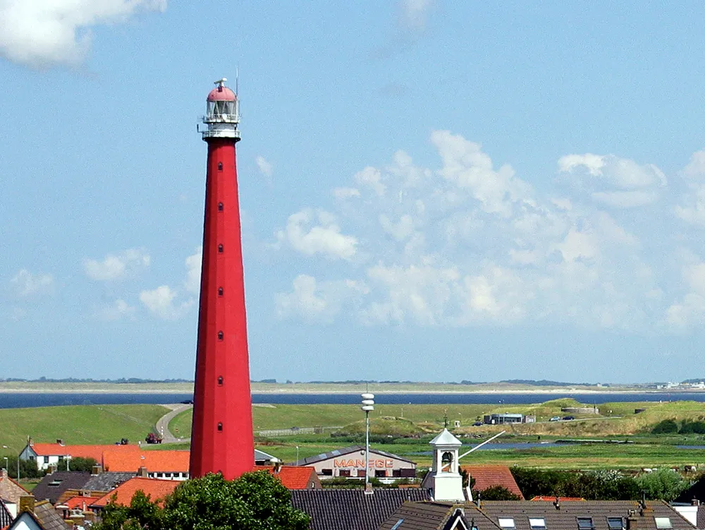 Lange Jaap Landmark, Den Helder Municipality16 km NW
-
Strandslag Voordijk Beach, Schagen Municipality11 km W
-
Strandslag Drooghe Weert Beach, Den Helder Municipality11 km NW
-
Strandslag Zandloper Beach, Den Helder Municipality12 km NW
-
Strandslag Julianadorp Beach, Den Helder Municipality12 km NW
-
Strandslag Falga Beach, Den Helder Municipality13 km NW
Other cities and towns in Hollands Kroon Municipality
-
Slootdorp Village, Hollands Kroon Municipality7.2 km E
-
Middenmeer Village, Hollands Kroon Municipality9.6 km E
-
Gelderse Buurt Village, Hollands Kroon Municipality6.8 km NW
-
 Lutjewinkel Village, Hollands Kroon Municipality7.8 km S
-
Winkel Village, Hollands Kroon Municipality9.4 km S
-
Haringhuizen Village, Hollands Kroon Municipality7.4 km S
Sources & licences
Data last updated: · 2 independent sources