- Population
- 57,909
- 57.9K
- Elevation
- 11 m
- above sea level
- Local time
- UTC+01:00
- Europe/Amsterdam · UTC+01:00
- Airports
- GRQ Groningen Airport Eelde61 km
- FMO Münster Osnabrück Airport88 km
About Hardenberg
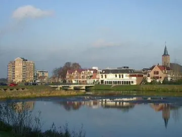
Hardenberg is a town. Location: Gemeente Hardenberg, Overijssel. Population: 57,909. Elevation: 11 m.
Hardenberg (Dutch: [ˈɦɑrdə(m)bɛr(ə)x] ; Dutch Low Saxon: Haddenbarreg or 'n Arnbarg) is a city and municipality in the province of Overijssel in north-eastern Netherlands. It has borders with the province of Drenthe and an international German border. The population of Hardenberg municipality is 63,895 (in 2025). Other than Hardenberg itself, the second largest population center is Dedemsvaart, and Gramsbergen is the only other city in the municipality.
Source: Wikipedia · CC BY-SA 4.0
Photos of Hardenberg
-

Ronald Dunnewind · CC BY-SA 4.0 -

Arjan · CC BY 2.0 -

Ahospers · CC BY-SA 4.0 -

Ahospers · CC BY-SA 4.0 -

Roepers · CC BY 4.0


Climate of Hardenberg
Best months for sightseeingBest months for sightseeing: June–August.
This month · November
A cold month
Day 9° · Night 3° · Rain 75 mm
- Hottest month
- August (day 22°)
- Coldest month
- February (night 0°)
- Wettest month
- December (79 mm)
- Driest month
- April (47 mm)
Bars: average monthly low and high temperature. Below: precipitation. Monthly averages for 1970–2000 at about 18 km resolution, adjusted for elevation. Highlighted months are mild and relatively dry. Source: WorldClim 2.1 (CC BY 4.0).
Show values as a table
| Month | Jan | Feb | Mar | Apr | May | Jun | Jul | Aug | Sep | Oct | Nov | Dec |
|---|---|---|---|---|---|---|---|---|---|---|---|---|
| Average high (°C) | 5° | 5° | 9° | 13° | 18° | 20° | 22° | 22° | 18° | 14° | 9° | 6° |
| Average low (°C) | 0° | 0° | 2° | 3° | 7° | 10° | 12° | 11° | 9° | 6° | 3° | 1° |
| Precipitation (mm) | 69 | 49 | 66 | 47 | 58 | 74 | 72 | 55 | 70 | 71 | 75 | 79 |
How to get to Hardenberg
The nearest airport is Groningen Airport Eelde (GRQ), 61 km to the north as the crow flies. The nearest large city is Zwolle, 36 km to the west.
Airports
- Groningen Airport Eelde (GRQ) Groningen 61 kmnorth
- Münster Osnabrück Airport (FMO) Greven 88 kmsoutheast
- Weeze (Niederrhein) Airport (NRN) Weeze 113 kmsouth
Nearby large cities
- Zwolle Population: 129.8K 36 kmwest
- Enschede Population: 153.7K 44 kmsoutheast
- Apeldoorn Population: 136.7K 60 kmsouthwest
- Groningen Population: 244.8K 72 kmnorth
- Arnhem Population: 162.4K 82 kmsouthwest
Straight-line distances; road distances are longer. Airport data: OurAirports.
Day trips from Hardenberg
Within 100 km: 116 historic and cultural sites, 590 natural sites, 306 lakes, rivers and coasts.
0–25 km22 places
- Spöllberg Mountain 22 kmE
- Weißer Berg Mountain 17 kmSE
- Bovenfeld Natural site 20 kmSE
- Mickenquelle Natural site 19 kmSE
25–60 km184 places
- Putjensberg Mountain 47 kmSW
- Mickelmeer Lake 56 kmE
- Fallermoor Lake 60 kmE
- Dankernsee Lake 46 kmNE
60–100 km806 places
- Werse River 94 kmSE
- Hatzumer Sand Island 95 kmNE
- Goten Lake 97 kmE
- Wijlermeer Lake 96 kmSW
Straight-line distances.
Hardenberg and similar cities
Side by side with cities of similar size in the same country: population, elevation and climate.
| Measure | Hardenberg | Assen | Middelburg | Drachten |
|---|---|---|---|---|
| Population | 57.9K | 68.8K | 46.5K | 45.2K |
| Elevation | 11 m | 12 m | 8 m | 3 m |
| Summer day (hottest month) | 22° | 22° | 21° | 21° |
| Winter night (coldest month) | 0° | -1° | 1° | 0° |
| Annual rainfall | 785 mm | 829 mm | 757 mm | 829 mm |
| Best months | Jun–Aug | Jun–Aug | Jun–Aug | Jun–Aug |
| Distance | — | 47 km | 238 km | 69 km |
Climate values are 1970–2000 monthly averages; straight-line distance.
Nearby attractions & nature
Everything nearby-
Radewijkerbeek River, Germany1 km S
-
Kniepenberg Mountain, Wielen9.1 km SE
-
Radewijke River, Thuringia7.4 km E
-
Fürstenbelt Mountain, Itterbeck13 km SE
-
Breiberg Mountain, Coevorden12 km N
-
Tutenberg Mountain, Tubbergen Municipality22 km SE
-
Braamberg Mountain, Tubbergen Municipality22 km SE
-
Besthmenerberg Mountain, Ommen Municipality15 km SW
Sources & licences
Data last updated: · 2 independent sources