Gemeente Hof van Twente
Located in Overijssel, The Netherlands Coordinates: 52°14′36″ N 6°35′51″ E
- Population
- 35,040
- 35K
- Elevation
- 14 m
- above sea level
- Local time
- UTC+01:00
- Europe/Amsterdam · UTC+01:00
- Places inside
- 19
- listed under Gemeente Hof van Twente
About Gemeente Hof van Twente
Gemeente Hof van Twente is a district. Location: Overijssel, The Netherlands. Population: 35,040.
In comparison
- Listed here: Village: 16, Town: 2, Mountain: 1
Places in Gemeente Hof van Twente
19 places-
Goor Town11.5K
-
Markelo Village3.8K
-
Delden Town6.9K
-
Diepenheim Village1.9K
-
Hengevelde Village1.5K
-
Elsen Village760
-
Bentelo Village730
-
Stokkum Village730
-
Wiene Village520
-
Zeldam Village510
-
Markeloschebroek Village430
-
Deldenerbroek Village420
-
Herike Village370
-
Markvelde Village320
-
Kerspel-Goor Village230
-
Deldeneresch Village200
-
Azelo Village170
-
Elsenerbroek Village140
-
Apenberg Mountain
Nearby attractions & nature
Everything nearby-
Zuurberg Mountain, Gemeente Rijssen-Holten11 km W
-
Lokerenk Mountain, Gemeente Rijssen-Holten12 km W
-
Grote Koningsbelt Mountain, Hellendoorn Municipality16 km NW
-
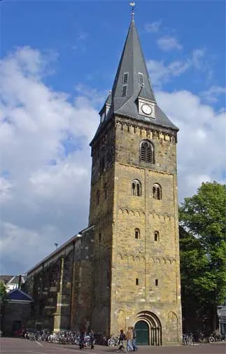 Grote Kerk Attraction, Enschede Municipality21 km E
-
Luttenberg Mountain, Raalte Municipality23 km NW
-
Ölbach River, North Rhine-Westphalia24 km SE
Sources & licences
Data last updated: