Gemeente Haaksbergen
Local name: Haaksbergen
Located in Overijssel, The Netherlands Coordinates: 52°09′19″ N 6°45′15″ E
- Population
- 24,229
- 24.2K
- Elevation
- 29 m
- above sea level
- Local time
- UTC+01:00
- Europe/Amsterdam · UTC+01:00
- Places inside
- 7
- listed under Gemeente Haaksbergen
About Gemeente Haaksbergen
Gemeente Haaksbergen is a district. Location: Overijssel, The Netherlands. Population: 24,229.
Haaksbergen (Dutch pronunciation: [ˈɦaːksbɛrɣə(n)] ) is a municipality and a town in the eastern Netherlands, in the province of Overijssel, in the Twente region. The Buurserbeek flows through the municipality of Haaksbergen.
Read more on Wikipedia Text: Wikipedia contributors · CC BY-SA 4.0 · shortened
At a glance
- Area
- 106 km²
Source: Wikidata
In comparison
- Listed here: Village: 6, Town: 1
Places in Gemeente Haaksbergen
7 places-
Haaksbergen Town24.1K
-
Brammelo Village
-
Den Braam Village
-
Eppenzolder Village
-
Harmöle Village
-
Langelo Village
-
Stepelo Village
Nearby attractions & nature
Everything nearby-
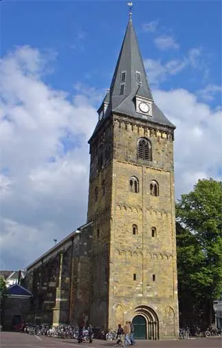 Grote Kerk Attraction, Enschede Municipality12 km NE
-
Daßberg Mountain, Vreden16 km S
-
Ölbach River, North Rhine-Westphalia10 km S
-
Apenberg Mountain, Gemeente Hof van Twente20 km NW
-
Naturschutzgebiet Flörbach Natural site, Gronau (Westf.)16 km E
-
Moorbach River, North Rhine-Westphalia15 km S
Sources & licences
Data last updated: · 2 independent sources