- Population
- 665
- 665
- Elevation
- 1 m
- above sea level
- Local time
- UTC+01:00
- Europe/Amsterdam · UTC+01:00
- Airports
- ANR Antwerp International Airport (Deurne)55 km
- RTM Rotterdam The Hague Airport60 km
About Wilhelminadorp
Wilhelminadorp is a village. Location: Gemeente Goes, Zeeland. Population: 665. Elevation: 1 m. The best months to visit are June–August. The nearest airport is Antwerp International Airport (Deurne) (55 km). Nearby sights include Fort Rammekens and Zandkreekplaat.
Climate of Wilhelminadorp
Best months for sightseeingBest months for sightseeing: June–August.
This month · November
A cold month
Day 10° · Night 5° · Rain 82 mm
- Hottest month
- August (day 21°)
- Coldest month
- February (night 1°)
- Wettest month
- October (83 mm)
- Driest month
- April (45 mm)
Bars: average monthly low and high temperature. Below: precipitation. Monthly averages for 1970–2000 at about 18 km resolution, adjusted for elevation. Highlighted months are mild and relatively dry. Source: WorldClim 2.1 (CC BY 4.0).
Show values as a table
| Month | Jan | Feb | Mar | Apr | May | Jun | Jul | Aug | Sep | Oct | Nov | Dec |
|---|---|---|---|---|---|---|---|---|---|---|---|---|
| Average high (°C) | 6° | 6° | 9° | 12° | 16° | 18° | 21° | 21° | 18° | 14° | 10° | 7° |
| Average low (°C) | 1° | 1° | 3° | 5° | 9° | 12° | 14° | 14° | 12° | 9° | 5° | 3° |
| Precipitation (mm) | 62 | 49 | 59 | 45 | 49 | 69 | 68 | 59 | 80 | 83 | 82 | 74 |
How to get to Wilhelminadorp
The nearest airport is Antwerp International Airport (Deurne) (ANR), 55 km to the southeast as the crow flies. For international flights: Rotterdam The Hague Airport (RTM) (60 km). The nearest large city is Antwerp, 49 km to the southeast.
Airports
- Antwerp International Airport (Deurne) (ANR) Antwerp 55 kmsoutheast
- Rotterdam The Hague Airport (RTM) Rotterdam 60 kmnortheast
- Ostend-Bruges International Airport (OST) Oostende 80 kmsouthwest
Nearby large cities
- Antwerp Population: 529.2K 49 kmsoutheast
- Ghent Population: 265.1K 55 kmsouth
- Bruges Population: 118.5K 59 kmsouthwest
- Rotterdam Population: 868.1K 59 kmnortheast
- Breda Population: 184.1K 61 kmeast
Straight-line distances; road distances are longer. Airport data: OurAirports.
Day trips from Wilhelminadorp
Within 100 km: 181 historic and cultural sites, 251 natural sites, 655 lakes, rivers and coasts.
0–25 km6 places
- Aloha Beach Beach 23 kmW
- Aardbeieneiland Island 14 kmW
- Zandkreekplaat Island 12 kmW
- Soelekerkplaat Mountain 14 kmW
25–60 km250 places
- IJsselmonde Island 57 kmNE
- Knokke-Strand Beach 46 kmSW
- Het Eiland Island 35 kmS
- Putse Moer Lake 41 kmSE
60–100 km831 places
- Klein Strand Oostende Beach 75 kmSW
- Hofstademeer Lake 74 kmSE
- Blankaart Lake 95 kmSW
- Vijvers van Bellefroid Lake 89 kmSE
Straight-line distances.
Nearby attractions & nature
Everything nearby-
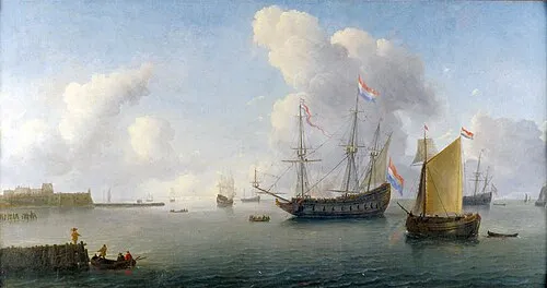 Fort Rammekens Historic site, Gemeente Vlissingen19 km SW
-
Zandkreekplaat Island, Gemeente Goes12 km W
-
Soelekerkplaat Mountain, Veere Municipality14 km W
-
Aardbeieneiland Island, Gemeente Middelburg14 km W
-
Ellewoutsdijk Fort Historic site, Borsele Municipality17 km S
-
Aloha Beach Beach, Veere Municipality23 km W
Sources & licences
Data last updated: