- Elevation
- 3 m
- above sea level
- Local time
- UTC+01:00
- Europe/Amsterdam · UTC+01:00
- Airports
- ANR Antwerp International Airport (Deurne)56 km
- OST Ostend-Bruges International Airport59 km
About Biervliet
Biervliet is a village. Location: Gemeente Terneuzen, Zeeland. Elevation: 3 m.
Biervliet is a small city in the Dutch province of Zeeland. It is a part of the municipality of Terneuzen, and lies about 16 km South of Vlissingen. Biervliet received city rights in 1183. It was originally a fishing village which specialised in herring. The flood of 1375 resulted in the creation of the former inlet Braakman, and after the St. Elizabeth's flood of 1404, Biervliet was on an island. In 1572, it was captured by the Geuzen.
Source: Wikipedia · CC BY-SA 4.0
Climate of Biervliet
Best months for sightseeingBest months for sightseeing: June–August.
This month · November
A cold month
Day 10° · Night 5° · Rain 79 mm
- Hottest month
- August (day 22°)
- Coldest month
- February (night 1°)
- Wettest month
- November (79 mm)
- Driest month
- April (46 mm)
Bars: average monthly low and high temperature. Below: precipitation. Monthly averages for 1970–2000 at about 18 km resolution, adjusted for elevation. Highlighted months are mild and relatively dry. Source: WorldClim 2.1 (CC BY 4.0).
Show values as a table
| Month | Jan | Feb | Mar | Apr | May | Jun | Jul | Aug | Sep | Oct | Nov | Dec |
|---|---|---|---|---|---|---|---|---|---|---|---|---|
| Average high (°C) | 6° | 6° | 10° | 13° | 17° | 20° | 22° | 22° | 19° | 15° | 10° | 7° |
| Average low (°C) | 1° | 1° | 3° | 5° | 9° | 12° | 14° | 14° | 11° | 8° | 5° | 3° |
| Precipitation (mm) | 63 | 47 | 58 | 46 | 56 | 74 | 68 | 56 | 70 | 77 | 79 | 75 |
How to get to Biervliet
The nearest airport is Antwerp International Airport (Deurne) (ANR), 56 km to the east as the crow flies. For international flights: Ostend-Bruges International Airport (OST) (59 km). The nearest large city is Ghent, 31 km to the south.
Airports
- Antwerp International Airport (Deurne) (ANR) Antwerp 56 kmeast
- Ostend-Bruges International Airport (OST) Oostende 59 kmwest
- Brussels Airport (BRU) Zaventem 73 kmsoutheast
Nearby large cities
- Ghent Population: 265.1K 31 kmsouth
- Bruges Population: 118.5K 35 kmwest
- Antwerp Population: 529.2K 51 kmeast
- Anderlecht Population: 160.6K 70 kmsoutheast
- Schaarbeek Population: 132.8K 70 kmsoutheast
Straight-line distances; road distances are longer. Airport data: OurAirports.
Day trips from Biervliet
Within 100 km: 231 historic and cultural sites, 322 natural sites, 779 lakes, rivers and coasts.
0–25 km35 places
- Het Eiland Island 22 kmSE
- Scheutbos Natural site 17 kmS
- Kloosterbos Natural site 18 kmSE
- Heidebos Natural site 22 kmSE
25–60 km385 places
- Knokke-Strand Beach 28 kmW
- Klein Strand Oostende Beach 55 kmW
- Putse Moer Lake 52 kmE
- Stappensven Lake 53 kmE
60–100 km912 places
- IJsselmonde Island 83 kmNE
- Hofstademeer Lake 69 kmSE
- Blankaart Lake 70 kmSW
- Vijvers van Bellefroid Lake 85 kmSE
Straight-line distances.
Nearby attractions & nature
Everything nearby-
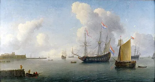 Fort Rammekens Historic site, Gemeente Vlissingen14 km N
-
Doodhoekbeek River, East Flanders8.7 km S
-
Blauwepoortbeek River, East Flanders8.7 km S
-
Ellewoutsdijk Fort Historic site, Borsele Municipality11 km NE
-
Isabellastroom River, East Flanders8.9 km S
-
Vlietbeek River, East Flanders9.3 km SE
Sources & licences
Data last updated: · 2 independent sources