
- Population
- 150
- 150
- Elevation
- 1 m
- above sea level
- Local time
- UTC+01:00
- Europe/Amsterdam · UTC+01:00
- Airports
- ANR Antwerp International Airport (Deurne)41 km
- BRU Brussels Airport62 km
About Reuzenhoek
Reuzenhoek is a village. Location: Gemeente Terneuzen, Zeeland. Population: 150. Elevation: 1 m.
Reuzenhoek is a hamlet in the Dutch province of Zeeland. It is a part of the municipality of Terneuzen and is about 28 kilometres (17 mi) southeast of Vlissingen. Reuzenhoek is not a statistical entity, and the postal authorities have placed it under Terneuzen. It has place name signs. It was home to 110 people in 1840. Nowadays, it consists of about 60 houses. It was first mentioned between 1838 and 1857 as Reuzenhoek. The etymology is unclear.
Source: Wikipedia · CC BY-SA 4.0
Climate of Reuzenhoek
Best months for sightseeingBest months for sightseeing: July–August.
This month · November
A cold month
Day 10° · Night 4° · Rain 77 mm
- Hottest month
- August (day 22°)
- Coldest month
- February (night 1°)
- Wettest month
- October (77 mm)
- Driest month
- February (48 mm)
Bars: average monthly low and high temperature. Below: precipitation. Monthly averages for 1970–2000 at about 18 km resolution, adjusted for elevation. Highlighted months are mild and relatively dry. Source: WorldClim 2.1 (CC BY 4.0).
Show values as a table
| Month | Jan | Feb | Mar | Apr | May | Jun | Jul | Aug | Sep | Oct | Nov | Dec |
|---|---|---|---|---|---|---|---|---|---|---|---|---|
| Average high (°C) | 6° | 6° | 10° | 13° | 17° | 20° | 22° | 22° | 19° | 15° | 10° | 7° |
| Average low (°C) | 1° | 1° | 3° | 5° | 9° | 12° | 14° | 14° | 11° | 8° | 4° | 2° |
| Precipitation (mm) | 62 | 48 | 58 | 48 | 59 | 76 | 68 | 56 | 70 | 77 | 77 | 74 |
How to get to Reuzenhoek
The nearest airport is Antwerp International Airport (Deurne) (ANR), 41 km to the east as the crow flies. For international flights: Brussels Airport (BRU) (62 km). The nearest large city is Ghent, 34 km to the southwest.
Airports
- Antwerp International Airport (Deurne) (ANR) Antwerp 41 kmeast
- Brussels Airport (BRU) Zaventem 62 kmsoutheast
- Ostend-Bruges International Airport (OST) Oostende 74 kmwest
Nearby large cities
- Ghent Population: 265.1K 34 kmsouthwest
- Antwerp Population: 529.2K 36 kmeast
- Bruges Population: 118.5K 50 kmwest
- Schaarbeek Population: 132.8K 60 kmsoutheast
- Brussels Population: 1M 61 kmsoutheast
Straight-line distances; road distances are longer. Airport data: OurAirports.
Day trips from Reuzenhoek
Within 100 km: 226 historic and cultural sites, 381 natural sites, 861 lakes, rivers and coasts.
0–25 km53 places
- Het Eiland Island 12 kmS
- Kleine Weel Lake 19 kmE
- Grote Weel Lake 20 kmE
- Grote Geule Lake 18 kmE
25–60 km449 places
- Knokke-Strand Beach 44 kmW
- Putse Moer Lake 37 kmE
- Stappensven Lake 38 kmE
- Hofstademeer Lake 56 kmSE
60–100 km966 places
- IJsselmonde Island 73 kmNE
- Klein Strand Oostende Beach 70 kmW
- Blankaart Lake 83 kmSW
- Vijvers van Bellefroid Lake 72 kmSE
Straight-line distances.
Nearby attractions & nature
Everything nearby-
Ellewoutsdijk Fort Historic site, Borsele Municipality9.7 km NW
-
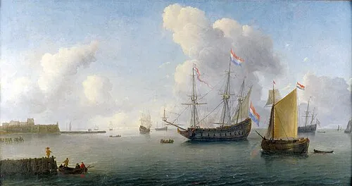 Fort Rammekens Historic site, Gemeente Vlissingen23 km NW
-
Vijfhonderd Gemetenbeek River, East Flanders12 km SW
-
Het Eiland Island, East Flanders12 km S
-
Vlietbeek River, East Flanders13 km SW
-
Oud Fort Bedmar Historic site, Sint-Gillis-Waas15 km SE
Other cities and towns in Gemeente Terneuzen
-
Sluiskil Village, Gemeente Terneuzen7.6 km SW
-
 Westdorpe Village, Gemeente Terneuzen12 km SW
-
Koewacht Village, Gemeente Terneuzen12 km S
-
Zandstraat Village, Gemeente Terneuzen9.9 km SW
-
Driewegen Village, Gemeente Terneuzen4.9 km W
-
 Sas van Gent Village, Gemeente Terneuzen14 km SW
Sources & licences
Data last updated: · 2 independent sources