
- Population
- 1,790
- 1.8K
- Elevation
- 1 m
- above sea level
- Local time
- UTC+01:00
- Europe/Amsterdam · UTC+01:00
- Airports
- OST Ostend-Bruges International Airport58 km
- ANR Antwerp International Airport (Deurne)68 km
About West-Souburg
West-Souburg is a village. Location: Gemeente Vlissingen, Zeeland. Population: 1,790. Elevation: 1 m.
West-Souburg is a neighbourhood of Vlissingen and former village in the Dutch province of Zeeland. It is part of the municipality of Vlissingen, and has been annexed by the city. The village was first mentioned in 1162 as Sutburch, and used to mean "southern fortified place", because it was the most southern of three defensive structures to defend against the Vikings. West was added later to distinguish from Oost-Souburg.
Source: Wikipedia · CC BY-SA 4.0
At a glance
- Area
- 30 ha
Source: Wikidata
Photos of West-Souburg
-
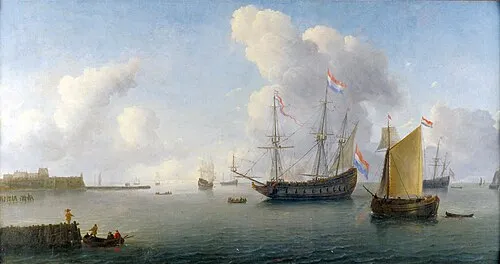
Fort Rammekens Willem van Diest · Public domain

Climate of West-Souburg
Best months for sightseeingBest months for sightseeing: June–August.
This month · November
A cold month
Day 10° · Night 5° · Rain 80 mm
- Hottest month
- August (day 21°)
- Coldest month
- February (night 1°)
- Wettest month
- October (82 mm)
- Driest month
- April (44 mm)
Bars: average monthly low and high temperature. Below: precipitation. Monthly averages for 1970–2000 at about 18 km resolution, adjusted for elevation. Highlighted months are mild and relatively dry. Source: WorldClim 2.1 (CC BY 4.0).
Show values as a table
| Month | Jan | Feb | Mar | Apr | May | Jun | Jul | Aug | Sep | Oct | Nov | Dec |
|---|---|---|---|---|---|---|---|---|---|---|---|---|
| Average high (°C) | 6° | 6° | 9° | 12° | 16° | 19° | 21° | 21° | 19° | 14° | 10° | 7° |
| Average low (°C) | 2° | 1° | 3° | 5° | 9° | 12° | 14° | 14° | 12° | 9° | 5° | 3° |
| Precipitation (mm) | 62 | 46 | 56 | 44 | 53 | 68 | 64 | 56 | 73 | 82 | 80 | 73 |
How to get to West-Souburg
The nearest airport is Ostend-Bruges International Airport (OST), 58 km to the southwest as the crow flies. The nearest large city is Bruges, 38 km to the southwest.
Airports
- Ostend-Bruges International Airport (OST) Oostende 58 kmsouthwest
- Antwerp International Airport (Deurne) (ANR) Antwerp 68 kmsoutheast
- Rotterdam The Hague Airport (RTM) Rotterdam 80 kmnortheast
Nearby large cities
- Bruges Population: 118.5K 38 kmsouthwest
- Ghent Population: 265.1K 47 kmsouth
- Antwerp Population: 529.2K 63 kmsoutheast
- Rotterdam Population: 868.1K 80 kmnortheast
- Breda Population: 184.1K 83 kmeast
Straight-line distances; road distances are longer. Airport data: OurAirports.
Day trips from West-Souburg
Within 100 km: 200 historic and cultural sites, 192 natural sites, 654 lakes, rivers and coasts.
0–25 km11 places
- Knokke-Strand Beach 24 kmSW
- Molenkreek River 20 kmS
- Doodhoekbeek River 25 kmS
- Blauwepoortbeek River 25 kmS
25–60 km200 places
- Klein Strand Oostende Beach 53 kmSW
- Het Eiland Island 37 kmSE
- Putse Moer Lake 59 kmE
- Stappensven Lake 59 kmE
60–100 km835 places
- IJsselmonde Island 78 kmNE
- Hofstademeer Lake 83 kmSE
- Blankaart Lake 74 kmSW
- Vijvers van Bellefroid Lake 99 kmSE
Straight-line distances.
Nearby attractions & nature
Everything nearby-
Fort Rammekens Historic site, Gemeente Vlissingen4.5 km E
-
Soelekerkplaat Mountain, Veere Municipality11 km NE
-
Aardbeieneiland Island, Gemeente Middelburg9.9 km NE
-
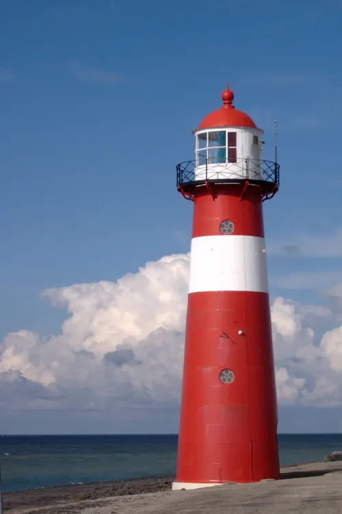 Noorderhoofd Landmark, Veere Municipality14 km NW
-
Zandkreekplaat Island, Gemeente Goes12 km NE
-
Ellewoutsdijk Fort Historic site, Borsele Municipality18 km SE
Sources & licences
Data last updated: · 2 independent sources