Sirjansland
Located in Schouwen-Duiveland Municipality, Zeeland Coordinates: 51°40′39″ N 4°01′50″ E

- Population
- 260
- 260
- Elevation
- 2 m
- above sea level
- Local time
- UTC+01:00
- Europe/Amsterdam · UTC+01:00
- Airports
- RTM Rotterdam The Hague Airport42 km
- ANR Antwerp International Airport (Deurne)62 km
About Sirjansland
Sirjansland is a village. Location: Schouwen-Duiveland Municipality, Zeeland. Population: 260. Elevation: 2 m.
Sirjansland is a village in the Dutch province of Zeeland. It is a part of the municipality of Schouwen-Duiveland, and lies about 19 km south of Hellevoetsluis.
Source: Wikipedia · CC BY-SA 4.0
Photos of Sirjansland
-

IJsbrand Heins · CC BY-SA 4.0 -

Nationaal Archief · CC0 -

User:Creosoph · CC BY-SA 4.0 -

Rene1971 · CC BY-SA 3.0


Climate of Sirjansland
Best months for sightseeingBest months for sightseeing: June–August.
This month · November
A cold month
Day 10° · Night 5° · Rain 86 mm
- Hottest month
- August (day 21°)
- Coldest month
- February (night 1°)
- Wettest month
- November (86 mm)
- Driest month
- April (42 mm)
Bars: average monthly low and high temperature. Below: precipitation. Monthly averages for 1970–2000 at about 18 km resolution, adjusted for elevation. Highlighted months are mild and relatively dry. Source: WorldClim 2.1 (CC BY 4.0).
Show values as a table
| Month | Jan | Feb | Mar | Apr | May | Jun | Jul | Aug | Sep | Oct | Nov | Dec |
|---|---|---|---|---|---|---|---|---|---|---|---|---|
| Average high (°C) | 5° | 6° | 9° | 12° | 16° | 18° | 20° | 21° | 18° | 14° | 10° | 7° |
| Average low (°C) | 1° | 1° | 3° | 5° | 9° | 11° | 14° | 14° | 11° | 8° | 5° | 2° |
| Precipitation (mm) | 63 | 48 | 60 | 42 | 49 | 69 | 71 | 59 | 83 | 84 | 86 | 73 |
How to get to Sirjansland
The nearest airport is Rotterdam The Hague Airport (RTM), 42 km to the northeast as the crow flies. The nearest large city is Rotterdam, 41 km to the northeast.
Airports
- Rotterdam The Hague Airport (RTM) Rotterdam 42 kmnortheast
- Antwerp International Airport (Deurne) (ANR) Antwerp 62 kmsoutheast
- Amsterdam Airport Schiphol (AMS) Amsterdam 86 kmnortheast
Nearby large cities
- Rotterdam Population: 868.1K 41 kmnortheast
- Dordrecht Population: 119.3K 47 kmeast
- The Hague Population: 474.3K 48 kmnorth
- Breda Population: 184.1K 53 kmeast
- Zoetermeer Population: 115.8K 53 kmnortheast
Straight-line distances; road distances are longer. Airport data: OurAirports.
Day trips from Sirjansland
Within 100 km: 221 historic and cultural sites, 161 natural sites, 475 lakes, rivers and coasts.
0–25 km3 places
- Ouddorp Beach Beach 19 kmNW
- Badstrand Rockanje Beach 21 kmN
- Fort de Roovere Historic site 25 kmSE
25–60 km169 places
- IJsselmonde Island 40 kmNE
- Het Eiland Island 52 kmS
- Putse Moer Lake 43 kmSE
- Stappensven Lake 41 kmSE
60–100 km685 places
- Knokke-Strand Beach 63 kmSW
- Klein Strand Oostende Beach 91 kmSW
- Hofstademeer Lake 84 kmSE
- Vijvers van Bellefroid Lake 98 kmSE
Straight-line distances.
Nearby attractions & nature
Everything nearby-
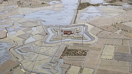 Fort de Roovere Historic site, Bergen op Zoom Municipality25 km SE
-
Ouddorp Beach Beach, The Netherlands19 km NW
-
Badstrand Rockanje Beach, Voorne aan Zee21 km N
Other cities and towns in Schouwen-Duiveland Municipality
-
 Ouwerkerk Village, Schouwen-Duiveland Municipality6.6 km SW
-
 Brouwershaven Village, Schouwen-Duiveland Municipality9.8 km NW
-
 Nieuwerkerke Village, Schouwen-Duiveland Municipality9.9 km W
-
 Kerkwerve Village, Schouwen-Duiveland Municipality9.2 km W
-
Schuddebeurs Village, Schouwen-Duiveland Municipality6 km W
-
Malta Neighbourhood, Schouwen-Duiveland Municipality7.4 km SW
Sources & licences
Data last updated: · 2 independent sources