Zierikzee
Located in Schouwen-Duiveland Municipality, Zeeland Coordinates: 51°39′00″ N 3°55′10″ E
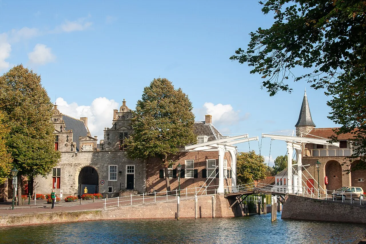
- Population
- 10,483
- 10.5K
- Elevation
- 7 m
- above sea level
- Local time
- UTC+01:00
- Europe/Amsterdam · UTC+01:00
- Airports
- RTM Rotterdam The Hague Airport49 km
- ANR Antwerp International Airport (Deurne)64 km
About Zierikzee
Zierikzee is a town. Location: Schouwen-Duiveland Municipality, Zeeland. Population: 10,483. Elevation: 7 m.
Zierikzee (Dutch pronunciation: [ˈziːrɪkseː]) is a small city in the southwest Netherlands, 50 km southwest of Rotterdam. It is situated in the municipality of Schouwen-Duiveland, Zeeland. The city hall of Schouwen-Duiveland is located in Zierikzee, its largest city. Zierikzee is connected to Oosterschelde through a canal. In 2001, the town of Zierikzee had 10,313 inhabitants. The built-up area of the town was 3.0 km2, and contained 4,295 residences.
Source: Wikipedia · CC BY-SA 4.0
Photos of Zierikzee
-

Ben Bender · CC BY-SA 3.0 -

Fotograaf Onbekend / Anefo · CC0 -

Harry Pot for Anefo · CC0 -

Nationaal Archief · CC0 -

James Postema · CC BY 4.0


Travel notes for Zierikzee
From Wikivoyage
Zierikzee is a town in the municipality of Schouwen-Duiveland in the Dutch province of Zeeland. The city has 11,000 inhabitants and is the capital of the municipality.
Understand+
Zierikzee is a historic town on the Eastern Scheldt. It has 568 official monuments, a unique medieval street pattern and the oldest still playing carillon of the Netherlands. During high season it is crowded with visitors, mainly Dutch and German. It's a good hub to explore the rest of the province which has much to offer both culturally and scenically. Historical cities, attractions and beaches are nearby. Zierikzee offers good hotels and restaurants and is a pleasant city to stay.
History:
The name Siricasha (Zierikzee) was first mentioned in 1156. The city rights were confirmed and expended by count William II of Holland. It is unknown when the city received its rights for the first time. At the end of the Middle Ages Zierikzee was an important city. In 1304 the Battle of Zierikzee took place where a combined French and Holland fleet was successfully in defeating the Flemish who had invaded Zeeland and Holland. During the 80 years war the city was taken by the Geuzen (Beggars) and later recaptured by the Spaniards. They left the city four months later after a mutiny of Spanish soldiers because of arrears. In the 17th century Zierikzee was primarily a fishery city and had a commercial fleet that limited herself to European waters. Unlike Middelburg the city had little input in the colonization of East and West Indian regions. In the 18th century the trade became more important than fishing. The merchant had to cope with setbacks about the middle of the 18th century. The fourth Anglo-Dutch war resulted in a decline of the fleet and the inhabitants of Zierikzee fell from 10,000 to 6,000. During the 19th century Zierikzee became to a more or less forgotten city.
Tourist office:
Get in+
Zierikzee has no railway connection and there is no nearby airport. It can be reached by car or by public bus. Coming from the East follow A58 to the direction of Middelburg and turn right to N256 after Goes. The N256 ends at Zierikzee just after passing the 5km long Zeelandbrug.
Bus line 132 from Goes takes a half hour to Zierikzee bus station.
From Rotterdam Zuidplein bus station to Zierikzee take either Interliner 395 (weekdays only) or bus line 436 and change bus in Oude Tonge to bus line 133 (all lines operated by Connexxion)
Source: Wikivoyage · CC BY-SA 4.0 · abridged
Population of Zierikzee over time
| 1889 | 7,060 | |
|---|---|---|
| 1899 | 6,818 | |
| 1909 | 6,808 | |
| 1920 | 6,835 | |
| 1930 | 6,771 | |
| 1947 | 6,884 | |
| 1960 | 7,057 | |
| 1971 | 8,134 | |
| 1980 | 9,422 | |
| 1990 | 9,813 | |
| 2015 | 11,117 | |
| 2019 | 11,360 |
Censuses and official estimates; source: Wikidata.
Climate of Zierikzee
Best months for sightseeingBest months for sightseeing: June–August.
This month · November
A cold month
Day 10° · Night 5° · Rain 82 mm
- Hottest month
- August (day 21°)
- Coldest month
- February (night 1°)
- Wettest month
- October (83 mm)
- Driest month
- April (45 mm)
Bars: average monthly low and high temperature. Below: precipitation. Monthly averages for 1970–2000 at about 18 km resolution, adjusted for elevation. Highlighted months are mild and relatively dry. Source: WorldClim 2.1 (CC BY 4.0).
Show values as a table
| Month | Jan | Feb | Mar | Apr | May | Jun | Jul | Aug | Sep | Oct | Nov | Dec |
|---|---|---|---|---|---|---|---|---|---|---|---|---|
| Average high (°C) | 6° | 6° | 9° | 12° | 16° | 18° | 21° | 21° | 18° | 14° | 10° | 7° |
| Average low (°C) | 1° | 1° | 3° | 5° | 9° | 12° | 14° | 14° | 12° | 9° | 5° | 3° |
| Precipitation (mm) | 62 | 49 | 59 | 45 | 49 | 69 | 68 | 59 | 80 | 83 | 82 | 74 |
How to get to Zierikzee
The nearest airport is Rotterdam The Hague Airport (RTM), 49 km to the northeast as the crow flies. The nearest large city is Rotterdam, 49 km to the northeast.
Airports
- Rotterdam The Hague Airport (RTM) Rotterdam 49 kmnortheast
- Antwerp International Airport (Deurne) (ANR) Antwerp 64 kmsoutheast
- Ostend-Bruges International Airport (OST) Oostende 88 kmsouthwest
Nearby large cities
- Rotterdam Population: 868.1K 49 kmnortheast
- The Hague Population: 474.3K 54 kmnortheast
- Dordrecht Population: 119.3K 55 kmeast
- Antwerp Population: 529.2K 58 kmsoutheast
- Breda Population: 184.1K 60 kmeast
Straight-line distances; road distances are longer. Airport data: OurAirports.
Day trips from Zierikzee
Within 100 km: 179 historic and cultural sites, 152 natural sites, 518 lakes, rivers and coasts.
0–25 km5 places
- Aloha Beach Beach 24 kmW
- Ouddorp Beach Beach 19 kmN
- Aardbeieneiland Island 21 kmSW
- Zandkreekplaat Island 19 kmSW
25–60 km176 places
- IJsselmonde Island 48 kmNE
- Knokke-Strand Beach 55 kmSW
- Het Eiland Island 48 kmS
- Putse Moer Lake 46 kmSE
60–100 km668 places
- Klein Strand Oostende Beach 83 kmSW
- Hofstademeer Lake 85 kmSE
- Vijvers van Bellefroid Lake 99 kmSE
- Wijngaardberg Mountain 98 kmSE
Straight-line distances.
Nearby attractions & nature
Everything nearby-
Soelekerkplaat Mountain, Veere Municipality20 km SW
-
Aardbeieneiland Island, Gemeente Middelburg21 km SW
-
Zandkreekplaat Island, Gemeente Goes19 km SW
-
Aloha Beach Beach, Veere Municipality24 km W
-
Ouddorp Beach Beach, The Netherlands19 km N
Sources & licences
Data last updated: · 2 independent sources