Emirdağ İlçesi
Located in Afyonkarahisar Province, Turkey Coordinates: 39°01′41″ N 31°09′17″ E
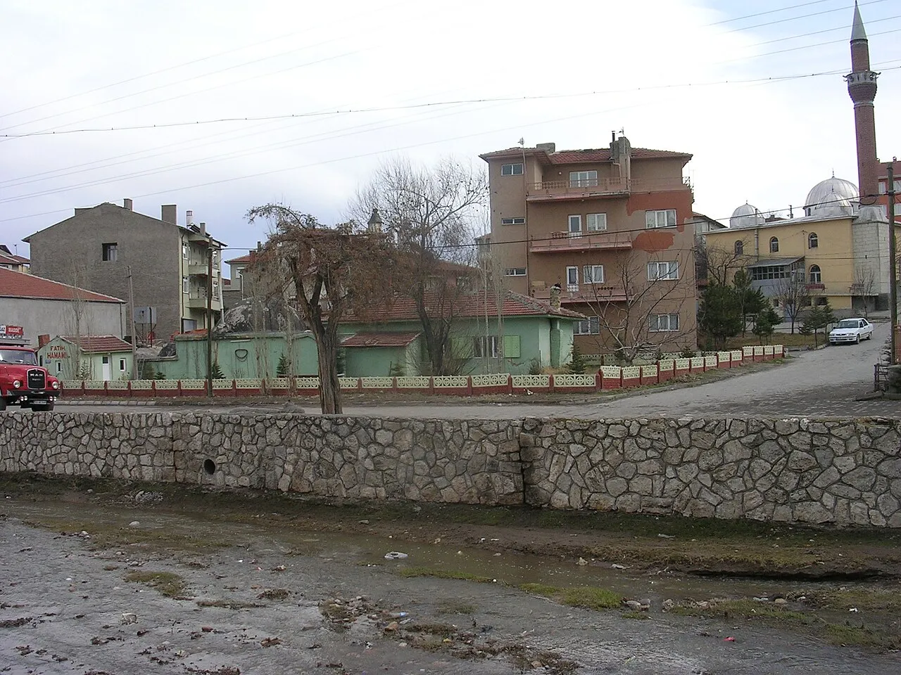
- Population
- 39,391
- 39.4K
- Elevation
- 978 m
- above sea level
- Local time
- UTC+03:00
- Europe/Istanbul · UTC+03:00
- Places inside
- 128
- listed under Emirdağ İlçesi
- Airports
- KZR Zafer Airport89 km
- AOE Hasan Polatkan Airport103 km
About Emirdağ İlçesi
Emirdağ İlçesi is a district. Location: Afyonkarahisar Province, Turkey. Population: 39,391. The best months to visit are May–June, September–October. The nearest airport is Zafer Airport (89 km). Nearby sights include Çayırlar Deresi and Çayırlık Deresi.
Climate of Emirdağ İlçesi
Best months for sightseeingBest months for sightseeing: May–June, September–October.
This month · November
A cold month
Day 12° · Night 2° · Rain 32 mm
Better nearby cities in November
- Alanya · 286 km south21°
- Aydin · 317 km southwest19°
- Silifke · 383 km southeast21°
- Hottest month
- July (day 29°)
- Coldest month
- January (night -3°)
- Wettest month
- May (56 mm)
- Driest month
- August (12 mm)
Bars: average monthly low and high temperature. Below: precipitation. Monthly averages for 1970–2000 at about 18 km resolution, adjusted for elevation. Highlighted months are mild and relatively dry. Source: WorldClim 2.1 (CC BY 4.0).
Show values as a table
| Month | Jan | Feb | Mar | Apr | May | Jun | Jul | Aug | Sep | Oct | Nov | Dec |
|---|---|---|---|---|---|---|---|---|---|---|---|---|
| Average high (°C) | 4° | 6° | 11° | 16° | 21° | 25° | 29° | 29° | 25° | 19° | 12° | 6° |
| Average low (°C) | -3° | -2° | 1° | 5° | 9° | 12° | 15° | 14° | 11° | 7° | 2° | -1° |
| Precipitation (mm) | 41 | 39 | 43 | 48 | 56 | 41 | 16 | 12 | 15 | 35 | 32 | 50 |
Other places to visit in this season: May June September October
How to get to Emirdağ İlçesi
The nearest airport is Zafer Airport (KZR), 89 km to the west as the crow flies. For international flights: Hasan Polatkan Airport (AOE) (103 km). The nearest large city is Afyonkarahisar, 61 km to the southwest.
Airports
- Zafer Airport (KZR) Altıntaş 89 kmwest
- Hasan Polatkan Airport (AOE) Eskişehir 103 kmnorthwest
- Süleyman Demirel International Airport (ISE) Isparta 147 kmsouthwest
Nearby large cities
- Afyonkarahisar Population: 251.8K 61 kmsouthwest
- Eskişehir Population: 921.6K 99 kmnorthwest
- Kütahya Population: 185K 110 kmnorthwest
- Isparta Population: 172.3K 150 kmsouth
- Uşak Population: 369.4K 157 kmwest
Straight-line distances; road distances are longer. Airport data: OurAirports.
Day trips from Emirdağ İlçesi
Within 100 km: 19 historic and cultural sites, 296 natural sites, 146 lakes, rivers and coasts.
0–25 km29 places
- Koca Göl Lake 16 kmE
- Dedeli Tepe Mountain 13 kmSW
- Eğerlidağı Tepesi Mountain 25 kmW
- Emirdede Tepe Mountain 15 kmSE
25–60 km112 places
- Lake Eber Lake 42 kmS
- Prymnessos Lake 47 kmSW
- Karkız Gölü Lake 37 kmN
- Yediler Tepesi Mountain 56 kmNE
60–100 km320 places
- Sarısunger Göleti Lake 90 kmNW
- Lake Çavuşçu Lake 99 kmSE
- Beylikahır Gölü Lake 74 kmN
- Lake Akşehir Lake 62 kmSE
Straight-line distances.
Places in Emirdağ İlçesi
128 placesBar: population relative to the most populous place in this list.
Cities & villages43
- Alibeyce · Village
- Amorion / Amorium · Village
- Arızlı Mahallesi · Village
- Aşağı Piribeyli · Village
- Aydınyaka · Village
- Ayınlı Mahallesi · Village
- Başali Mahallesi · Village
- Belkuyu Mahallesi · Village
- Ceneler Mahallesi · Village
- Cevik Yaylası · Village
- Çiftlik · Village
- Çiftlik Mahallesi · Village
- Çivikli Mahallesi · Village
- Dağdibi Mahallesi · Village
- Dere Mahallesi · Village
- Elmalı Yaylası · Village
- Eskiköy Mahallesi · Village
- Eydemir · Village
- Fakılı Mahallesi · Village
- Gökçeyaka · Village
- Gölçük Yaylası · Village
- Gömü · Village
- Güneykoy · Village
- Güzle Mahallesi · Village
- Hacıahmet Mahallesi · Village
- Hisarköy · Village
- Kaldırımyaylası · Village
- Kasapkuyusu Mahallesi · Village
- Keçigölcüğü Yaylası · Village
- Keçili · Village
- Kıllıçlı · Village
- Köseli Mahallesi · Village
- Küllüağıl Mahallesi · Village
- Kurudere · Village
- LabatlarMahallesi · Village
- Mahrumlu Mahallesi · Village
- Muhacirakören · Village
- Muslukbeleni Mahallesi · Village
- Pancarlı Mahallesi · Village
- Rahimli Mahallesi · Village
- Sarıçoban Yaylası · Village
- Sarıhöyük Mahallesi · Village
- Sekbiti Yaylası · Village
Mountains & nature10
- Adaçal Tepesi · Mountain
- Boz Tepe · Mountain
- Dedeli Tepe · Mountain
- Dua Tepe · Mountain
- Emirdede Tepe · Mountain
- Güneyağıl Tepesi · Mountain
- Hodulbaba Tepe · Mountain
- Karataşçalı · Mountain
- Kızdoğdu Tepesi · Mountain
- Kızılçal Tepesi · Mountain
Heritage & sights1
- Karaağaç Köprüsü · Landmark
Nearby attractions & nature
Everything nearby-
Çayırlar Deresi River, Afyonkarahisar Province5.8 km SW
-
Çayırlık Deresi River, Afyonkarahisar Province9.3 km NE
-
Kuru Dere River, Afyonkarahisar Province10 km SW
-
Bayat Boğazı Natural site, Afyonkarahisar Province12 km W
-
Emir Dağları Mountain, Afyonkarahisar Province23 km S
-
Çukurkuyu Deresi River, Afyonkarahisar Province14 km W
Sources & licences
Data last updated: