Demokrasi Meydanı Anıtı
Located in Şehitkamil, Gaziantep Province Coordinates: 37°03′56″ N 37°22′39″ E
- Local time
- UTC+03:00
- Europe/Istanbul · UTC+03:00
- Elevation
- 835 m
- above sea level
- Airports
- GZT Gaziantep Oğuzeli International Airport16 km
- KCM Kahramanmaraş Airport65 km
About Demokrasi Meydanı Anıtı
Demokrasi Meydanı Anıtı is a landmark. Location: Şehitkamil, Gaziantep Province. The best months to visit are April–May, October. The nearest airport is Gaziantep Oğuzeli International Airport (16 km). Nearby sights include Gaziantep Kamil Ocak Stadyumu and Şehitler Abidesi.
Climate of Demokrasi Meydanı Anıtı
Best months for sightseeingBest months for sightseeing: April–May, October.
This month · November
Outside the best season
Day 16° · Night 4° · Rain 59 mm
Better nearby cities in November
- Suruç · 94 km east20°
- Osmaniye · 100 km west21°
- İskenderun · 120 km southwest22°
- Hottest month
- July (day 36°)
- Coldest month
- January (night -1°)
- Wettest month
- January (96 mm)
- Driest month
- August (1 mm)
Bars: average monthly low and high temperature. Below: precipitation. Monthly averages for 1970–2000 at about 18 km resolution, adjusted for elevation. Highlighted months are mild and relatively dry. Source: WorldClim 2.1 (CC BY 4.0).
Show values as a table
| Month | Jan | Feb | Mar | Apr | May | Jun | Jul | Aug | Sep | Oct | Nov | Dec |
|---|---|---|---|---|---|---|---|---|---|---|---|---|
| Average high (°C) | 8° | 10° | 14° | 20° | 27° | 32° | 36° | 36° | 32° | 25° | 16° | 10° |
| Average low (°C) | -1° | 0° | 3° | 7° | 12° | 17° | 20° | 20° | 15° | 9° | 4° | 0° |
| Precipitation (mm) | 96 | 76 | 74 | 51 | 33 | 6 | 2 | 1 | 4 | 35 | 59 | 95 |
How to get to Demokrasi Meydanı Anıtı
The nearest airport is Gaziantep Oğuzeli International Airport (GZT), 16 km to the southeast as the crow flies. The nearest large city is Gaziantep, 1 km to the southeast.
Airports
- Gaziantep Oğuzeli International Airport (GZT) Gaziantep 16 kmsoutheast
- Kahramanmaraş Airport (KCM) Kahramanmaraş 65 kmnorthwest
- Aleppo International Airport (ALP) Aleppo 99 kmsouth
Nearby large cities
- Gaziantep Population: 2.2M 1 kmsoutheast
- Kilis Population: 111.6K 45 kmsouthwest
- Kahramanmaraş Population: 385K 70 kmnorthwest
- Suruç Population: 101.2K 94 kmeast
- Osmaniye Population: 202.8K 100 kmwest
Straight-line distances; road distances are longer. Airport data: OurAirports.
Day trips from Demokrasi Meydanı Anıtı
Within 100 km: 56 historic and cultural sites, 538 natural sites, 211 lakes, rivers and coasts.
0–25 km108 places
- Burç Göleti Lake 19 kmW
- Kartal Dağı Mountain 23 kmW
- Büyüksoy Tepe Mountain 23 kmW
- Mutlu Tepe Mountain 24 kmSE
25–60 km311 places
- Örmeli Göl Lake 57 kmW
- Kara Göl Lake 56 kmW
- Kayacıik Barajı Lake 30 kmS
- Konak Göleti Lake 35 kmSW
60–100 km386 places
- Arıklıkaş Göleti Lake 77 kmW
- İnekli Göl Lake 72 kmN
- Fevzipaşa Gölü Lake 68 kmW
- Azaplı Göl Lake 77 kmN
Straight-line distances.
Nearby attractions & nature
Everything nearby-
Gaziantep Kamil Ocak Stadyumu Landmark, Şehitkamil0.2 km N
-
Şehitler Abidesi Landmark, Şahinbey İlçesi0.2 km S
-
Kendirli Kilisesi Attraction, Şahinbey İlçesi0.3 km SW
-
Gaziantep Kalesi Historic site, Şehitkamil0.5 km E
-
Ondört Şehit Anıtı Landmark, Şehitkamil0.7 km NE
-
Yüz Yıl Parkı Natural site, Şehitkamil0.4 km W
-
Gaziantep Zeugma Mozaik Müzesi Museum, Şehitkamil1.3 km NE
-
Kırkayak Parkı Natural site, Şahinbey İlçesi0.7 km SW
Nearest towns and villages
-
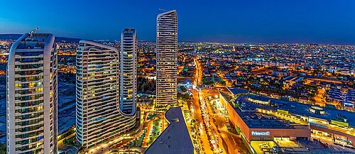 Gaziantep City, Gaziantep Province0.8 km SE
-
Seferpaşa Neighbourhood, Şehitkamil0.3 km E
-
Yaprak Neighbourhood, Şehitkamil0.5 km NE
-
İnceli Pınar Neighbourhood, Şehitkamil0.7 km NW
Sources & licences
Data last updated: