- Population
- 227
- 227
- Elevation
- 31 m
- above sea level
- Local time
- UTC+03:00
- Europe/Istanbul · UTC+03:00
- Airports
- HTY Hatay Airport37 km
- LTK Latakia International Airport76 km
About Yeşilyazı
Yeşilyazı is a village. Location: Samandağ, Hatay Province. Population: 227. Elevation: 31 m.
In comparison
- No. 11 of 11 places in Samandağ by population
- Nearest larger town: Aknehir, 2 km NE
- 9 sights and natural places within 10 km Samandağ Tepesi, Büyükkara Çay
Climate of Yeşilyazı
Best months for sightseeingBest months for sightseeing: April–May, November.
Bars: average monthly low and high temperature. Below: precipitation. Monthly averages for 1970–2000 at about 18 km resolution, adjusted for elevation. Highlighted months are mild and relatively dry. Source: WorldClim 2.1 (CC BY 4.0).
Show values as a table
| Month | Jan | Feb | Mar | Apr | May | Jun | Jul | Aug | Sep | Oct | Nov | Dec |
|---|---|---|---|---|---|---|---|---|---|---|---|---|
| Average high (°C) | 14° | 15° | 19° | 23° | 27° | 30° | 32° | 33° | 32° | 28° | 21° | 15° |
| Average low (°C) | 7° | 8° | 10° | 14° | 18° | 22° | 25° | 25° | 23° | 18° | 12° | 8° |
| Precipitation (mm) | 169 | 150 | 130 | 83 | 48 | 17 | 9 | 7 | 26 | 71 | 99 | 196 |
Airports nearest to Yeşilyazı
- Hatay Airport (HTY) Antakya 37 km
- Latakia International Airport (LTK) Latakia 76 km
- Aleppo International Airport (ALP) Aleppo 106 km
Straight-line distance; airports with scheduled flights only. Source: OurAirports (public domain).
Nearby attractions & nature
Everything nearby-
Samandağ Tepesi Mountain, Samandağ1.9 km NW
-
Büyükkara Çay River, Hatay Province3.9 km NE
-
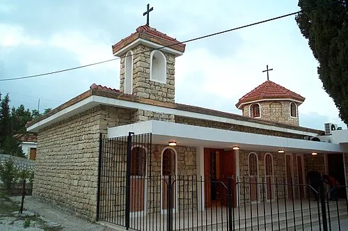 Church of the Holy Mother of God Attraction, Samandağ7.7 km NW
-
Ziyaret Dağı Mountain, Yayladağı İlçesi7.4 km SE
-
Büyükdere Natural site, Hatay Province7 km N
-
Kyuyuk-kara chay River, Hatay Province5.7 km NE
Sources & licences
Data last updated: