Bahçeköy
Located in Sarıyer, Istanbul Coordinates: 41°10′44″ N 28°59′31″ E
- Population
- 3,737
- 3.7K
- Elevation
- 124 m
- above sea level
- Local time
- UTC+03:00
- Europe/Istanbul · UTC+03:00
About Bahçeköy
Bahçeköy is a village. Location: Sarıyer, Istanbul. Population: 3,737. Elevation: 124 m.
Bahçeköy or Bahçeköy Merkez is a neighbourhood in the municipality and district of Sarıyer, Istanbul Province, Turkey. Its population is 3,737 (2022). Bahçeköy is situated 8 km (5.0 mi) from Sarıyer. It is bordered by Fatih Forest, Çayırbaşı, Büyükdere, Kemerburgaz, Zekeriyaköy and Gümüşdere. Institutions within its boundaries are Faculty of Forestry, Forestry Administration, Water and Sewerage Authority.
Read more on Wikipedia Text: Wikipedia contributors · CC BY-SA 4.0 · shortened
In comparison
- No. 11 of 14 places in Sarıyer by population
- Nearest larger town: Zekeriya, 4 km NE
- 17 sights and natural places within 10 km Eski Bağlar, Arabacı Mandırası
Nearby attractions & nature
Everything nearby-
Eski Bağlar River, Istanbul0.9 km NW
-
Arabacı Mandırası River, Istanbul0.9 km NW
-
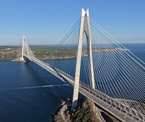 Yavuz Sultan Selim Bridge Landmark, Sarıyer10 km E
-
Kartal Tepesi Mountain, Sarıyer6.4 km N
-
Bosporus Powerline Crossing 2, Pylon West Landmark, Sarıyer6.5 km E
-
Türker İnanoğlu Maslak Landmark, Sarıyer6.5 km SE
Sources & licences
Data last updated: · 2 independent sources