Rumelihisarı
Located in Sarıyer, Istanbul Coordinates: 41°05′17″ N 29°03′22″ E
- Population
- 11,439
- 11.4K
- Elevation
- 27 m
- above sea level
- Local time
- UTC+03:00
- Europe/Istanbul · UTC+03:00
About Rumelihisarı
Rumelihisarı is a neighbourhood. Location: Sarıyer, Istanbul. Population: 11,439.
Rumelihisarı is a neighbourhood in the municipality and district of Sarıyer, Istanbul Province, Turkey. Its population is 10,073 (2022). It is on the European side of Istanbul. The neighbourhood is famous for and named after its medieval fortress, Rumelihisarı, built by Mehmed the Conqueror between 1451 and 1452.
Read more on Wikipedia Text: Wikipedia contributors · CC BY-SA 4.0 · shortened
At a glance
- Area
- 96 ha
Source: Wikidata
In comparison
- No. 6 of 14 places in Sarıyer by population
- Nearest larger town: İstinye, 2 km N
- 43 sights and natural places within 10 km Hagios Phokas monastery, Fatih Sultan Mehmet Bridge
Nearby attractions & nature
Everything nearby-
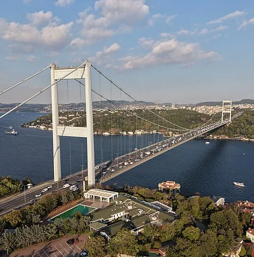 Fatih Sultan Mehmet Bridge Landmark, Istanbul0.5 km NE
-
Hagios Phokas monastery Historic site, Sarıyer0.4 km S
-
Küçüksu Kasrı Historic site, Üsküdar1.3 km SE
-
Göksu Deresi River, Istanbul1 km SE
-
Balıklı Dere River, Istanbul1 km SE
-
Bosporus Powerline Crossing 1, Tower East Landmark, Üsküdar2 km S
Sources & licences
Data last updated: · 2 independent sources