Tarabya
Located in Sarıyer, Istanbul Coordinates: 41°08′01″ N 29°02′47″ E
- Population
- 17,852
- 17.9K
- Elevation
- 63 m
- above sea level
- Local time
- UTC+03:00
- Europe/Istanbul · UTC+03:00
About Tarabya
Tarabya is a neighbourhood. Location: Sarıyer, Istanbul. Population: 17,852.
Tarabya (Ottoman Turkish: Tarabiye, Greek: Θεραπειά, romanized: Therapiá) is a neighbourhood in the municipality and district of Sarıyer, Istanbul Province, Turkey. Its population is 17,852 (2022). It is located on the European shoreline of the Bosphorus strait, between the neighbourhoods of Yeniköy and Kireçburnu. It is famous for its coastal fish restaurants. Lycée Français Pierre Loti d'Istanbul and Tarabya British Schools both have high school campuses in Tarabya.
Read more on Wikipedia Text: Wikipedia contributors · CC BY-SA 4.0 · shortened
At a glance
- Area
- 2.5 km²
Source: Wikidata
In comparison
- No. 2 of 14 places in Sarıyer by population
- Nearest larger town: Çubuklu, 5 km SE
- 30 sights and natural places within 10 km Türker İnanoğlu Maslak, Beykoz Deresi
Nearby attractions & nature
Everything nearby-
Türker İnanoğlu Maslak Landmark, Sarıyer1.8 km SW
-
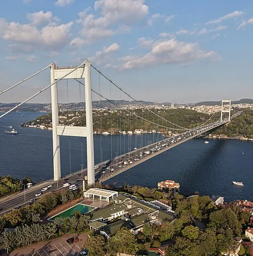 Fatih Sultan Mehmet Bridge Landmark, Istanbul4.9 km S
-
Beykoz Deresi River, Istanbul2.8 km E
-
Beikos Bay Natural site, Istanbul3.4 km E
-
Bosporus Powerline Crossing 2, Pylon West Landmark, Sarıyer5.1 km N
-
Bosporus Powerline Crossing 3, Pylon West Landmark, Sarıyer5.2 km N
Sources & licences
Data last updated: · 2 independent sources