Kandilli
Located in Üsküdar, Istanbul Coordinates: 41°04′15″ N 29°03′42″ E
- Population
- 1,729
- 1.7K
- Elevation
- 73 m
- above sea level
- Local time
- UTC+03:00
- Europe/Istanbul · UTC+03:00
About Kandilli
Kandilli is a neighbourhood. Location: Üsküdar, Istanbul. Population: 1,729.
Kandilli is a neighbourhood in the municipality and district of Üsküdar, Istanbul Province, Turkey. Its population is 1,414 (2025). It is located on the Asian side of the Bosphorus and is home to some of Istanbul's urban forests. The Kandilli Anatolian High School for Girls (Turkish: Kandilli Anadolu Kız Lisesi) was one of the first girl's high schools in Ottoman Turkey. The Kandilli Observatory, a facility of Boğaziçi University, is dedicated mostly to earthquake science.
Read more on Wikipedia Text: Wikipedia contributors · CC BY-SA 4.0 · shortened
At a glance
- Area
- 1.2 km²
Source: Wikidata
In comparison
- No. 7 of 7 places in Üsküdar by population
- Nearest larger town: Arnavutköy, 2 km W
- 62 sights and natural places within 10 km Bosporus Powerline Crossing 1, Tower East, Küçüksu Kasrı
Nearby attractions & nature
Everything nearby-
Bosporus Powerline Crossing 1, Tower East Landmark, Üsküdar0.2 km W
-
Küçüksu Kasrı Historic site, Üsküdar0.9 km N
-
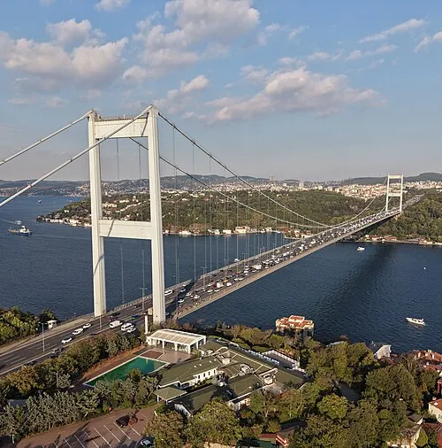 Fatih Sultan Mehmet Bridge Landmark, Istanbul2.3 km N
-
Hagios Phokas monastery Historic site, Sarıyer1.6 km N
-
Göz Tepe Mountain, Beykoz1.8 km NE
-
Bosporus Powerline Crossing 1, Tower West Landmark, Beşiktaş1.8 km W
Sources & licences
Data last updated: · 2 independent sources