- Elevation
- 1,518 m
- above sea level
- Local time
- UTC+03:00
- Europe/Istanbul · UTC+03:00
- Airports
- ASR Kayseri Erkilet International Airport23 km
- NAV Nevşehir Kapadokya Airport103 km
About Yazılı
Yazılı is a village. Location: Talas İlçesi, Kayseri Province. Elevation: 1,518 m. The best months to visit are June, September. The nearest airport is Kayseri Erkilet International Airport (23 km). Nearby sights include Çardak Tepe and Kızıl Dağ.
Climate of Yazılı
Best months for sightseeingBest months for sightseeing: June, September.
This month · November
A cold month
Day 10° · Night -3° · Rain 38 mm
Better nearby cities in November
- Osmaniye · 181 km south21°
- Adana · 187 km south21°
- Tarsus · 205 km south22°
- Hottest month
- August (day 28°)
- Coldest month
- January (night -9°)
- Wettest month
- May (57 mm)
- Driest month
- August (8 mm)
Bars: average monthly low and high temperature. Below: precipitation. Monthly averages for 1970–2000 at about 18 km resolution, adjusted for elevation. Highlighted months are mild and relatively dry. Source: WorldClim 2.1 (CC BY 4.0).
Show values as a table
| Month | Jan | Feb | Mar | Apr | May | Jun | Jul | Aug | Sep | Oct | Nov | Dec |
|---|---|---|---|---|---|---|---|---|---|---|---|---|
| Average high (°C) | 1° | 2° | 8° | 14° | 19° | 24° | 28° | 28° | 25° | 18° | 10° | 4° |
| Average low (°C) | -9° | -7° | -3° | 1° | 5° | 7° | 10° | 9° | 6° | 2° | -3° | -6° |
| Precipitation (mm) | 39 | 34 | 46 | 54 | 57 | 38 | 10 | 8 | 16 | 33 | 38 | 46 |
How to get to Yazılı
The nearest airport is Kayseri Erkilet International Airport (ASR), 23 km to the northwest as the crow flies. The nearest large city is Kayseri, 21 km to the northwest.
Airports
- Kayseri Erkilet International Airport (ASR) Kayseri 23 kmnorthwest
- Nevşehir Kapadokya Airport (NAV) Nevşehir 103 kmwest
- Kahramanmaraş Airport (KCM) Kahramanmaraş 164 kmsoutheast
Nearby large cities
- Kayseri Population: 1.5M 21 kmnorthwest
- Kırşehir Population: 150.7K 145 kmnorthwest
- Aksaray Population: 327.6K 149 kmwest
- Kahramanmaraş Population: 385K 159 kmsoutheast
- Sivas Population: 264K 167 kmnortheast
Straight-line distances; road distances are longer. Airport data: OurAirports.
Nearby attractions & nature
Everything nearby-
Çardak Tepe Mountain, Talas İlçesi8 km SW
-
Kızıl Dağ Mountain, Talas İlçesi8.9 km SW
-
Tekerlek Tepesi Mountain, Talas İlçesi9.8 km E
-
Ali Dağı Mountain, Talas İlçesi13 km W
-
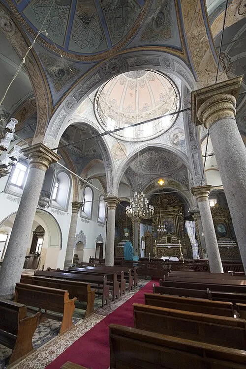 Saint Gregory the Illuminator Church Attraction, Melikgazi21 km W
-
Koç Dağı Mountain, Talas İlçesi16 km SW
Sources & licences
Data last updated: