Kanlıdivane
Located in Erdemli İlçesi, Mersin Province Coordinates: 36°31′33″ N 34°10′43″ E
- Local time
- UTC+03:00
- Europe/Istanbul · UTC+03:00
- Elevation
- 310 m
- above sea level
- Airports
- COV Çukurova International Airport89 km
- ECN Ercan International Airport164 km
About Kanlıdivane
Kanlıdivane is a historic site. Location: Erdemli İlçesi, Mersin Province.
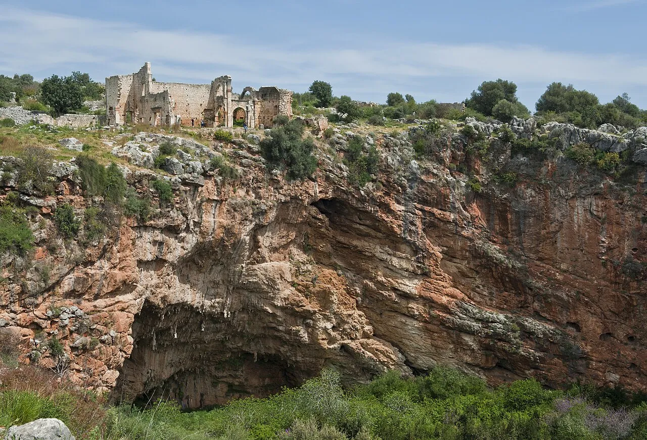
Kanlıdivane (ancient Canytelis, Greek: Κανυτελής) is an ancient city situated around a big sinkhole in Mersin Province, Turkey.
Source: Wikipedia · CC BY-SA 4.0
Photos of Kanlıdivane
-

Dosseman · CC BY-SA 4.0 -

Dosseman · CC BY-SA 4.0 -

Carole Raddato · CC BY-SA 2.0 -
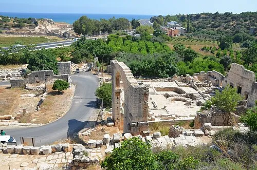
Elaiussa Sebaste Carole Raddato from FRANKFURT, Germany · CC BY-SA 2.0


Climate of Kanlıdivane
Best months for sightseeingBest months for sightseeing: April–June, October.
This month · November
Outside the best season
Day 19° · Night 10° · Rain 83 mm
Better nearby cities in November
- Silifke · 27 km southwest21°
- Mersin · 52 km northeast22°
- Tarsus · 77 km northeast22°
- Hottest month
- August (day 31°)
- Coldest month
- January (night 4°)
- Wettest month
- December (145 mm)
- Driest month
- August (3 mm)
Bars: average monthly low and high temperature. Below: precipitation. Monthly averages for 1970–2000 at about 18 km resolution, adjusted for elevation. Highlighted months are mild and relatively dry. Source: WorldClim 2.1 (CC BY 4.0).
Show values as a table
| Month | Jan | Feb | Mar | Apr | May | Jun | Jul | Aug | Sep | Oct | Nov | Dec |
|---|---|---|---|---|---|---|---|---|---|---|---|---|
| Average high (°C) | 13° | 13° | 16° | 20° | 24° | 28° | 30° | 31° | 29° | 25° | 19° | 14° |
| Average low (°C) | 4° | 5° | 7° | 11° | 15° | 19° | 22° | 22° | 19° | 14° | 10° | 6° |
| Precipitation (mm) | 127 | 95 | 70 | 43 | 30 | 13 | 8 | 3 | 9 | 49 | 83 | 145 |
Other places to visit in this season: April May June October
How to get to Kanlıdivane
The nearest airport is Çukurova International Airport (COV), 89 km to the northeast as the crow flies. The nearest large city is Silifke, 27 km to the southwest.
Airports
- Çukurova International Airport (COV) Tarsus 89 kmnortheast
- Ercan International Airport (ECN) Tymbou (Kirklar) 164 kmsouth
- Gazipaşa-Alanya Airport (GZP) Gazipaşa 171 kmwest
Nearby large cities
- Silifke Population: 132.7K 27 kmsouthwest
- Mersin Population: 537.8K 52 kmnortheast
- Tarsus Population: 350.7K 77 kmnortheast
- Heraclea Population: 156.3K 110 kmnorth
- Karaman Population: 175.4K 113 kmnorthwest
Straight-line distances; road distances are longer. Airport data: OurAirports.
Day trips from Kanlıdivane
Within 100 km: 35 historic and cultural sites, 587 natural sites, 151 lakes, rivers and coasts.
0–25 km25 places
- Sandal Dağı Mountain 10 kmN
- Çamlı Tepe Mountain 22 kmW
- Kapıtaşı Tepesi Mountain 7 kmSW
- Örmece Tepesi Mountain 21 kmW
25–60 km141 places
- Ovacık Adası Island 60 kmSW
- Dana Adası Island 52 kmSW
- Boğsak Adası Island 43 kmSW
- Paradeniz Gölü Lake 31 kmSW
60–100 km607 places
- Nisídes Kordýlia Island 99 kmS
- Nisída Gláros Island 99 kmS
- Nisída Lefkónisos Island 100 kmS
- Nisía Kleídes Island 99 kmSE
Straight-line distances.
Nearby attractions & nature
Everything nearby-
Elaiussa Sebaste Historic site, Erdemli İlçesi4.9 km S
-
Akkale Historic site, Erdemli İlçesi4 km E
-
Küçük Kale Historic site, Erdemli İlçesi5.9 km SW
-
Kız Kalesi Historic site, Mersin Province8.1 km S
-
Kapıtaşı Tepesi Mountain, Silifke İlçesi6.6 km SW
-
Karaçay Deresi River, Mersin Province5.4 km S
-
Kara Dağ Mountain, Silifke İlçesi9.4 km NW
-
Sandal Dağı Mountain, Erdemli İlçesi9.5 km N
Nearest towns and villages
-
Ayaş Village, Erdemli İlçesi4.6 km S
-
Batısandal Village, Erdemli İlçesi4.3 km N
-
Karaahmetli Village, Erdemli İlçesi5.2 km NW
-
Çanakçı Village, Erdemli İlçesi2.7 km NW
Sources & licences
Data last updated: · 2 independent sources