Kitreli
Located in Çiftlik District, Niğde Province Coordinates: 38°10′09″ N 34°21′10″ E
- Population
- 1,821
- 1.8K
- Elevation
- 1,567 m
- above sea level
- Local time
- UTC+03:00
- Europe/Istanbul · UTC+03:00
About Kitreli
Kitreli is a village. Location: Çiftlik District, Niğde Province. Population: 1,821. Elevation: 1,567 m.
Kitreli is a village in Çiftlik District of Niğde Province, Turkey. Its population is 1,188 (2022). Before the 2013 reorganisation, it was a town (belde). It is situated in a high peneplain at 1,600 m (5,200 ft) elevation. The distance to Çiftlik is 15 kilometres (9.3 mi) and to Niğde is 87 kilometres (54 mi). (Aksaray, the capital of the next province is closer to Kitreli than Niğde). The name Kitreli refers to tragacanth (Turkish: kitre) a natural gum, produced around the town.
Read more on Wikipedia Text: Wikipedia contributors · CC BY-SA 4.0 · shortened
In comparison
- Nearest larger town: Güzelyurt, 12 km N
- 5 sights and natural places within 10 km Boz Tepe, Çeçibuyduran Tepe
Nearby attractions & nature
Everything nearby-
Boz Tepe Mountain, Çiftlik District3 km NE
-
Çeçibuyduran Tepe Mountain, Altunhisar District7.3 km S
-
Melendiz Dağı Mountain, Altunhisar District8.1 km SE
-
Kılıç Tepesi Mountain, Aksaray8.5 km SW
-
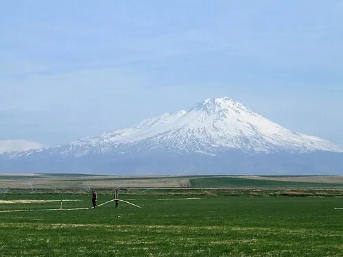 Mount Hasan Mountain, Aksaray17 km W
-
Güvercinlik Deresi River, Aksaray Province7.6 km NW
Sources & licences
Data last updated: · 2 independent sources