Çeçibuyduran Tepe
Located in Altunhisar District, Niğde Province Coordinates: 38°06′12″ N 34°21′27″ E
- Elevation
- 2,723 m
- above sea level
- Local time
- UTC+03:00
- Europe/Istanbul · UTC+03:00
- Airports
- NAV Nevşehir Kapadokya Airport76 km
- ASR Kayseri Erkilet International Airport124 km
About Çeçibuyduran Tepe
Çeçibuyduran Tepe is a mountain. Location: Altunhisar District, Niğde Province. Elevation: 2,723 m. The best months to visit are July–August. The nearest airport is Nevşehir Kapadokya Airport (76 km). Nearby sights include Melendiz Dağı and Kılıç Tepesi.
Climate of Çeçibuyduran Tepe
Best months for sightseeingBest months for sightseeing: July–August.
This month · November
A cold month
Day 3° · Night -8° · Rain 31 mm
Better nearby cities in November
- Tarsus · 140 km south22°
- Mersin · 146 km south22°
- Adana · 151 km southeast21°
- Hottest month
- August (day 20°)
- Coldest month
- January (night -14°)
- Wettest month
- May (61 mm)
- Driest month
- August (7 mm)
Bars: average monthly low and high temperature. Below: precipitation. Monthly averages for 1970–2000 at about 18 km resolution, adjusted for elevation. Highlighted months are mild and relatively dry. Source: WorldClim 2.1 (CC BY 4.0).
Show values as a table
| Month | Jan | Feb | Mar | Apr | May | Jun | Jul | Aug | Sep | Oct | Nov | Dec |
|---|---|---|---|---|---|---|---|---|---|---|---|---|
| Average high (°C) | -6° | -4° | 0° | 6° | 11° | 15° | 20° | 20° | 16° | 9° | 3° | -3° |
| Average low (°C) | -14° | -13° | -10° | -5° | -1° | 2° | 4° | 3° | 0° | -4° | -8° | -11° |
| Precipitation (mm) | 35 | 34 | 48 | 60 | 61 | 36 | 8 | 7 | 11 | 30 | 31 | 44 |
How to get to Çeçibuyduran Tepe
The nearest airport is Nevşehir Kapadokya Airport (NAV), 76 km to the north as the crow flies. The nearest large city is Aksaray, 42 km to the northwest.
Airports
- Nevşehir Kapadokya Airport (NAV) Nevşehir 76 kmnorth
- Kayseri Erkilet International Airport (ASR) Kayseri 124 kmnortheast
- Çukurova International Airport (COV) Tarsus 149 kmsoutheast
Nearby large cities
- Aksaray Population: 327.6K 42 kmnorthwest
- Heraclea Population: 156.3K 71 kmsouthwest
- Kırşehir Population: 150.7K 117 kmnorth
- Kayseri Population: 1.5M 121 kmnortheast
- Tarsus Population: 350.7K 140 kmsouth
Straight-line distances; road distances are longer. Airport data: OurAirports.
Day trips from Çeçibuyduran Tepe
Within 100 km: 13 historic and cultural sites, 246 natural sites, 129 lakes, rivers and coasts.
0–25 km25 places
- Yarık Tepe Mountain 24 kmSW
- Şahinkalesi Tepesi Mountain 21 kmN
- Melendiz Dağı Mountain 5 kmE
- Leşkeri Tepe Mountain 17 kmSW
25–60 km113 places
- Acıgöl Lake 28 kmN
- Uluağaç Göleti Lake 44 kmE
- Uluyol Sarnıcı Lake 28 kmNE
- Pozantı Dağı Mountain 53 kmSE
60–100 km250 places
- Akgöl Lake 85 kmW
- Söbe Göl Lake 87 kmNE
- Yaygölü Lake 84 kmE
- Camız Gölü Lake 82 kmE
Straight-line distances.
Nearest towns and villages
Nearby attractions & nature
Everything nearby-
Melendiz Dağı Mountain, Altunhisar District5.4 km E
-
Kılıç Tepesi Mountain, Aksaray8.6 km NW
-
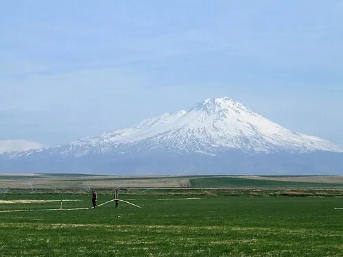 Mount Hasan Mountain, Aksaray17 km W
-
Boz Tepe Mountain, Çiftlik District9.2 km N
-
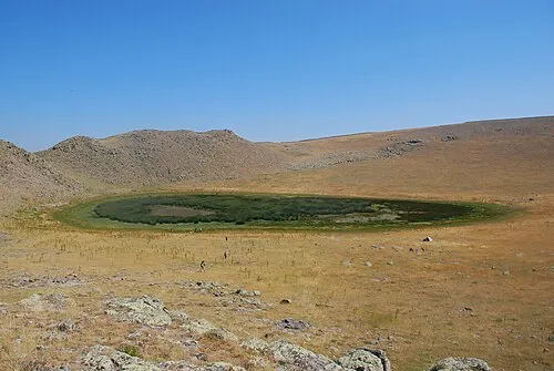 Göllü Dağ Mountain, Nigde25 km NE
-
Karakaya Tepesi Mountain, Altunhisar District12 km SW
-
Küçükhasan Dağı Mountain, Altunhisar District12 km W
-
Mahmutlu Tepesi Mountain, Aksaray23 km NW
Sources & licences
Data last updated: