Yozgat Province
Local name: Yozgat ili
Located in Turkey Coordinates: 39°35′00″ N 35°20′00″ E
- Population
- 418,442
- 418.4K
- Elevation
- 1,138 m
- above sea level
- Local time
- UTC+03:00
- Europe/Istanbul · UTC+03:00
- Places inside
- 148
- listed under Yozgat Province
About Yozgat Province
Yozgat Province is a region. Location: Turkey. Population: 418,442.
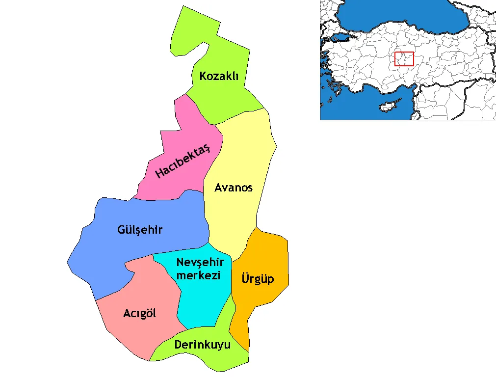
Yozgat Province (Turkish: Yozgat ili) is a province in central Turkey. Its area is 13,690 km2, and its population is 418,442 (2022). Its adjacent provinces are Çorum to the northwest, Kırıkkale to the west, Kırşehir to the southwest, Nevşehir to the south, Kayseri to the southeast, Sivas to the east, Tokat to the northeast, and Amasya to the north. The provincial capital is Yozgat.
Read more on Wikipedia Text: Wikipedia contributors · CC BY-SA 4.0 · shortened
At a glance
- Area
- 14,123 km²
Source: Wikidata
In comparison
- 11 sights and natural places within 10 km Dar Boğaz, Gırgır Tepesi
- Listed here: River: 81, Natural site: 19, Municipality: 17, District: 14
Places in Yozgat Province
148 places-
Sorgun İlçesi District81.2K
-
Akdağmadeni İlçesi District48.2K
-
Yerköy İlçesi District38.7K
-
Boğazlıyan İlçesi District34.9K
-
Sarıkaya District32.2K
-
Çekerek İlçesi District23.7K
-
Şefaatli İlçesi District16.2K
-
Saraykent İlçesi District15.1K
-
Çayıralan İlçesi District15K
-
Kadışehri İlçesi District14.6K
-
Aydıncık İlçesi District12.6K
-
Yenifakılı İlçesi District5.8K
-
Çandır İlçesi District4.8K
-
Abdilli Deresi River
-
Ağabayır Deresi River
-
Ağcakışla Tepesi Mountain
-
Akbenli Göleti Lake
-
Akçakoyunlu Deresi River
-
Akdağmadeni Bucağı Municipality
-
Akdağmadeni Dere River
-
Akkaya Deresi River
-
Aksu Pınarı Natural site
-
Ambarlık Tepesi Mountain
-
Araplı Deresi River
-
Arsızözü River
-
Aşağı İhsangazi Village
-
Avcı Deresi River
-
Ayazözü Boğazı Natural site
-
Aydıncık Bucağı Municipality
-
Bağırsak Deresi River
-
Bağlıca Deresi River
-
Bahçe Deresi River
-
Besim Çeşmesi Natural site
-
Bişek Deresi River
-
Bişek Deresi River
-
Boğaz Deresi River
-
Boğazlıyan Bucağı Municipality
-
Boğazlıyan Deresi River
-
Büyükacı Deresi River
-
Büyük Dere River
-
Çalören Deresi River
-
Çamurlu Dere River
-
Çatalkaya Deresi River
-
Çatal Pınarı Natural site
-
Çayıralan Bucağı Municipality
-
Çayırtarla Deresi River
-
Çaylak Hamamı Natural site
-
Çekerek Bucağı Municipality
-
Cender Deresi River
-
Çetin Deresi River
-
Cılga Deresi River
-
Çırçır Çeşmesi Natural site
-
Çokradan River
-
Çorak Çeşmesi Natural site
-
Çukurbaşı Tepesi Mountain
-
Dar Boğaz Natural site
-
Davulbaz Deresi River
-
Delimehmedin Pınarı Natural site
-
Demirci Deresi River
-
Eğridağtepeleri Mountain
Largest cities and towns
-
Yozgat City, Yozgat87.9K
-
Sorgun City, Sorgun İlçesi62.9K
-
Yerköy City, Yerköy İlçesi35.3K
-
Akdağmadeni City, Akdağmadeni İlçesi23K
-
Çayıralan City, Çayıralan İlçesi14.7K
-
Şefaatlı City, Şefaatli İlçesi13.9K
-
Çekerek City, Çekerek İlçesi10.6K
-
Yenifakılı City, Yenifakılı İlçesi11.5K
Nature and heritage in Yozgat Province
-
Sümrüksivrisi Mountain, Sorgun İlçesi
-
Kel Dağ Mountain, Boğazlıyan İlçesi
-
Dede Tepe Mountain, Çayıralan İlçesi
-
Halilbaba Tepesi Mountain, Sorgun İlçesi
-
Kurtmehmedin Tepesi Mountain, Sorgun İlçesi
-
Sırçalı Tepe Mountain, Boğazlıyan İlçesi
Other regions in Turkey
-
Kayseri Province Region, Turkey95 km S
-
 Nevşehir Province Region, Turkey94 km SW
-
Kozaklı İlçesi District, Nevşehir Province57 km SW
-
Melikgazi District, Kayseri Province94 km S
-
Felahiye İlçesi District, Kayseri Province57 km S
Sources & licences
Data last updated: · 2 independent sources